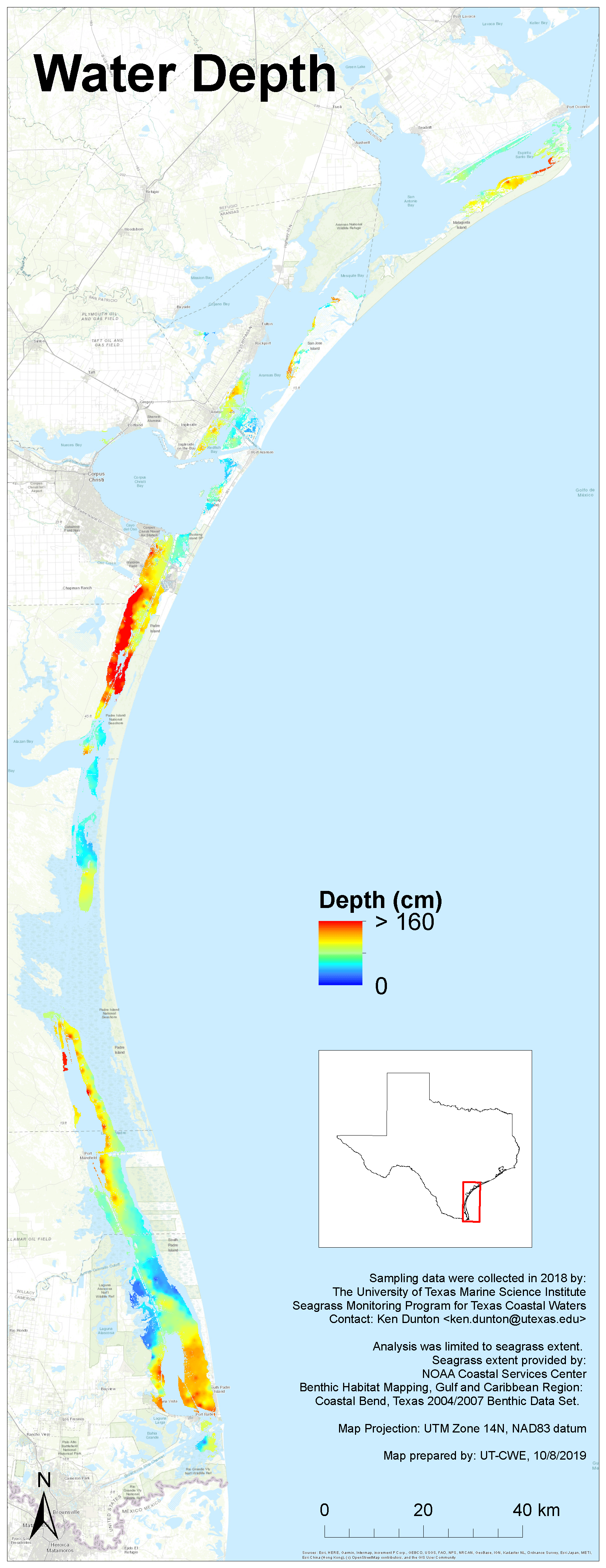
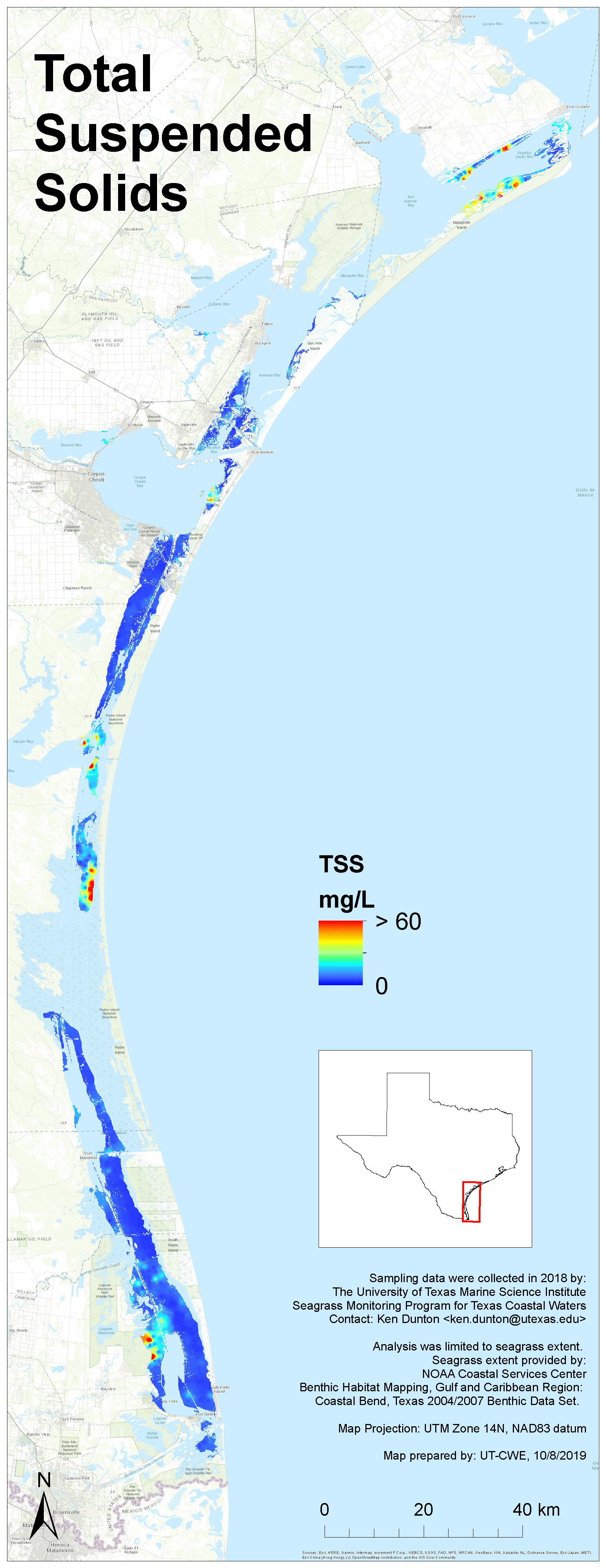
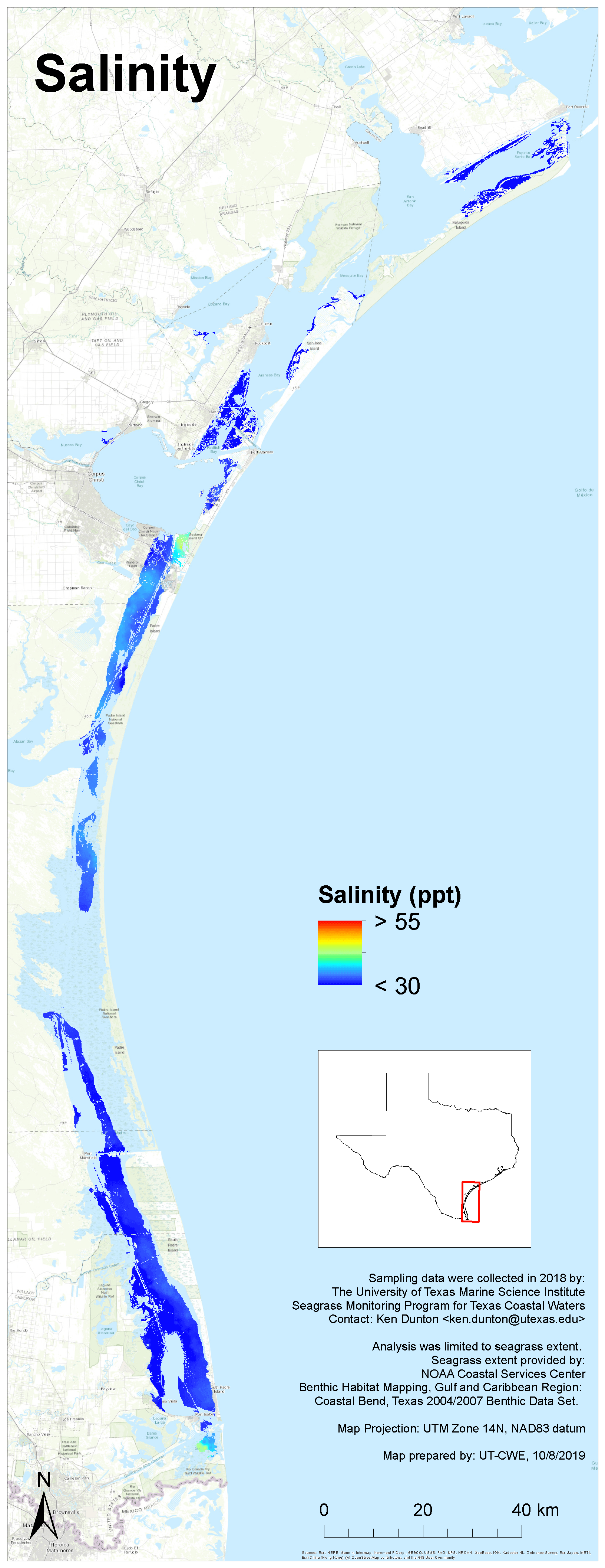
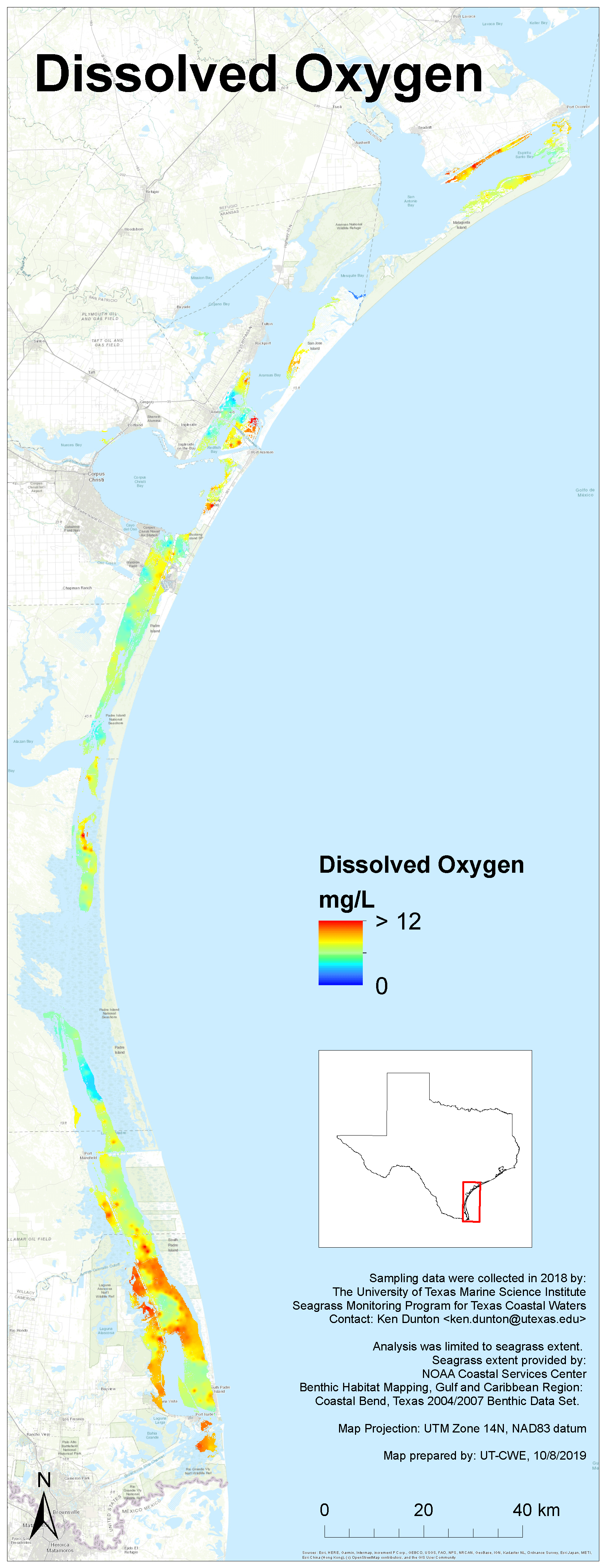
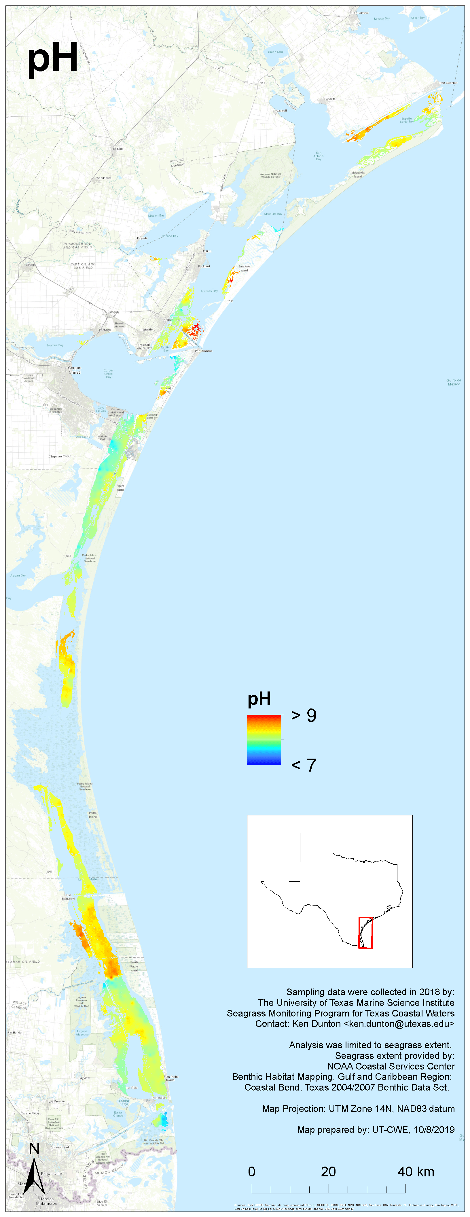
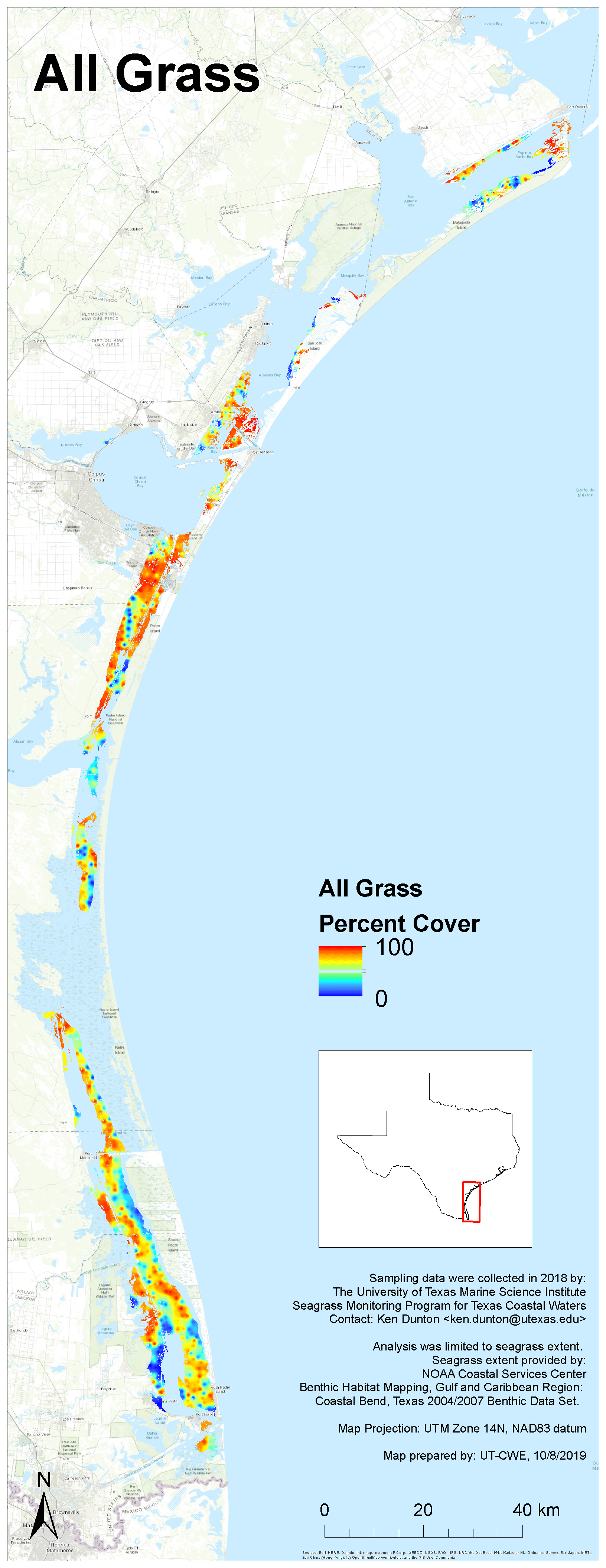
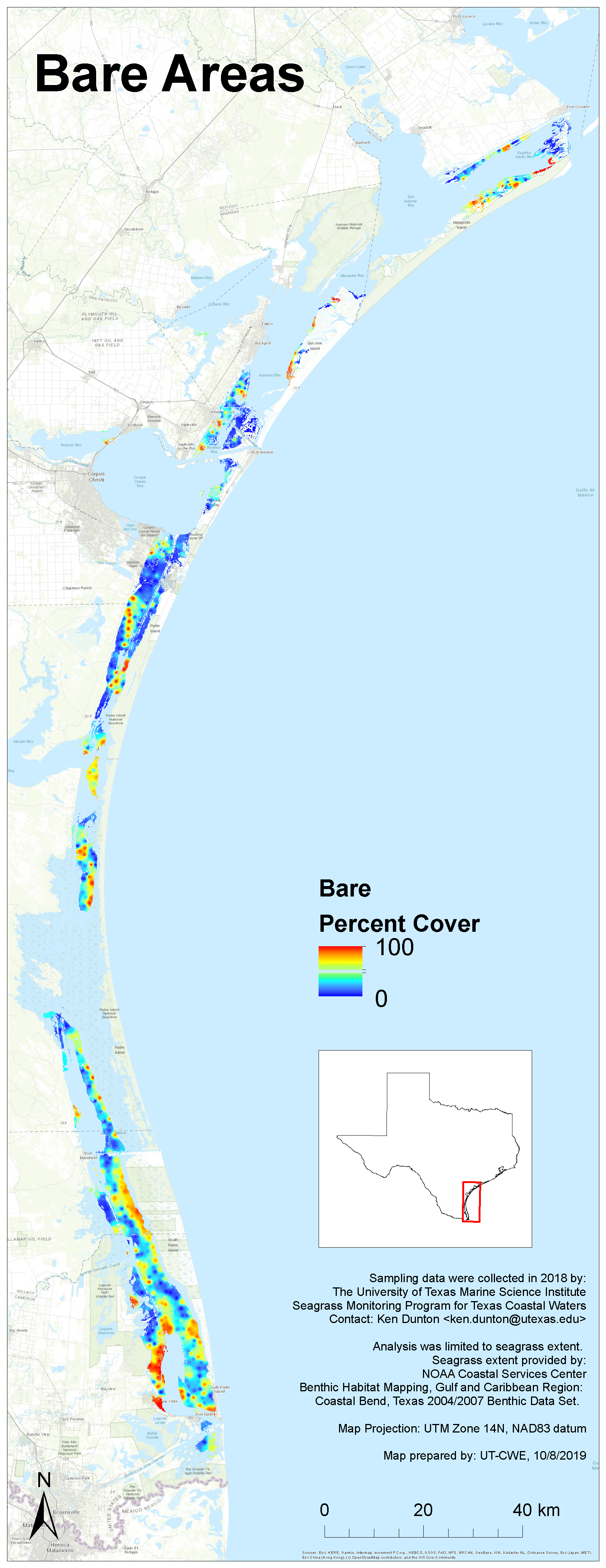
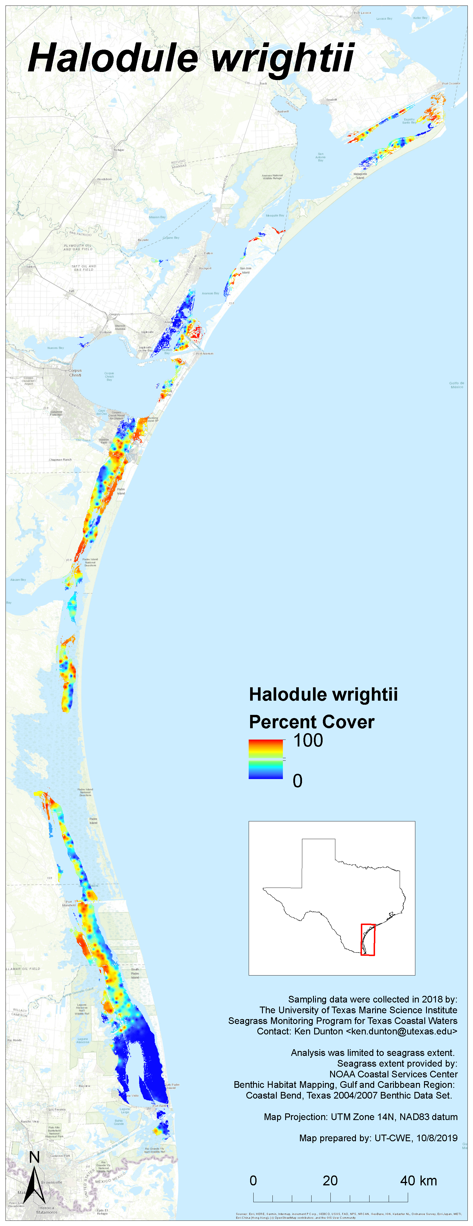
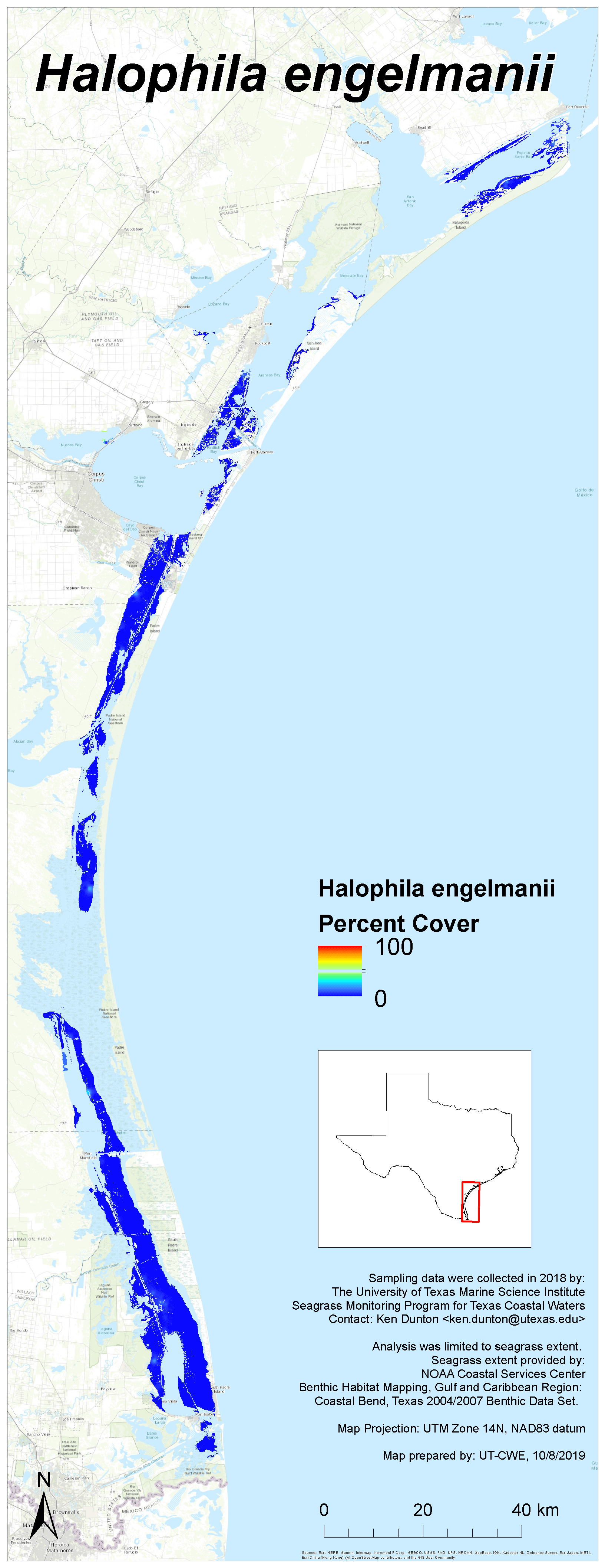
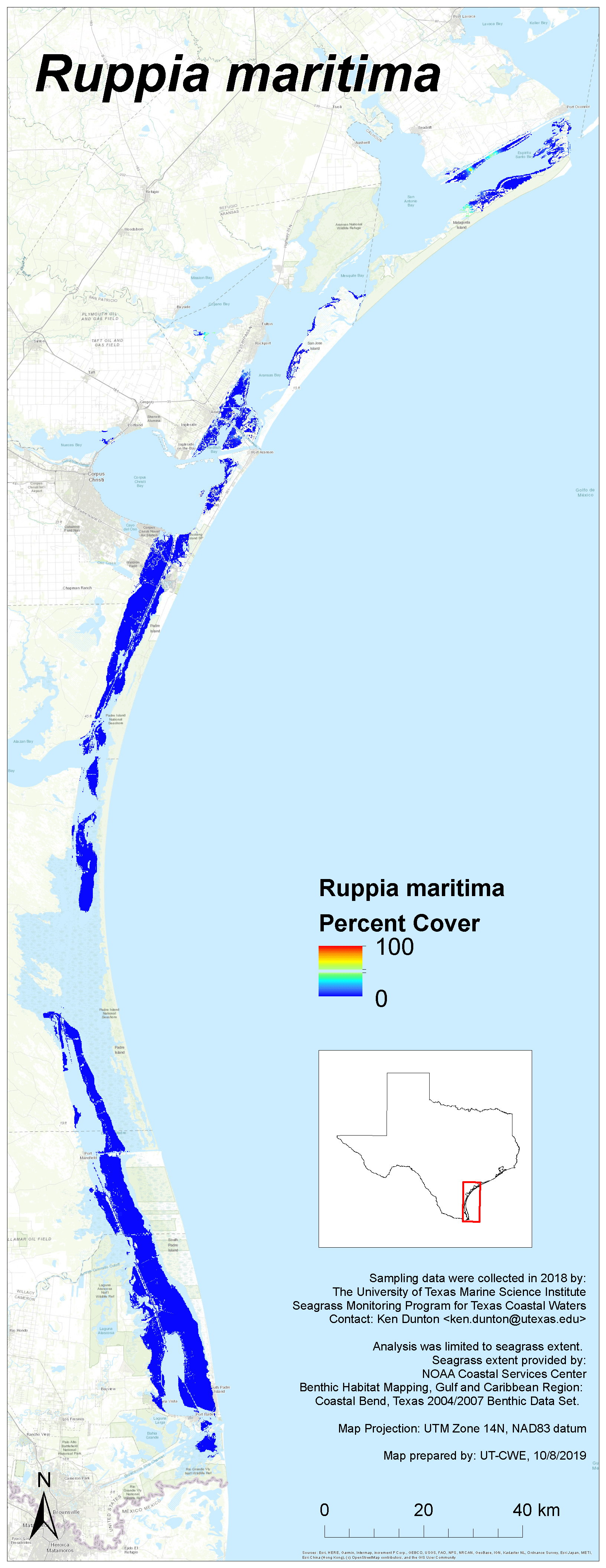
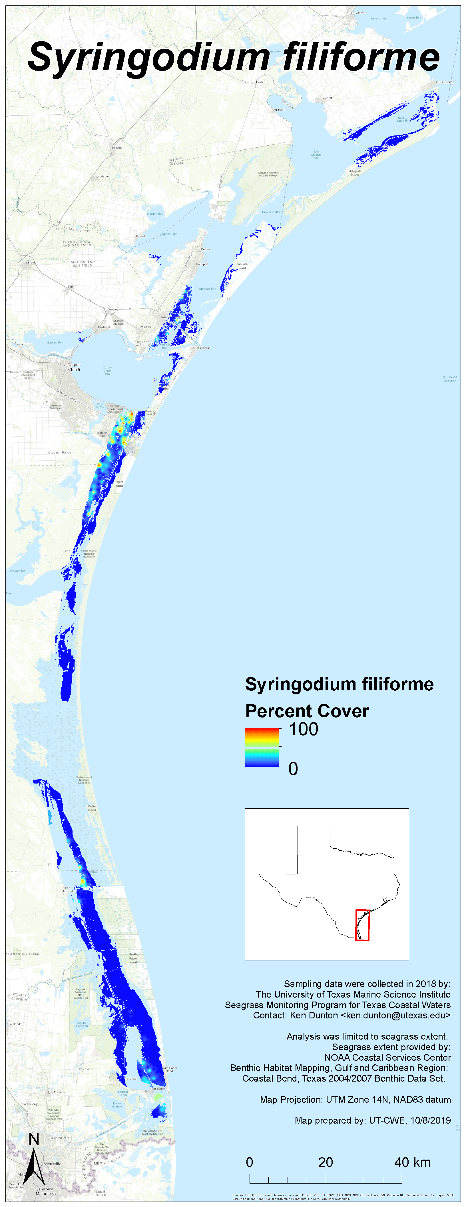
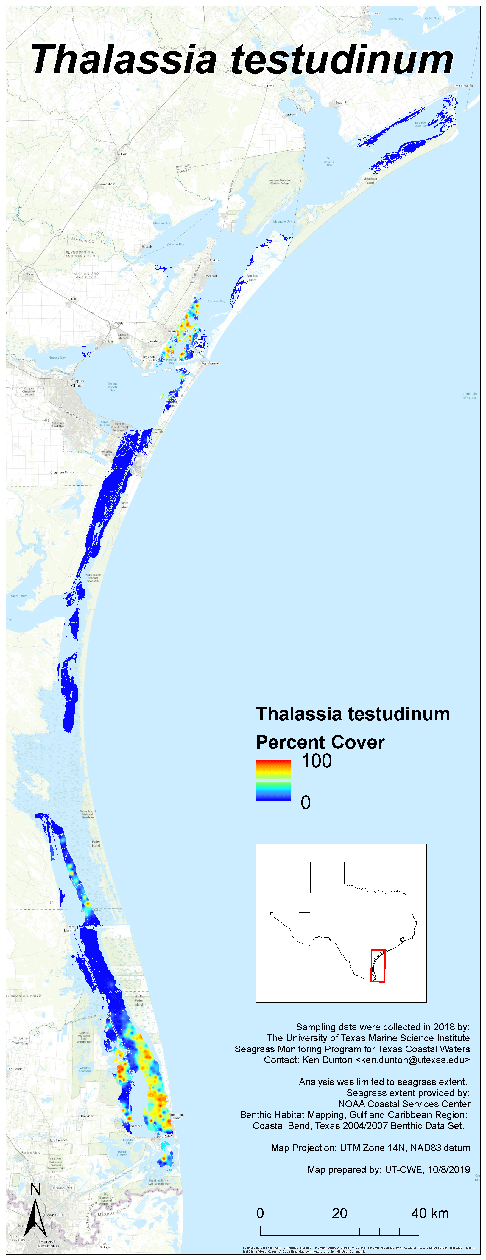
2018 Results
Each image links to a high resolution PNG. Click here to download the entire set (zipped, 27 MB).


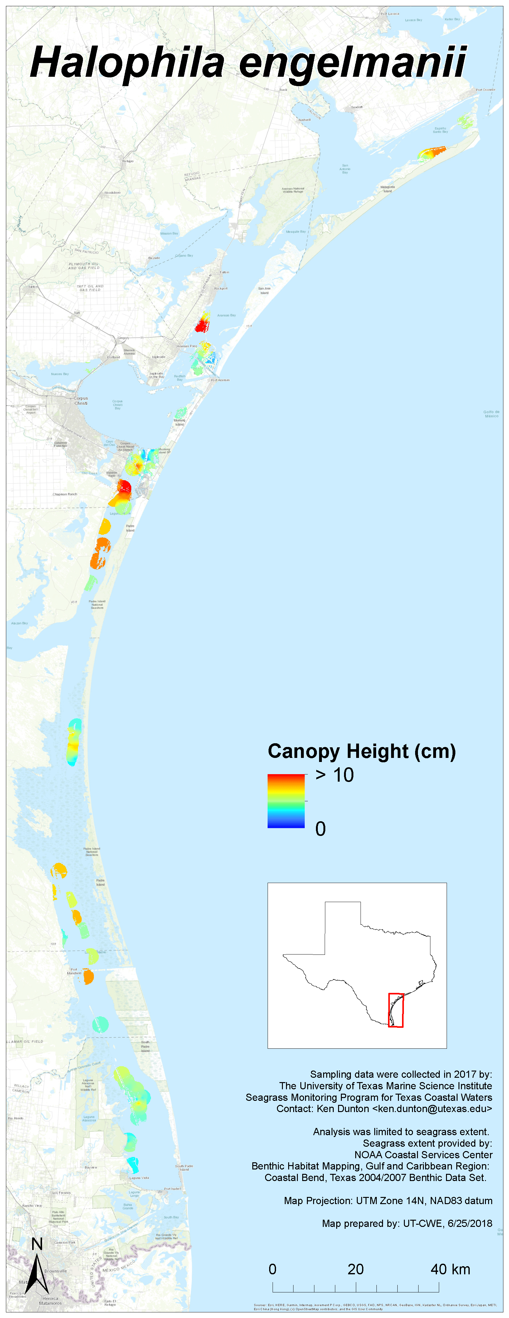


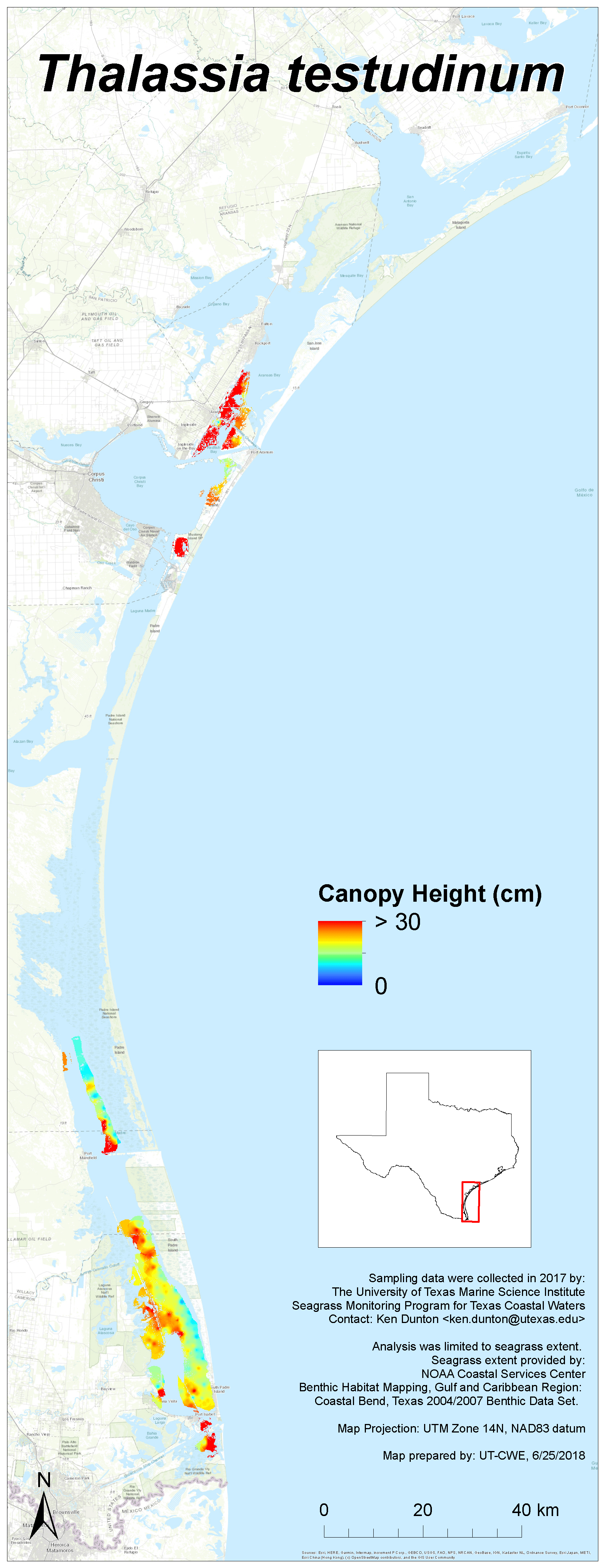
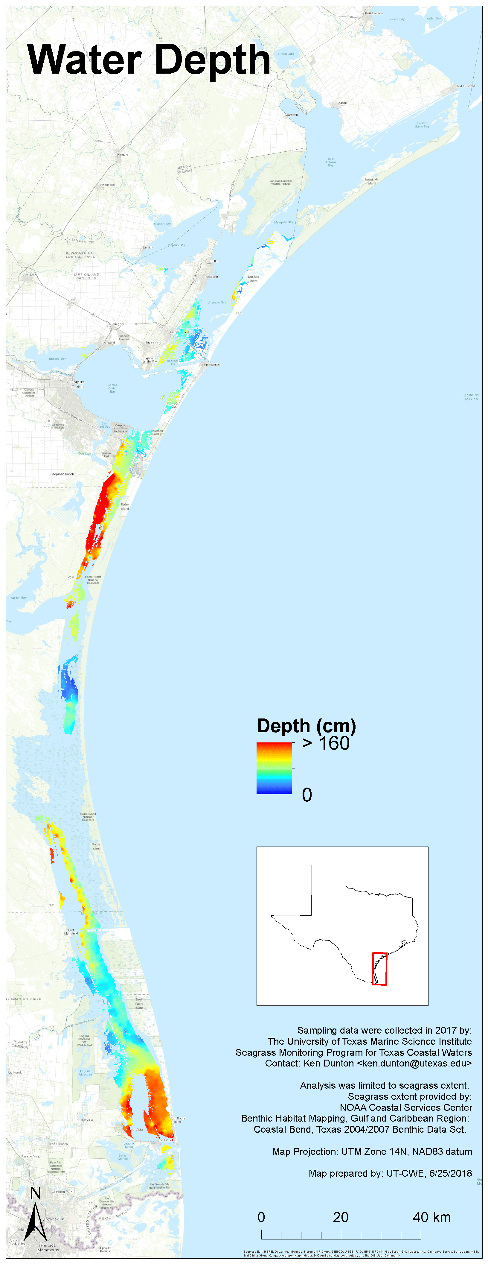
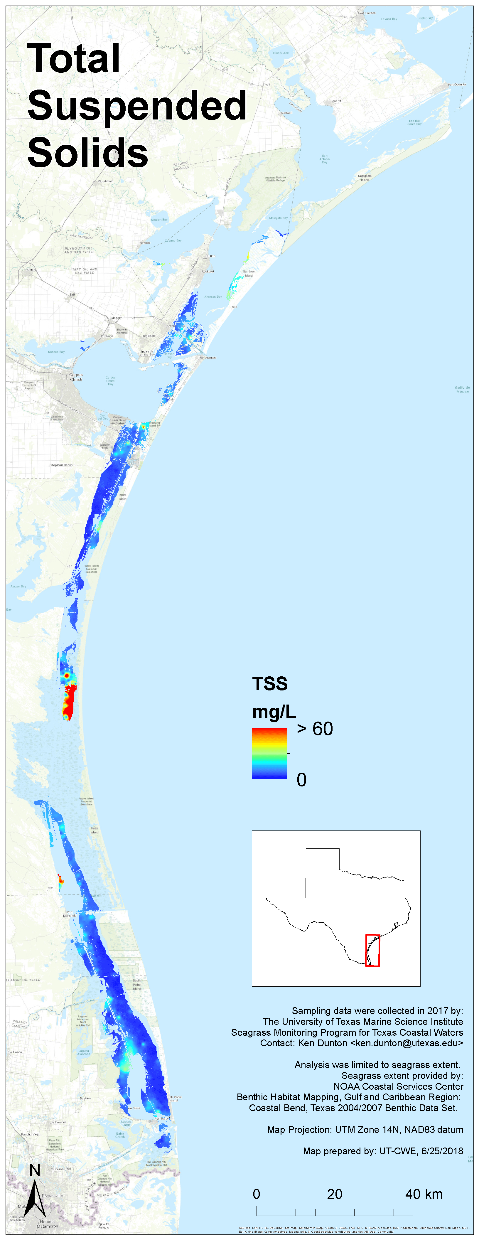
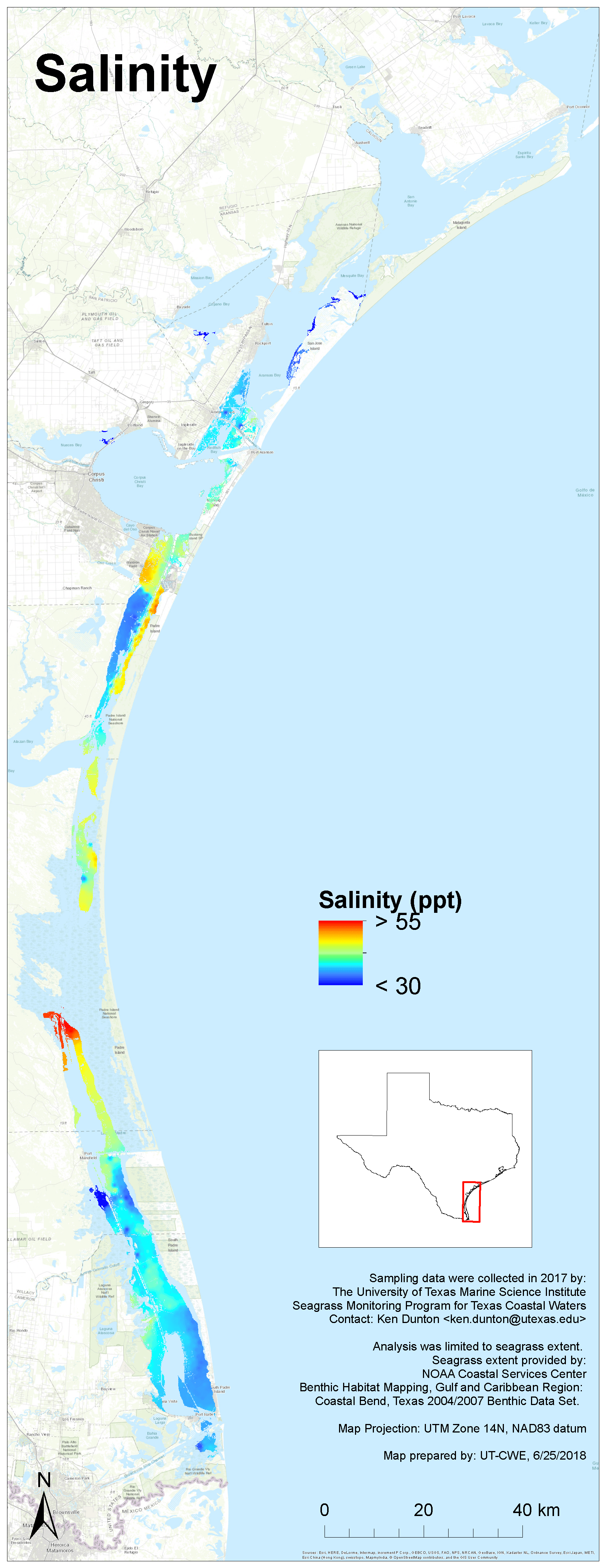
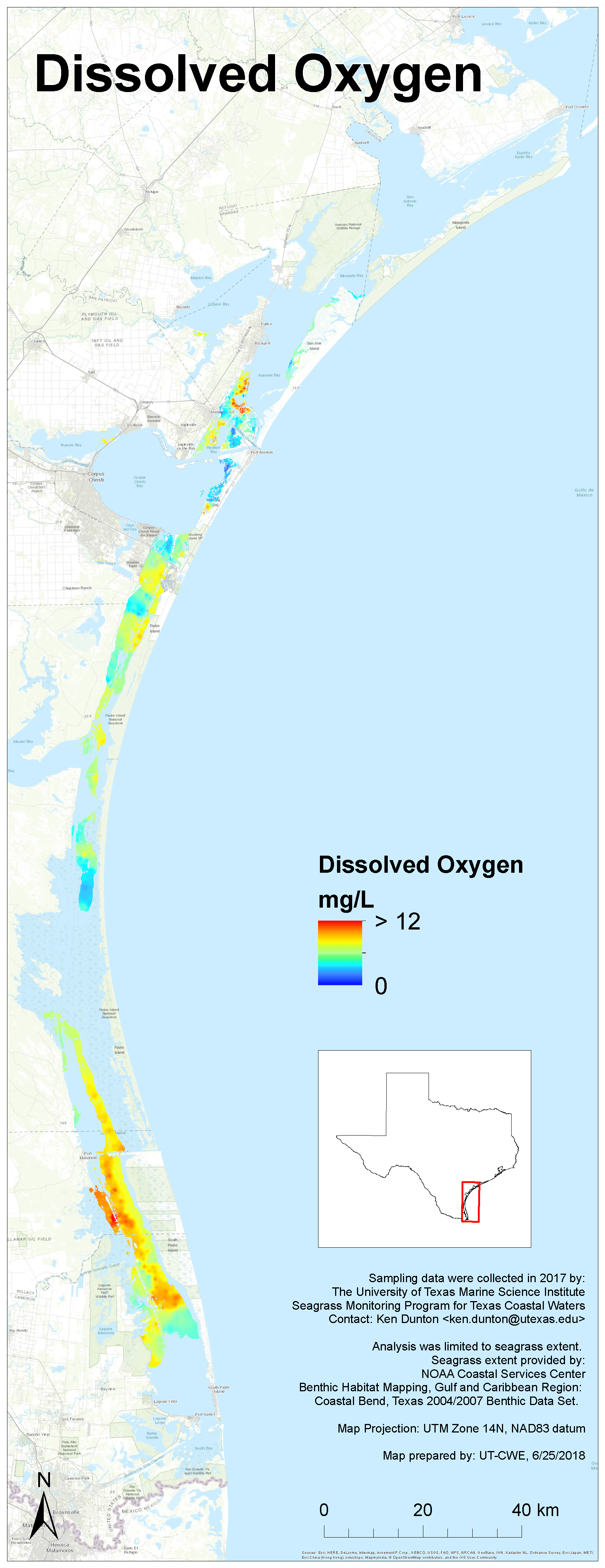
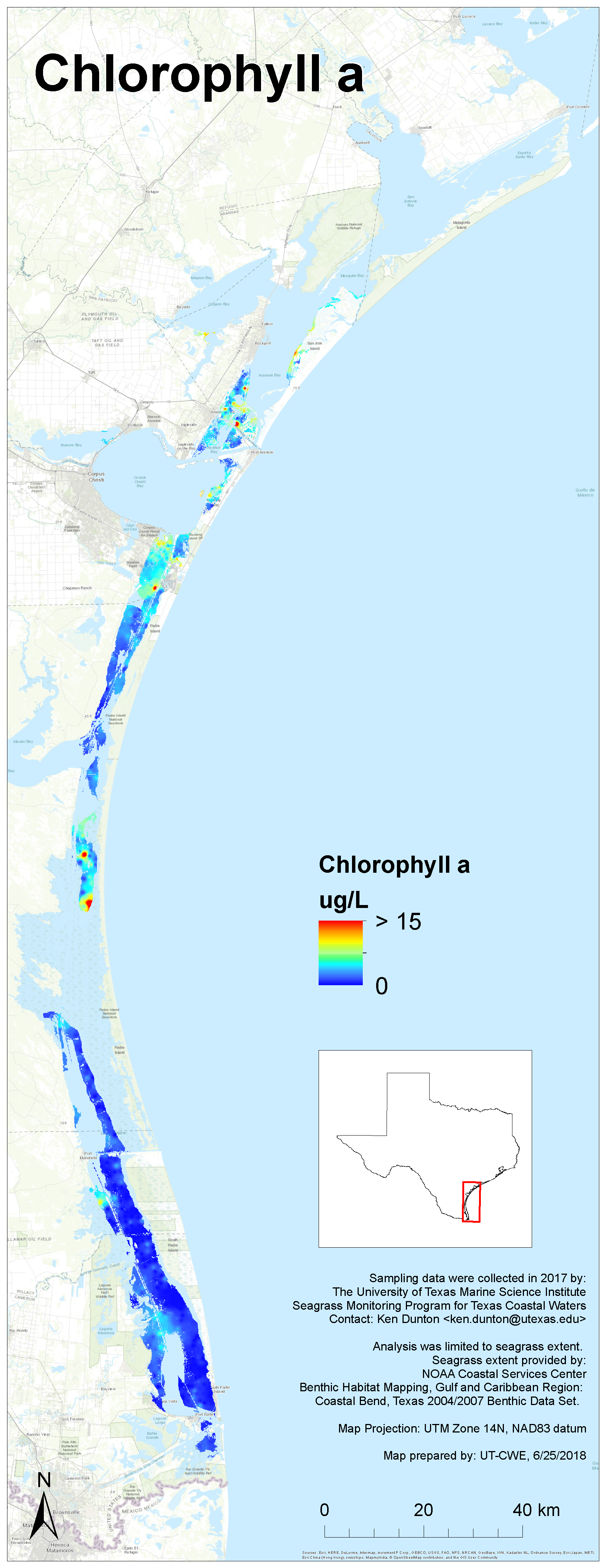
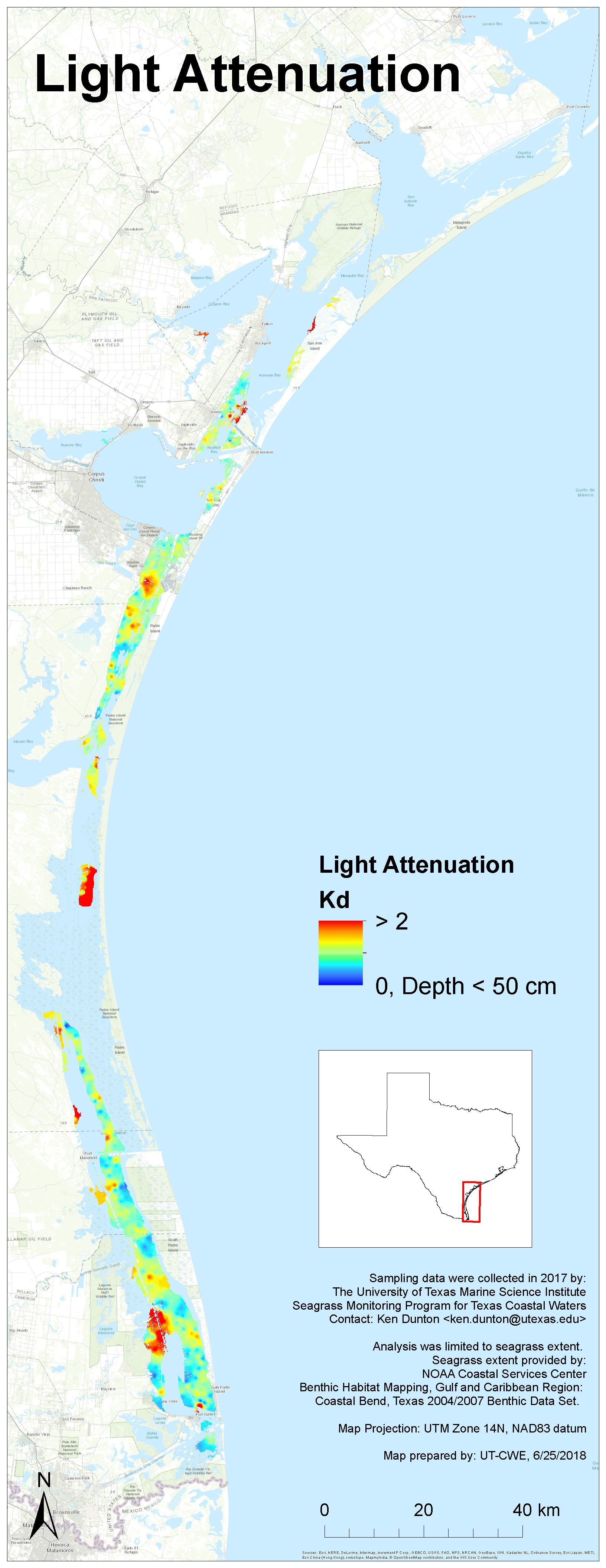
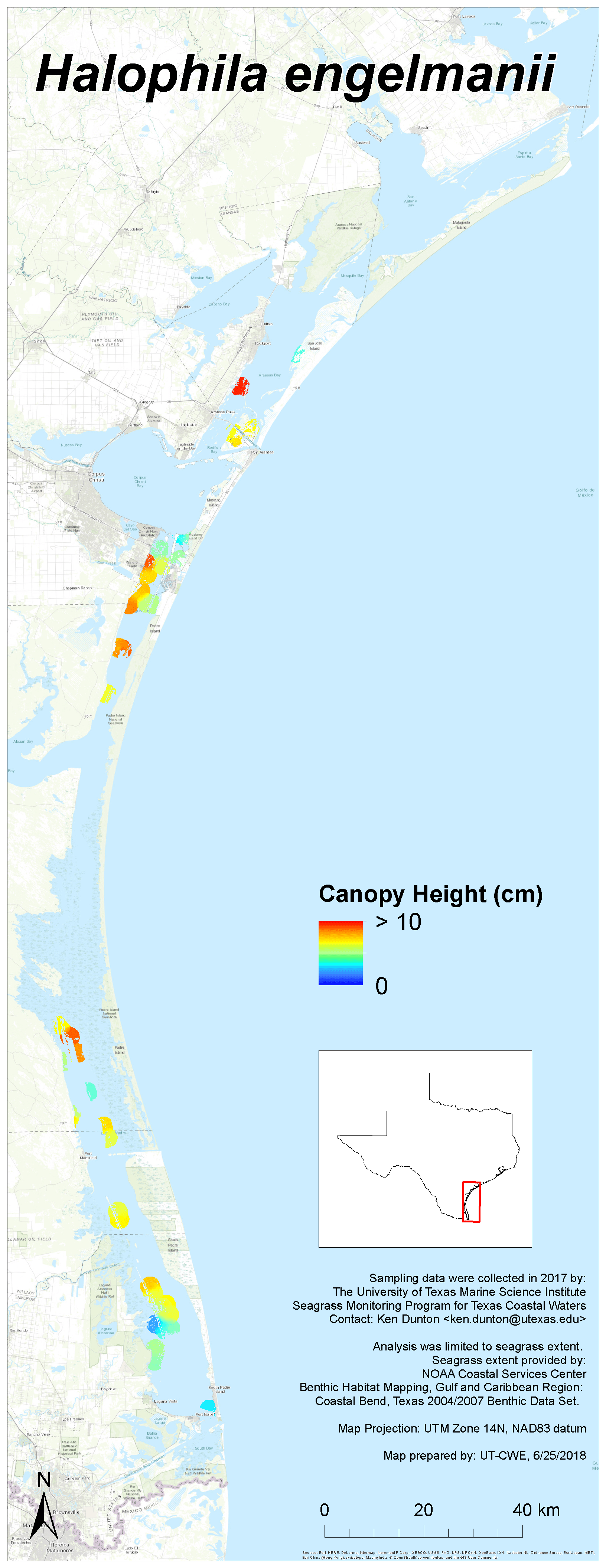
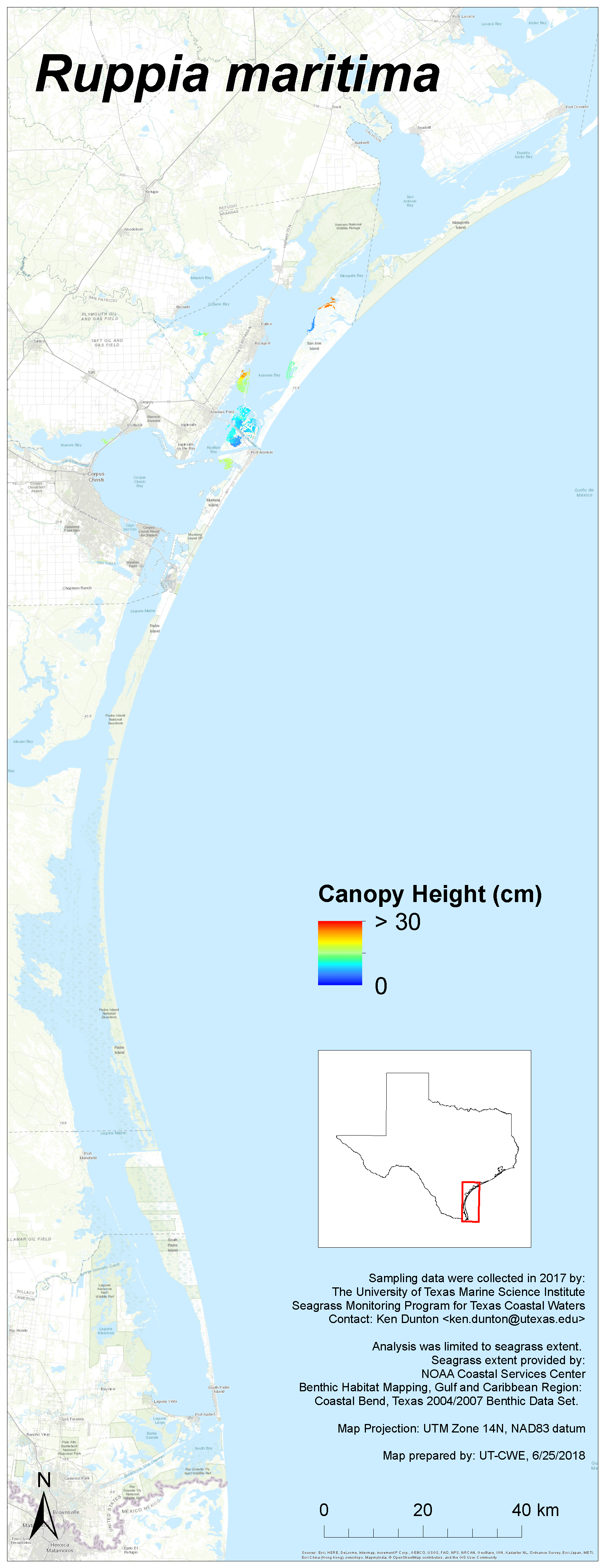
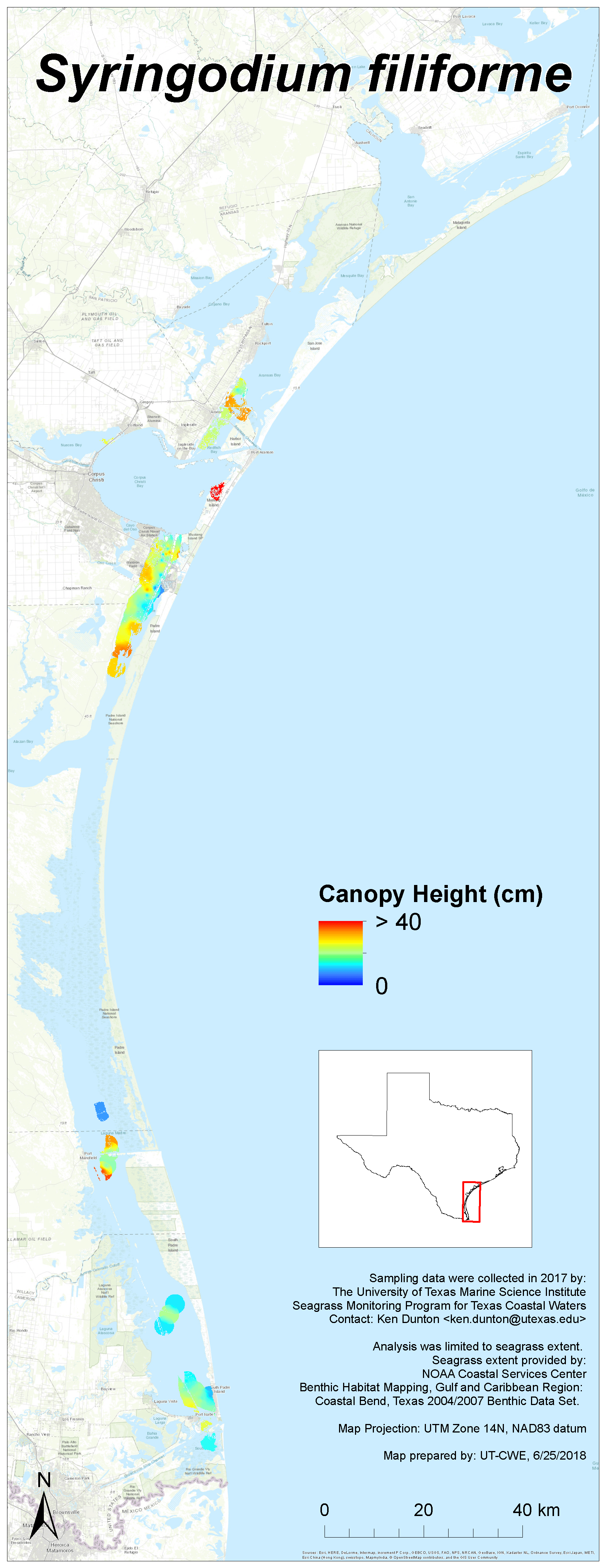
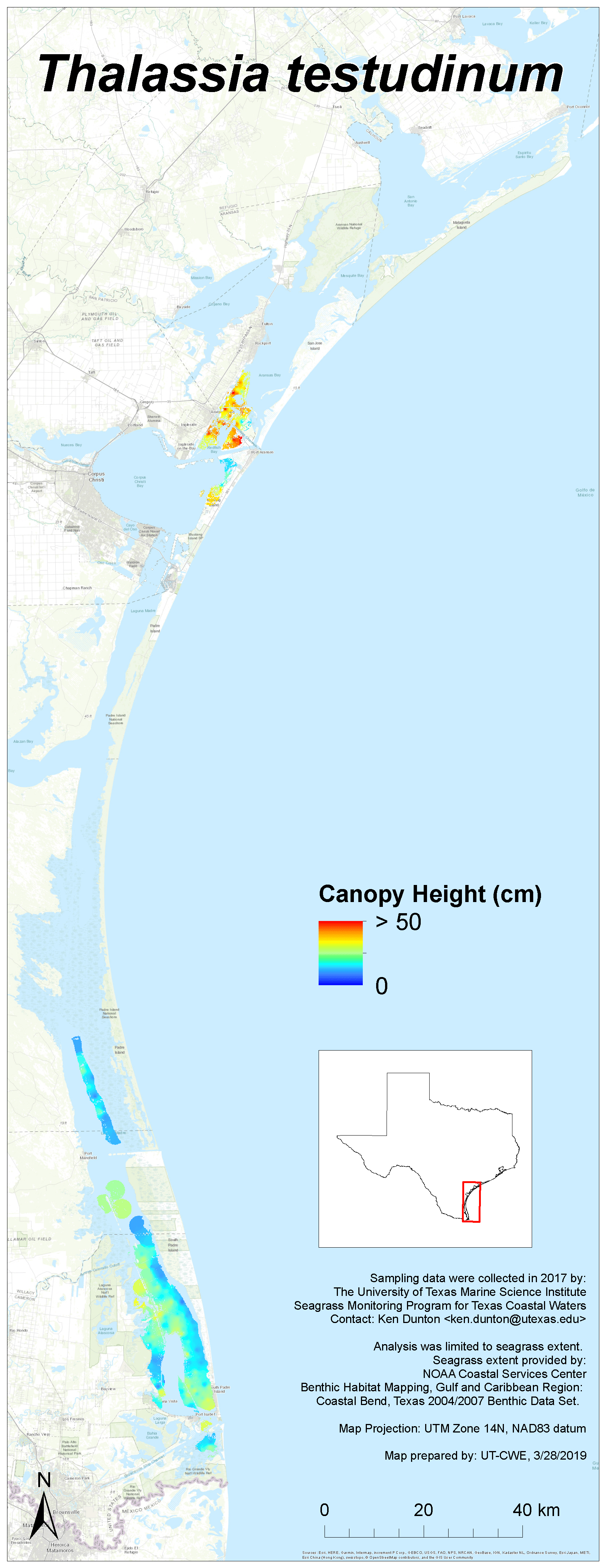
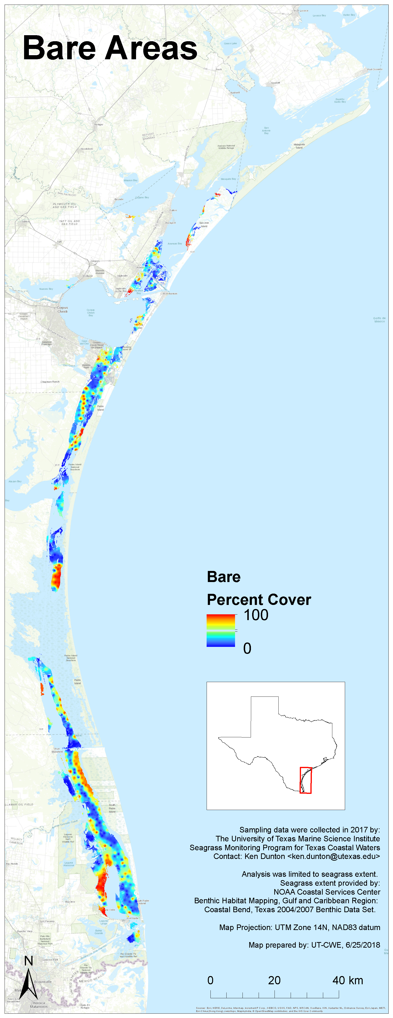
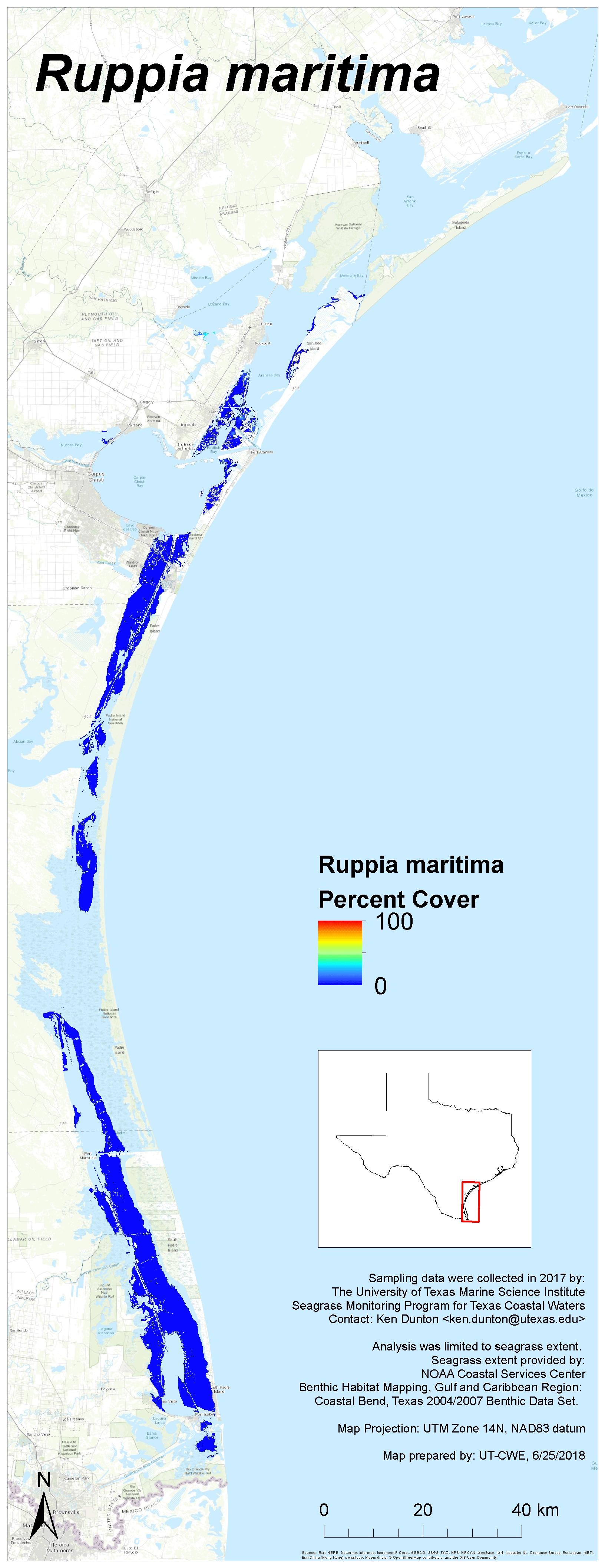
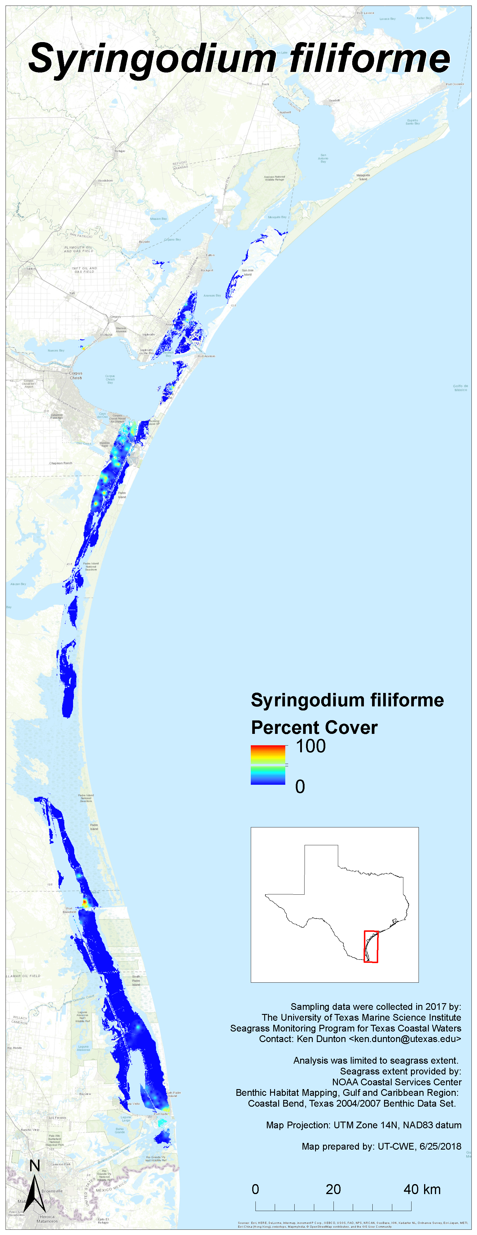
2017 Results
Each image links to a high resolution PNG. Click here to download the entire set (zipped, 27 MB).


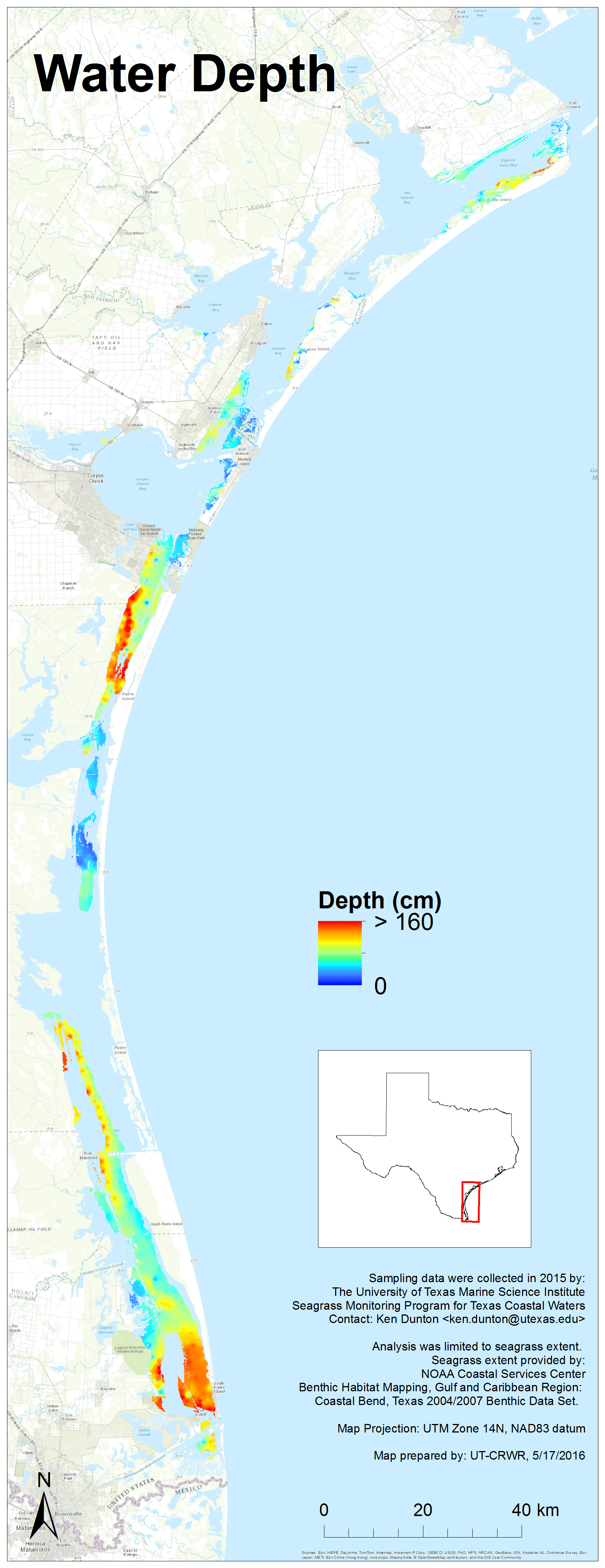
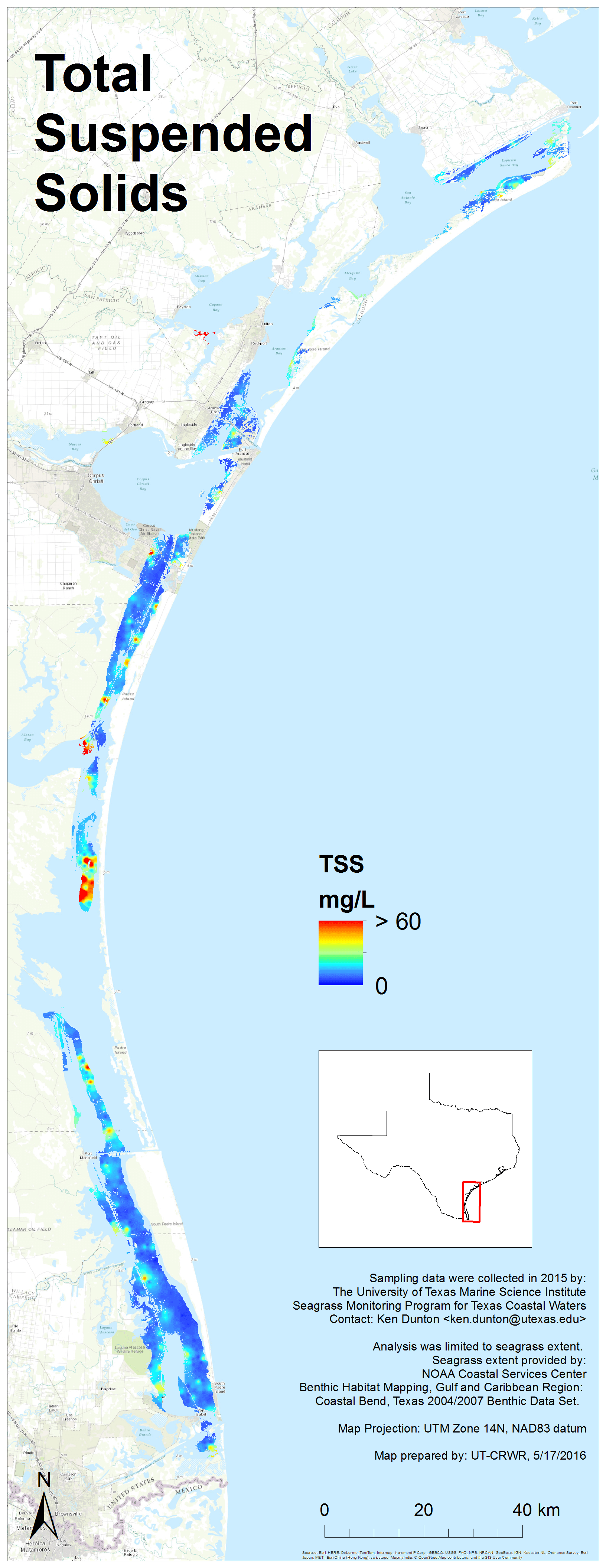
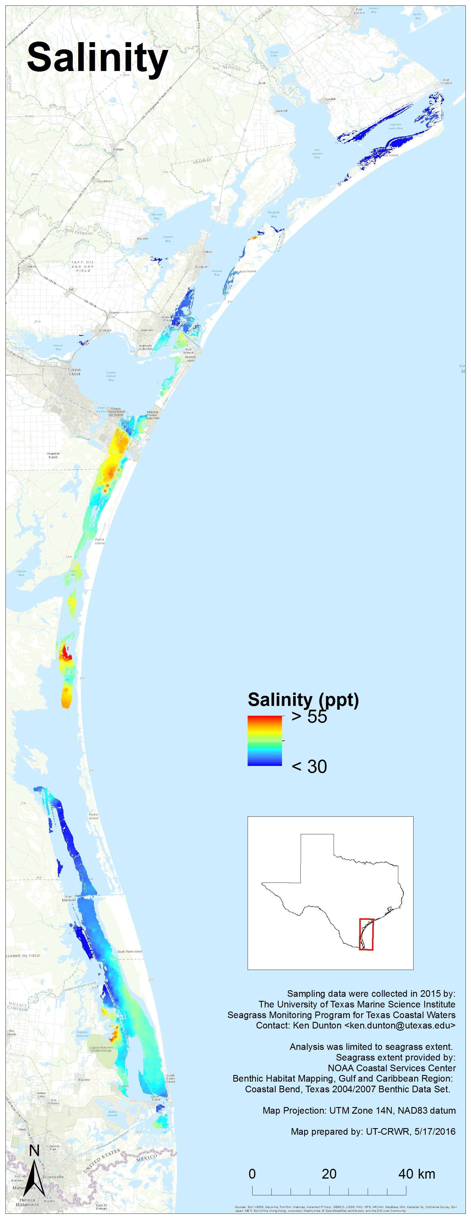
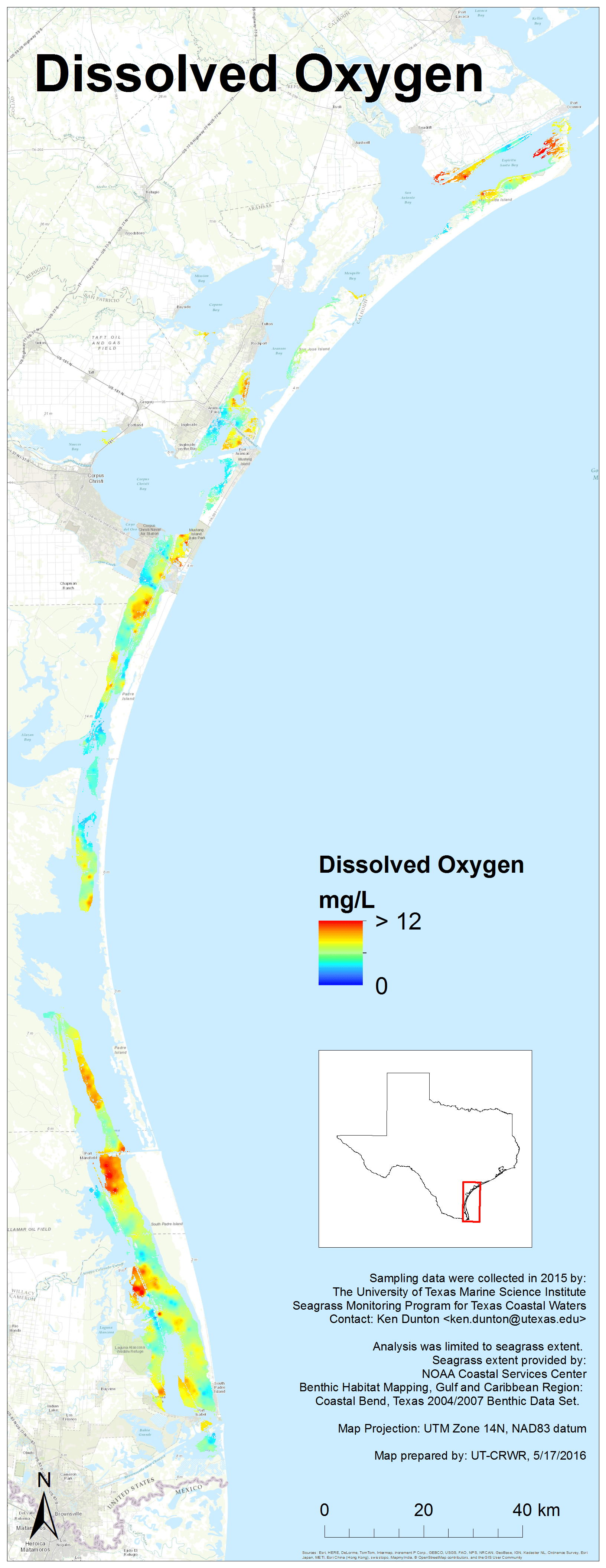
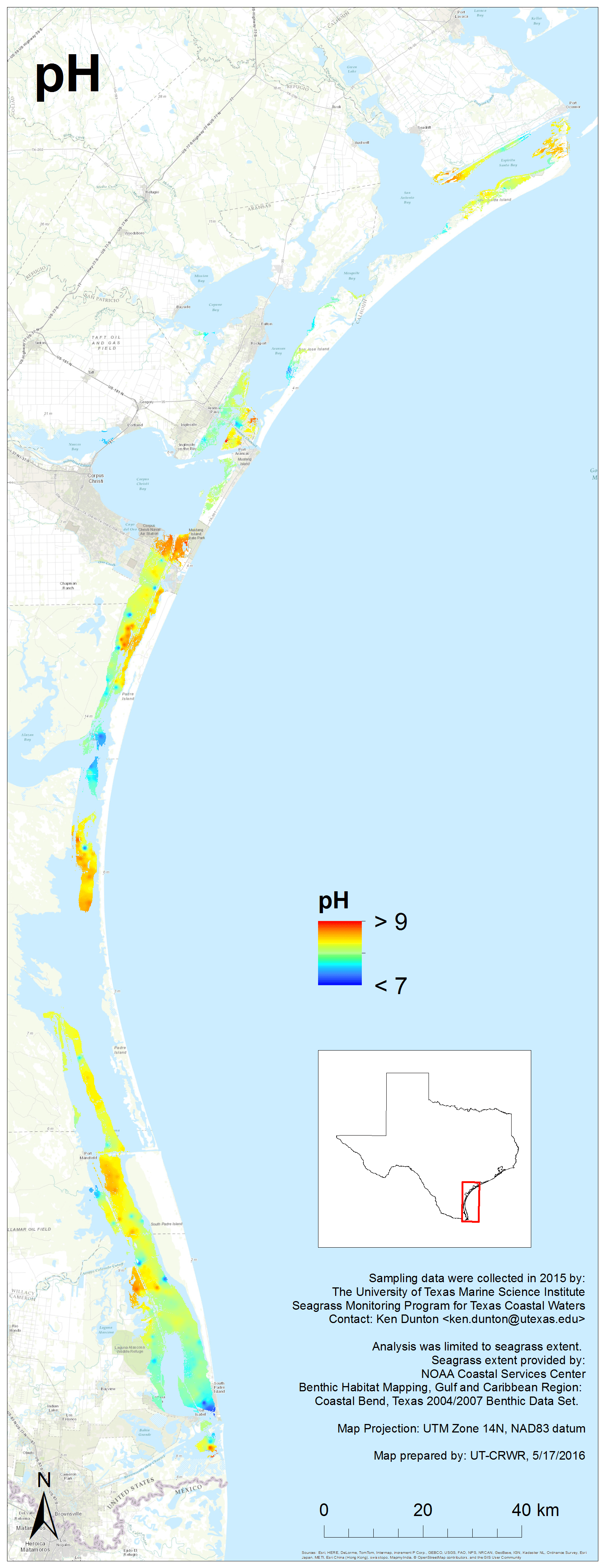
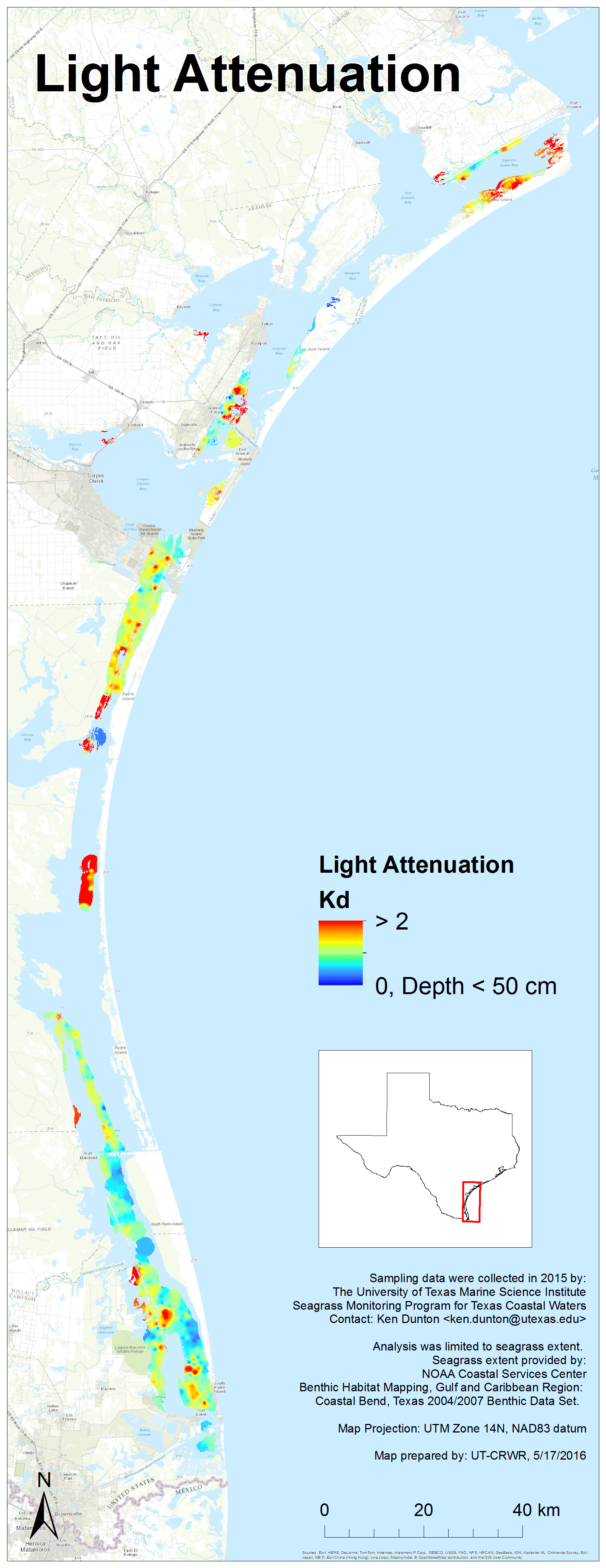
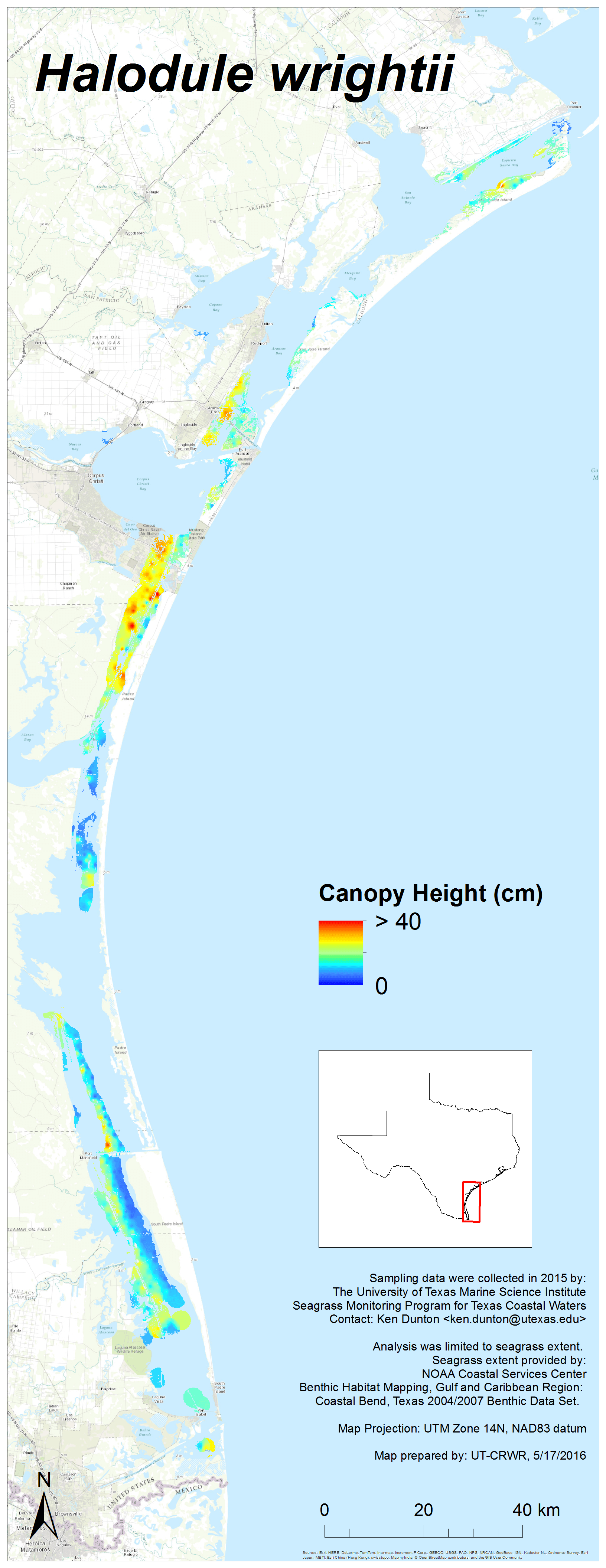
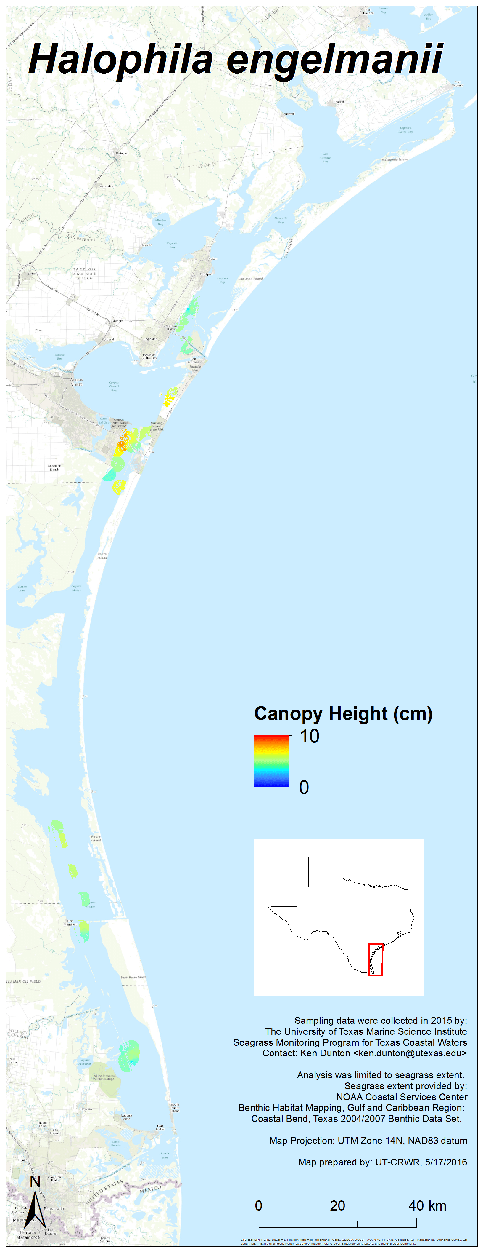
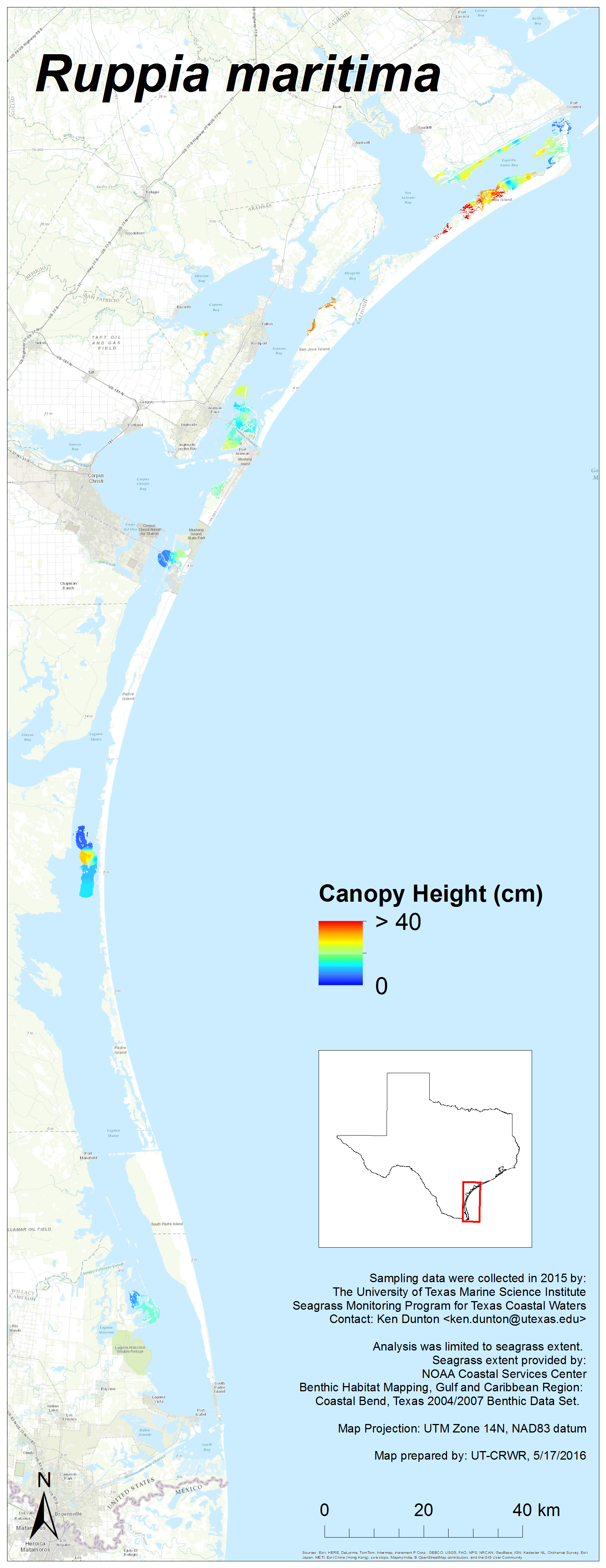
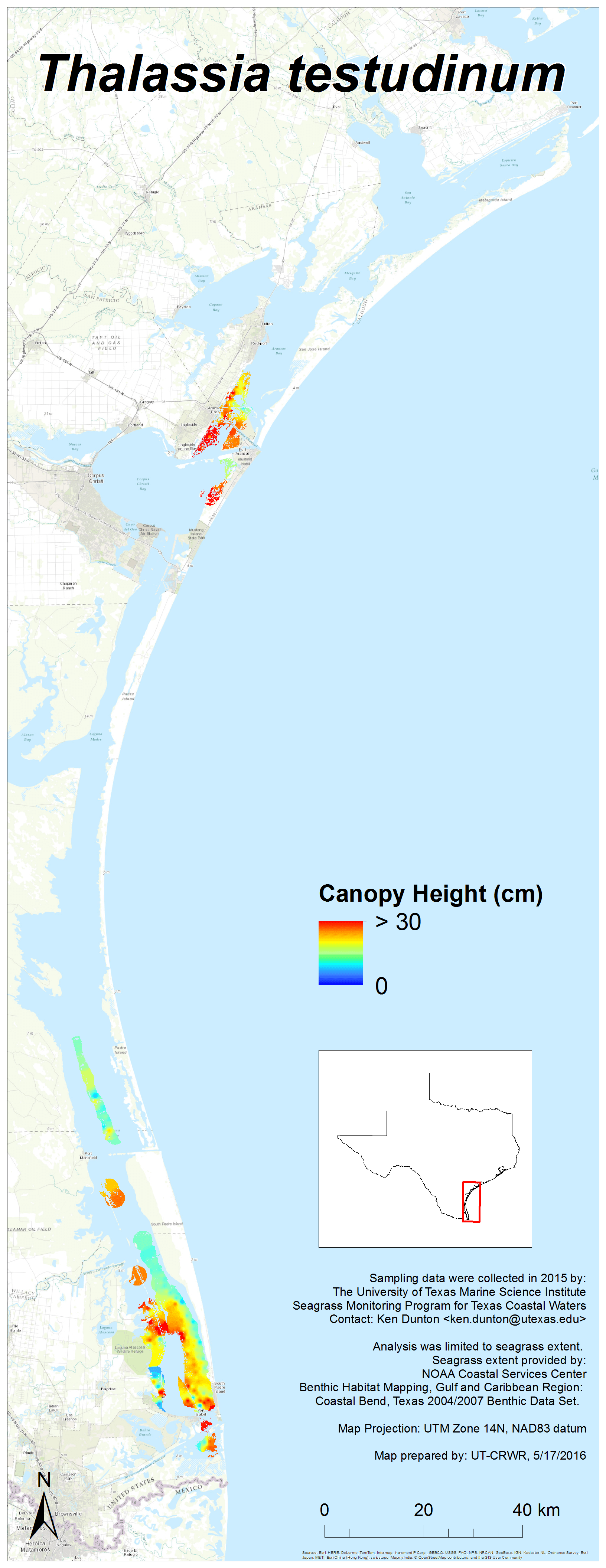
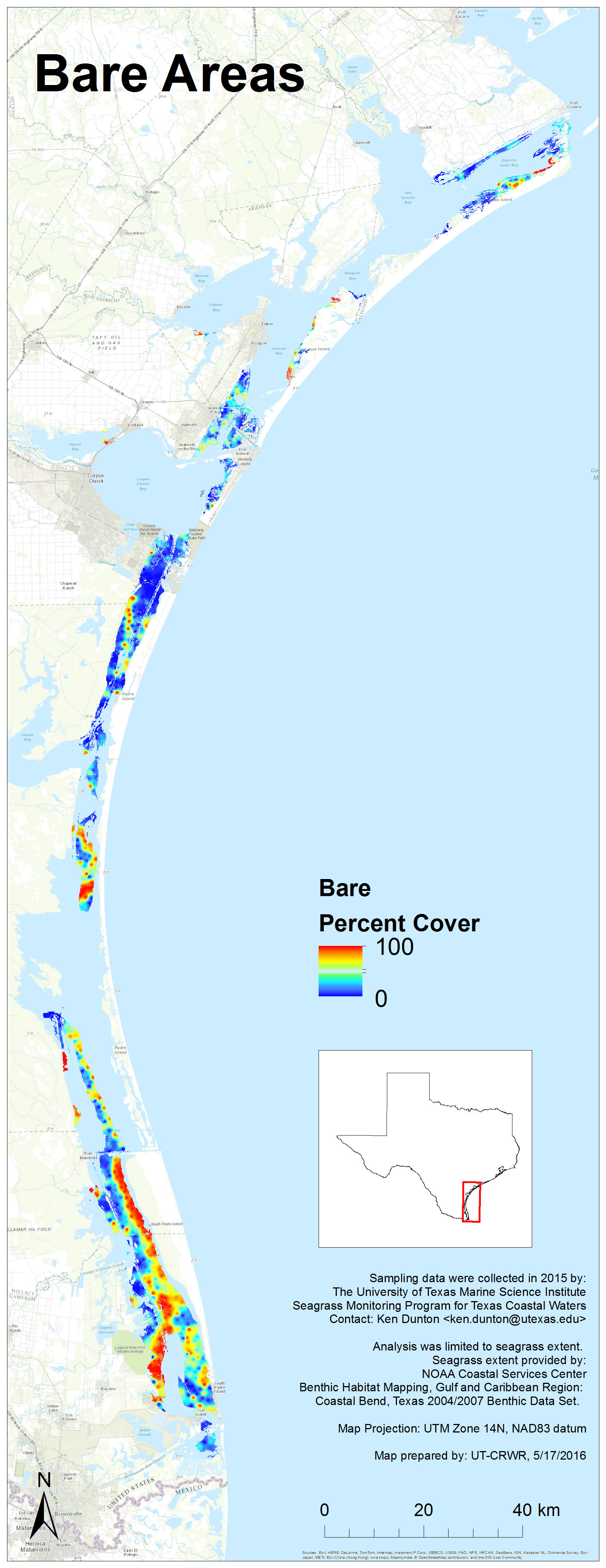
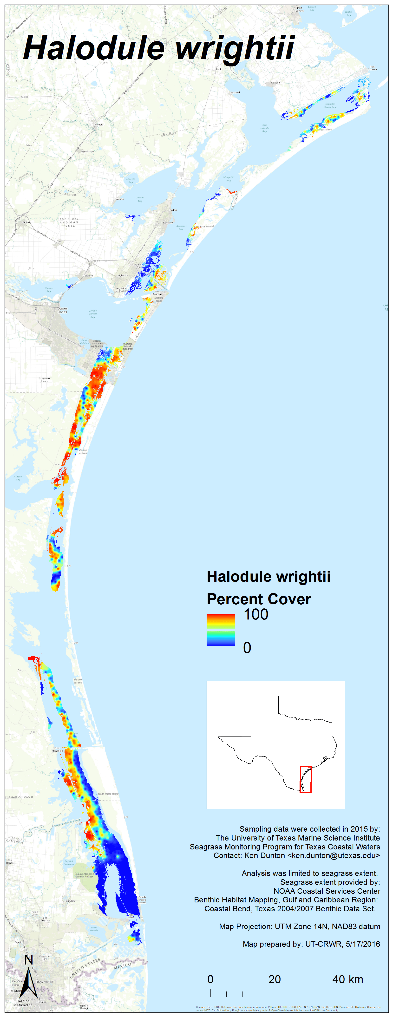
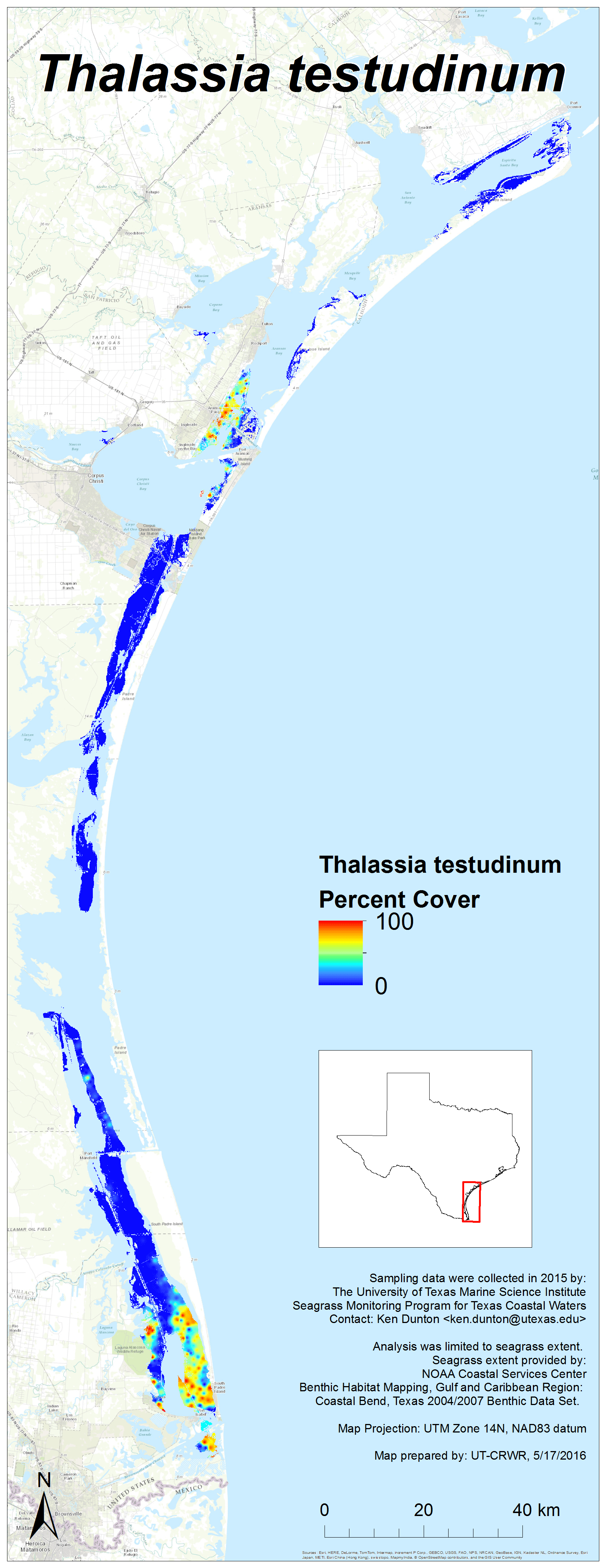
2015 Results
Each image links to a high resolution PNG. Click here to download the entire set (zipped, 24 MB).


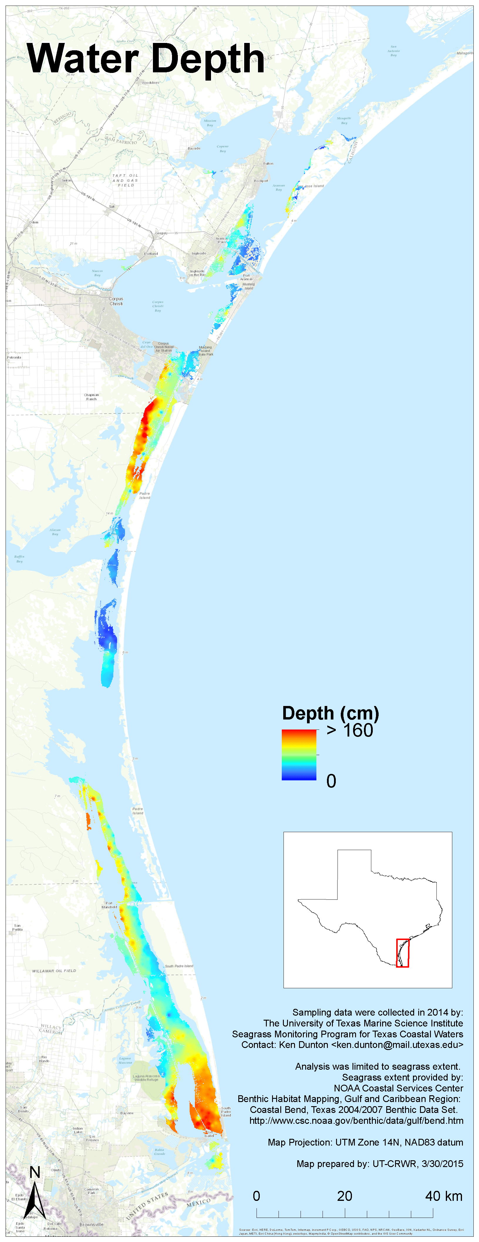
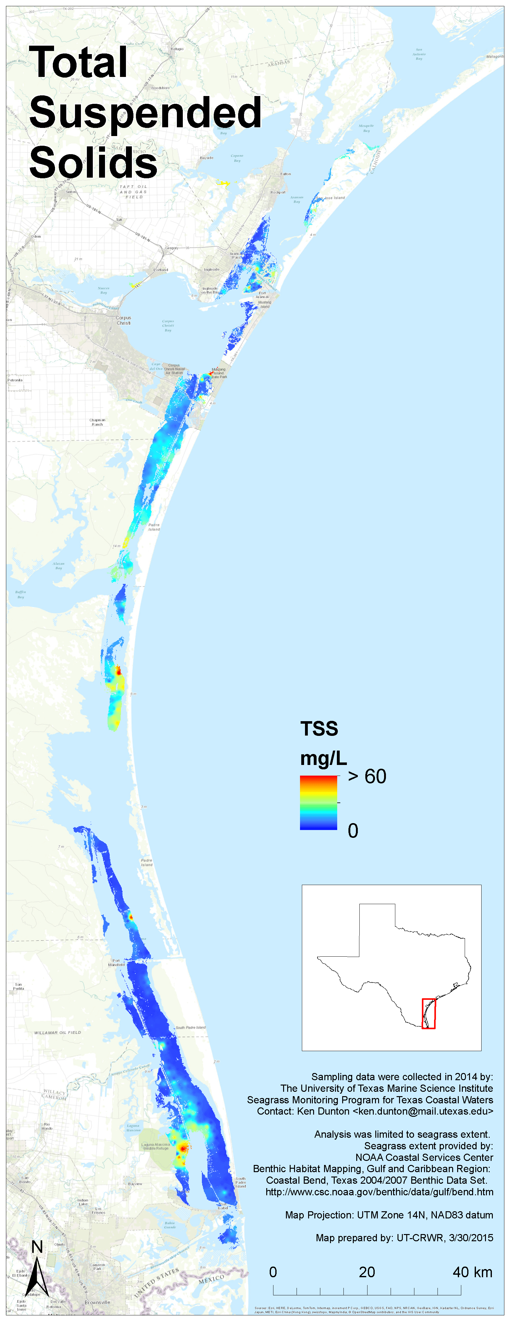
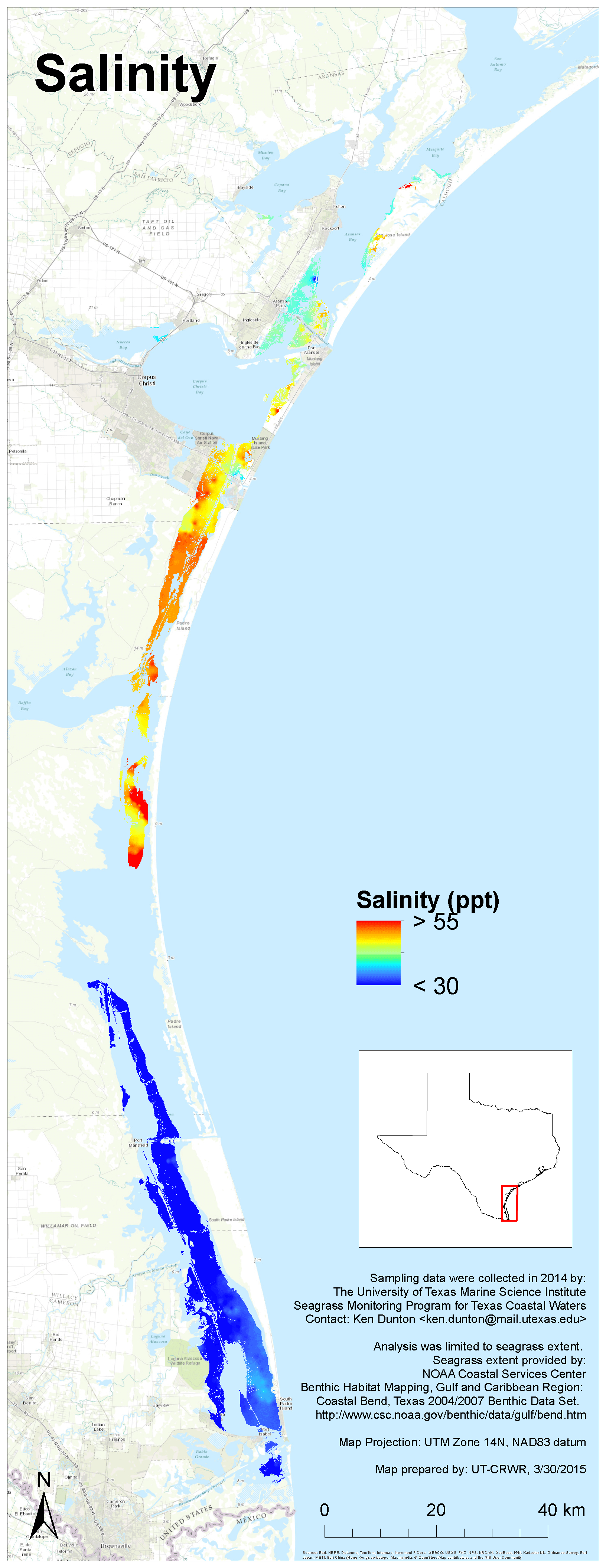
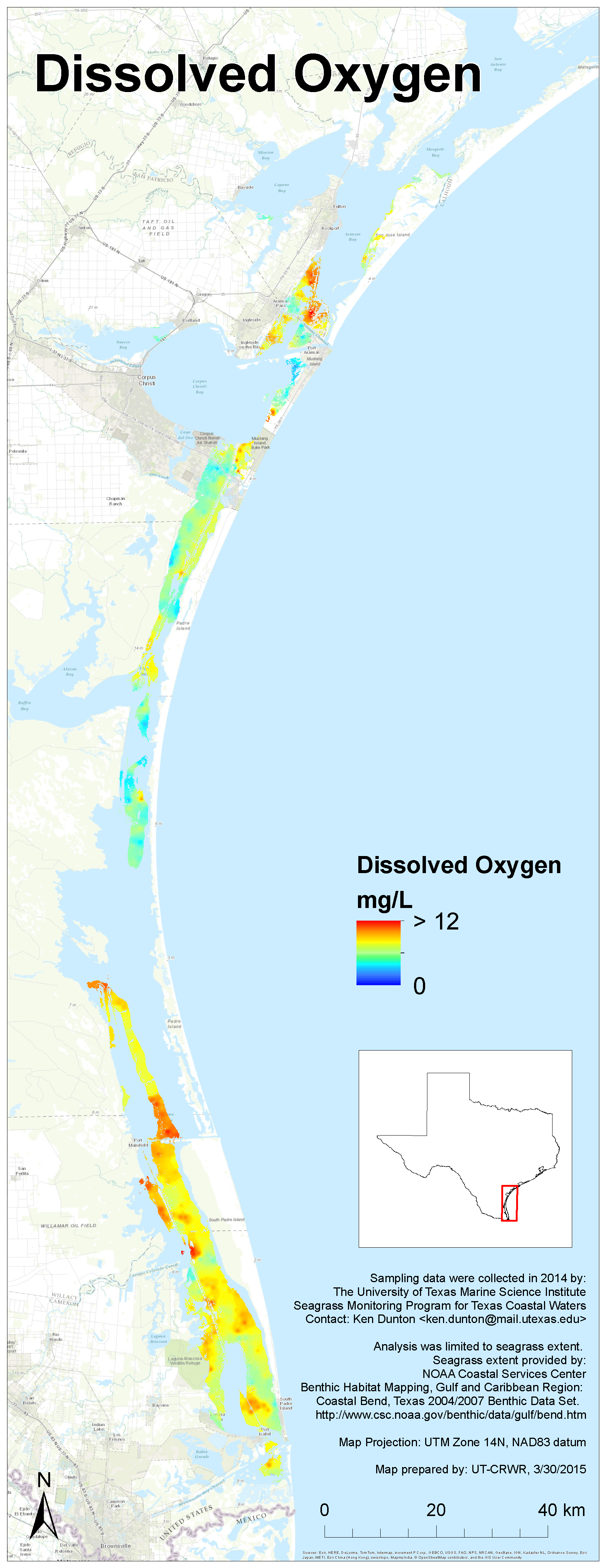
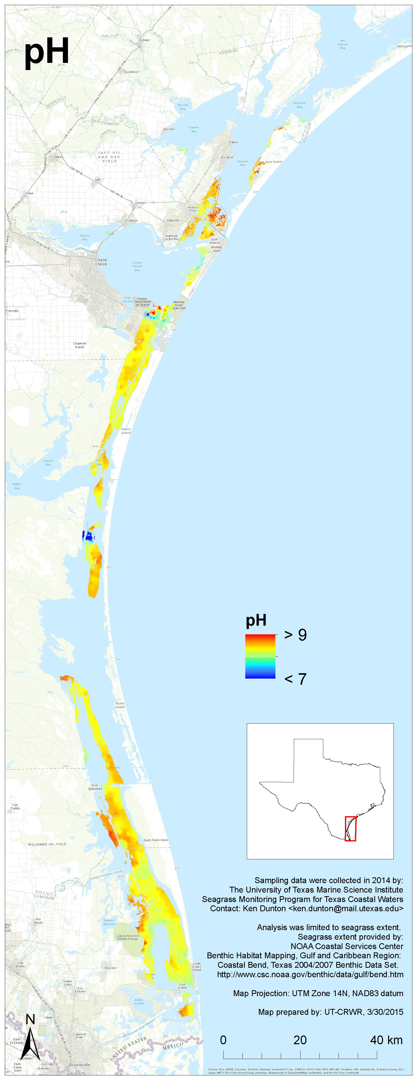
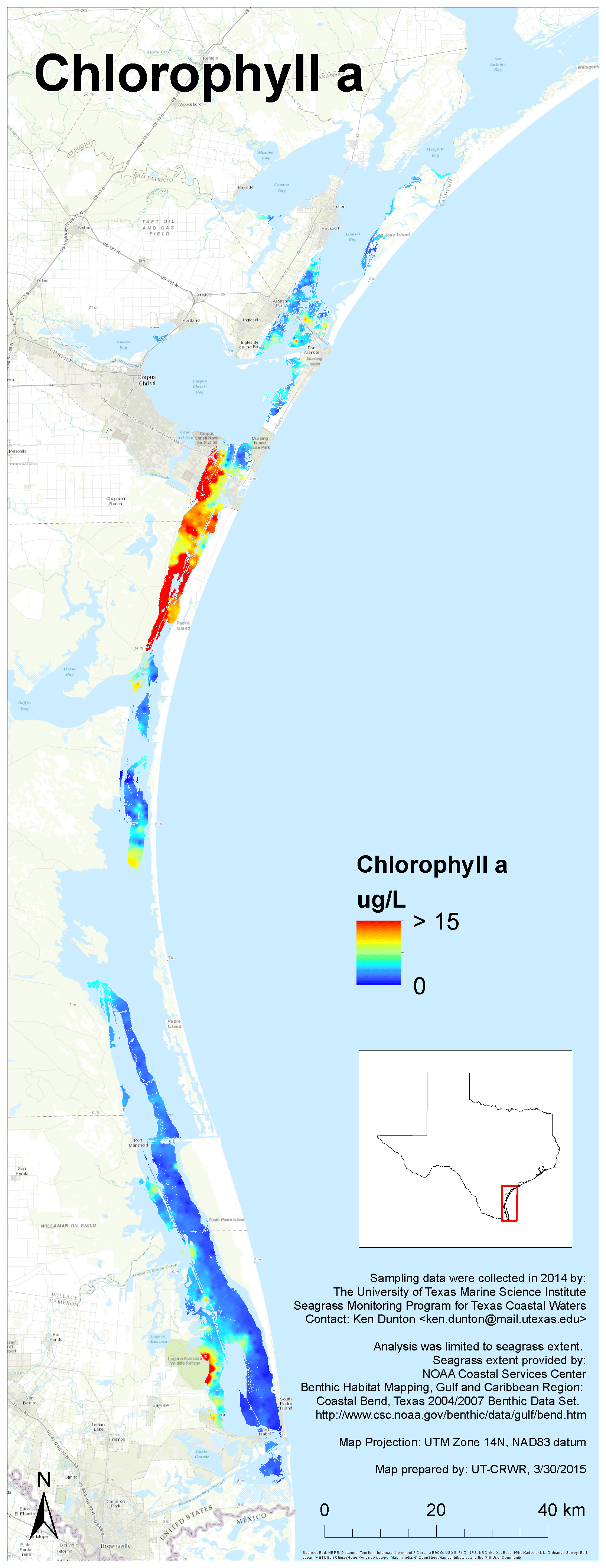
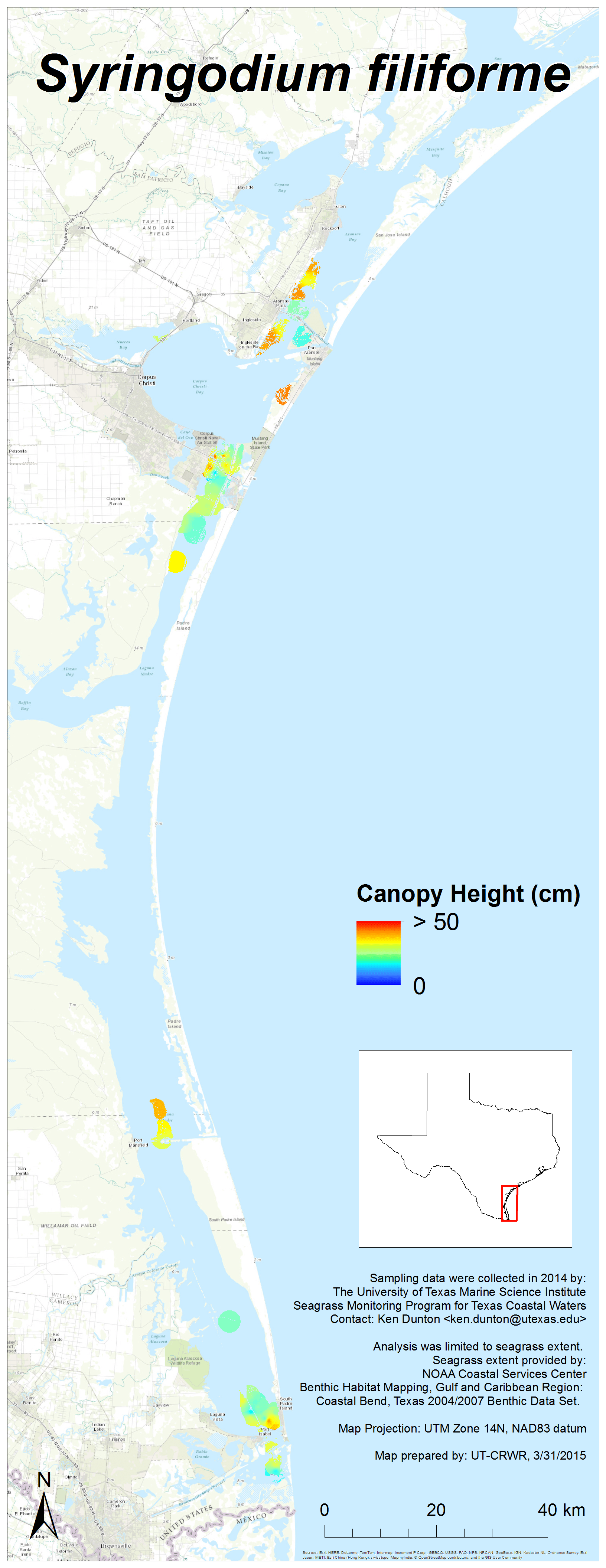
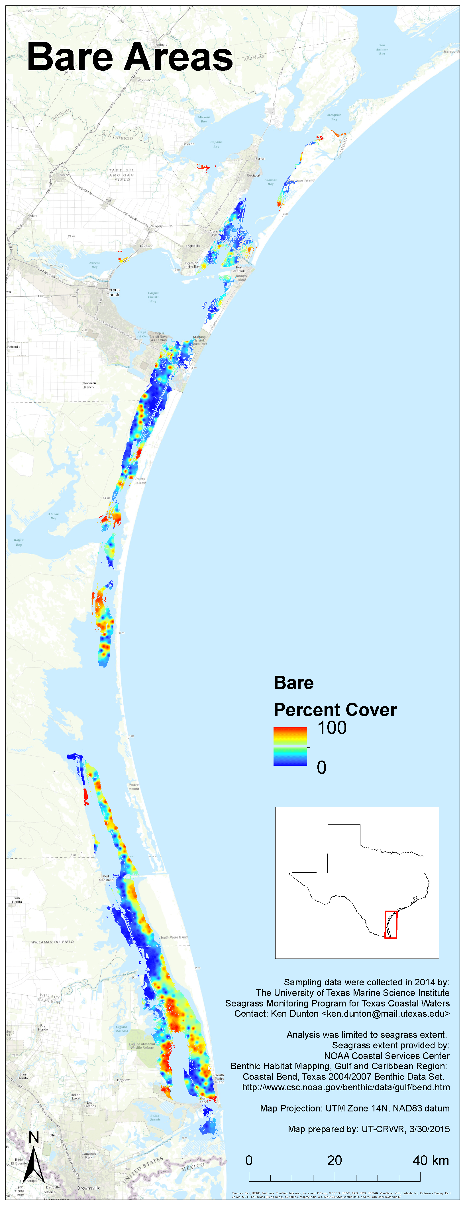
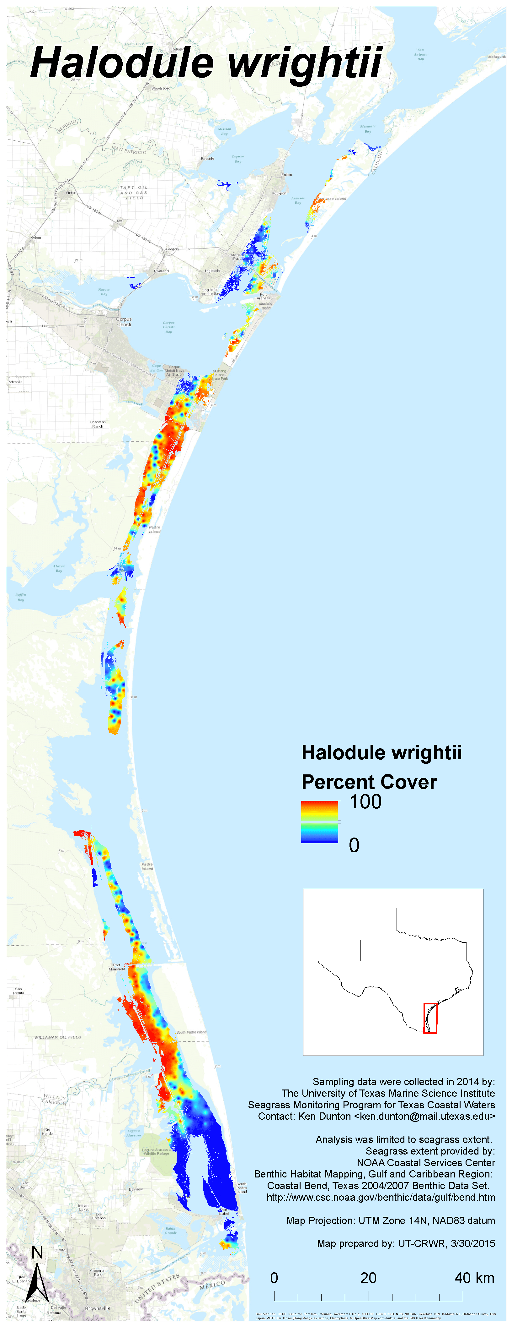
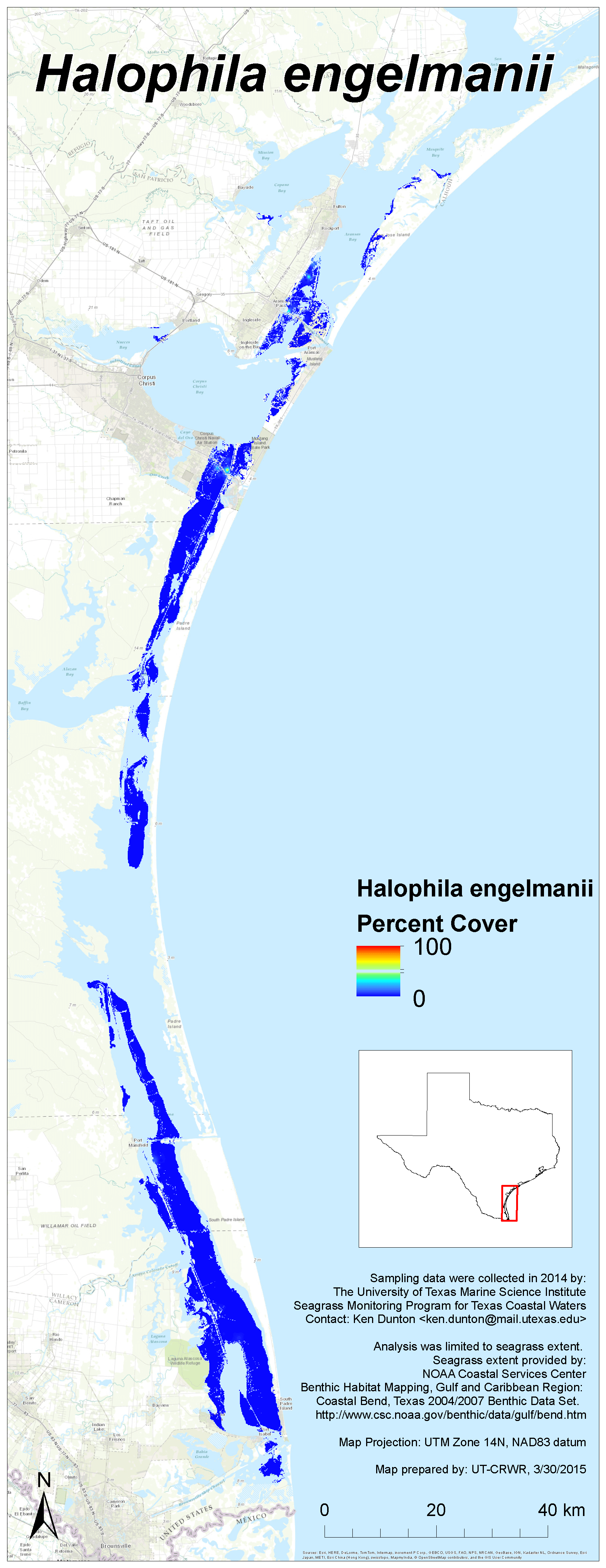
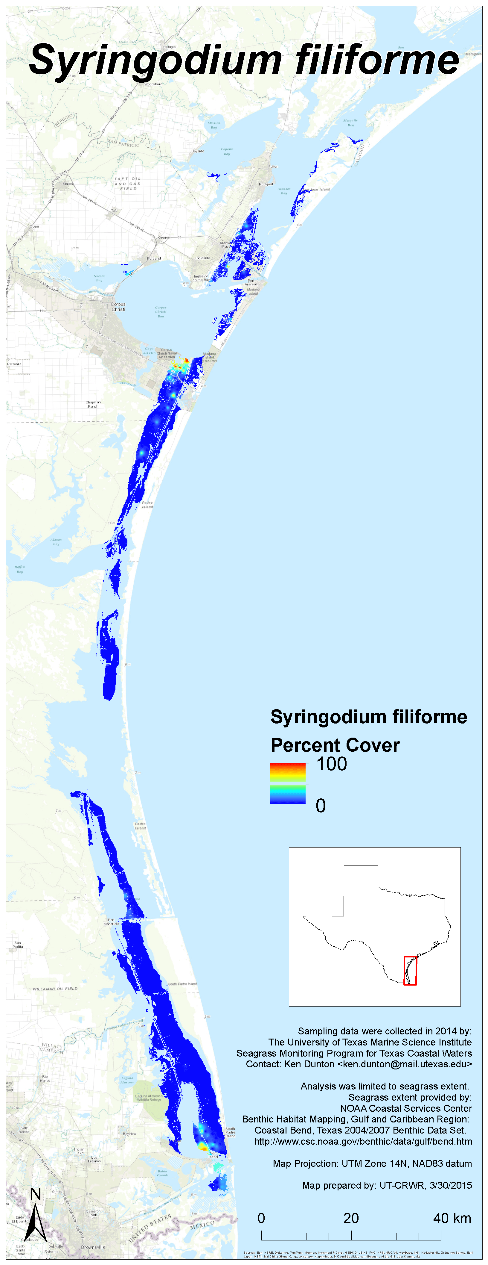
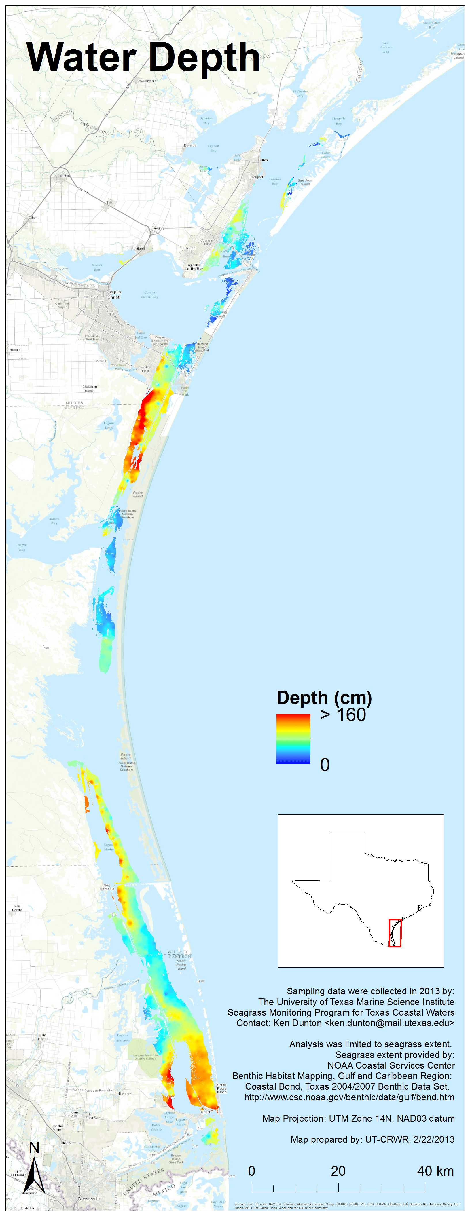
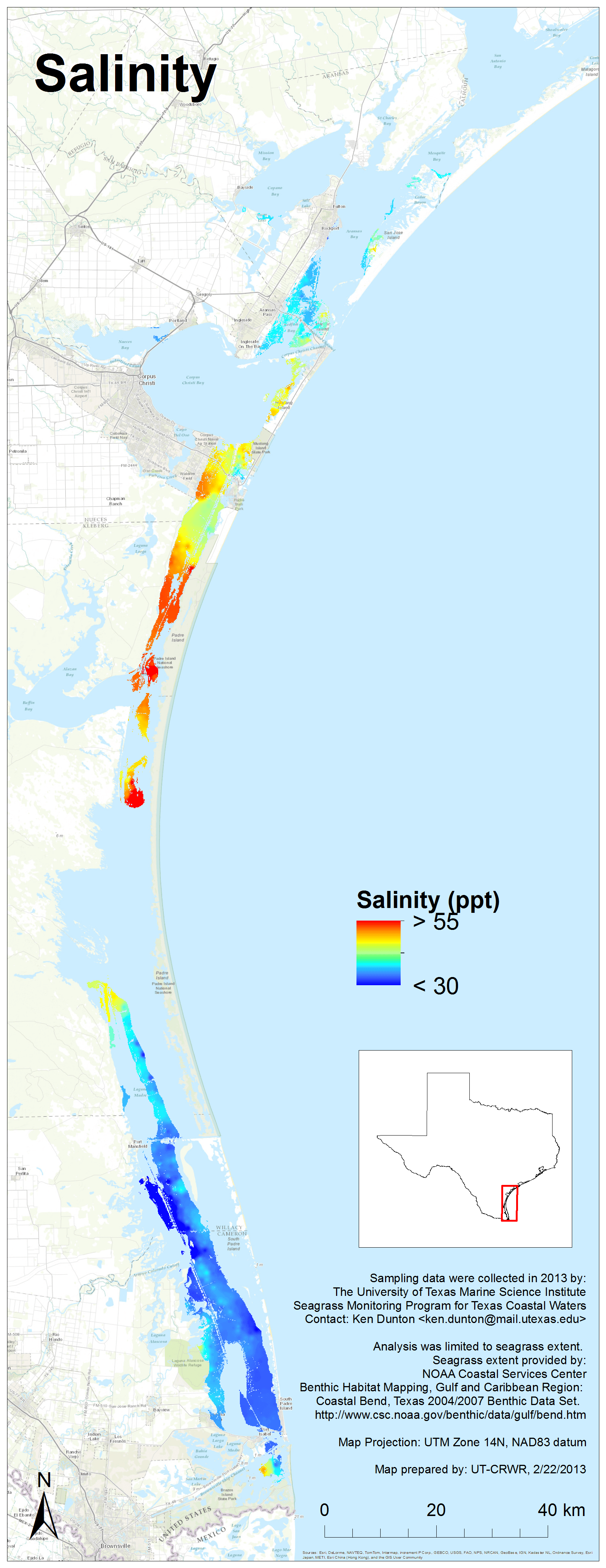
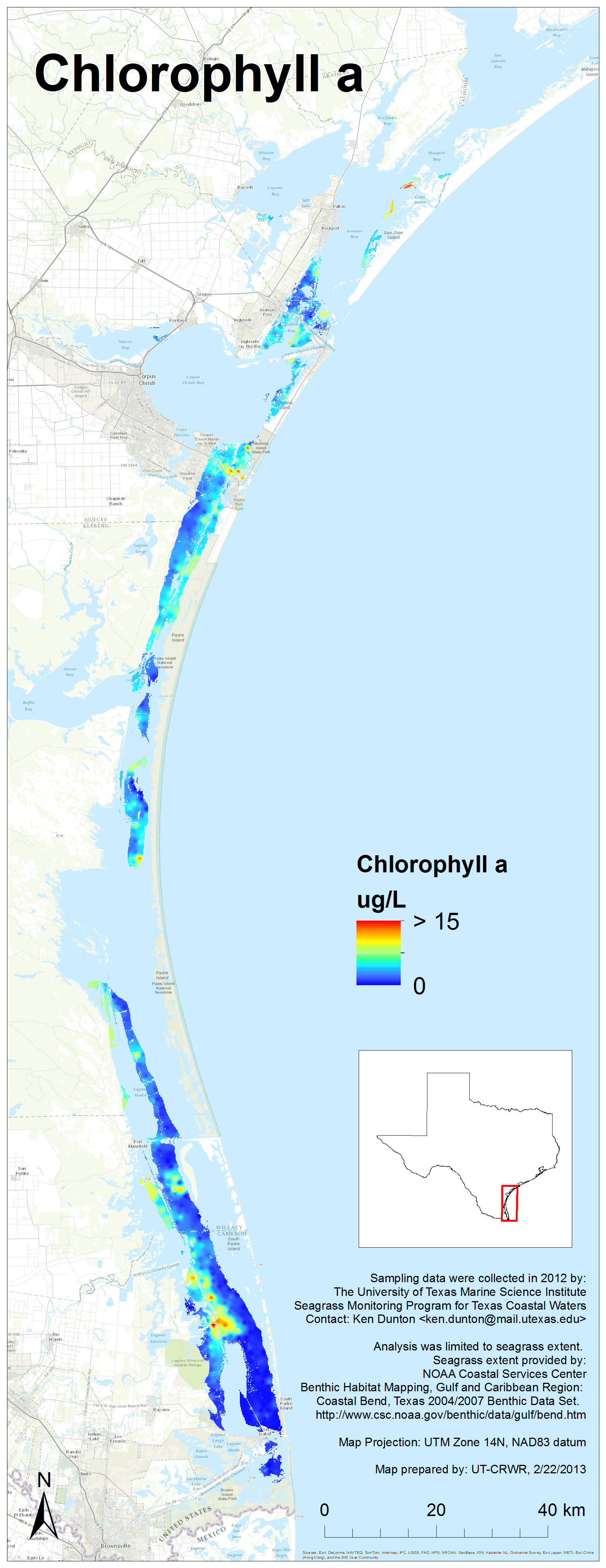
2014 Results
Each image links to a high resolution PNG. Click here to download the entire set (zipped, 24 MB).


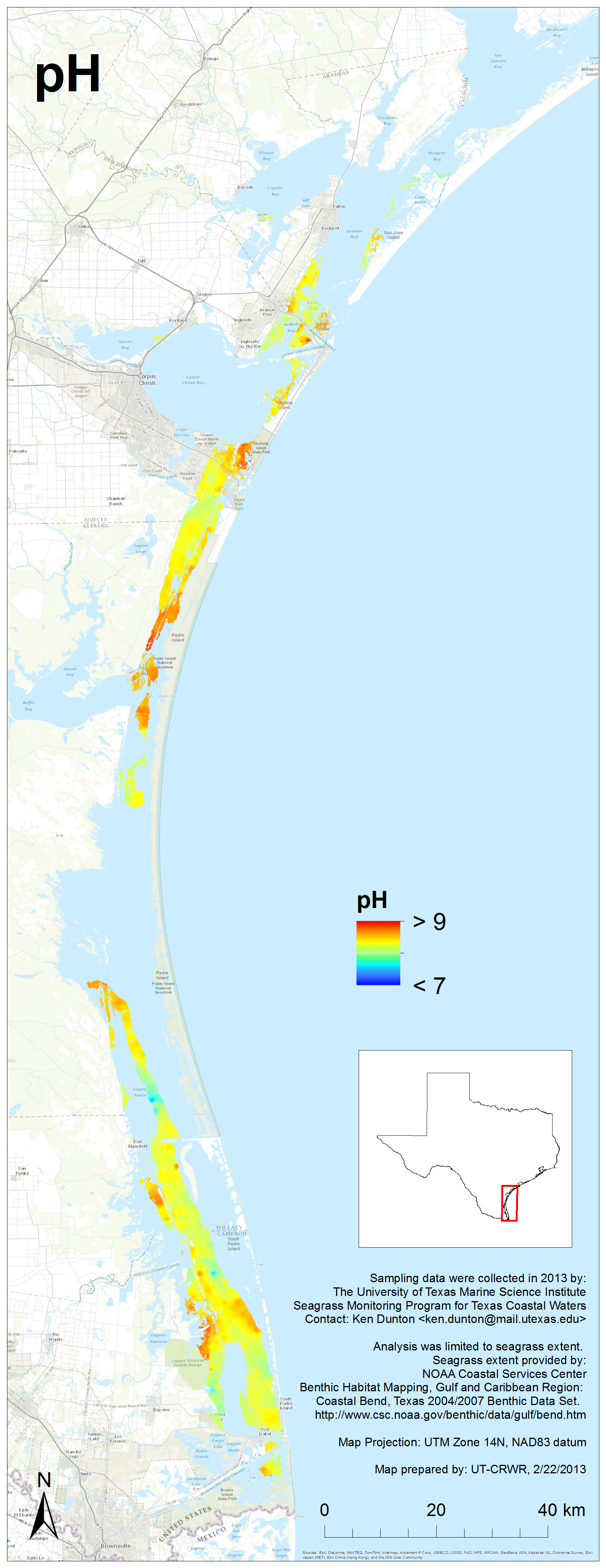
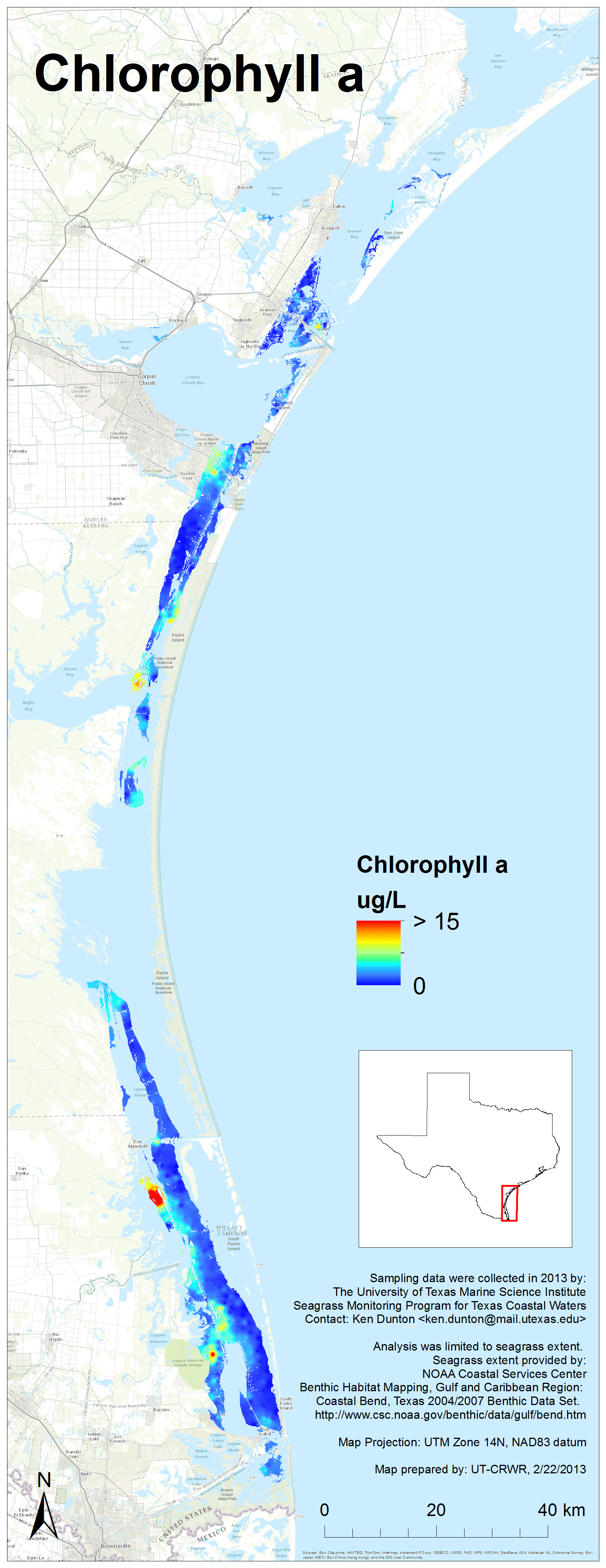
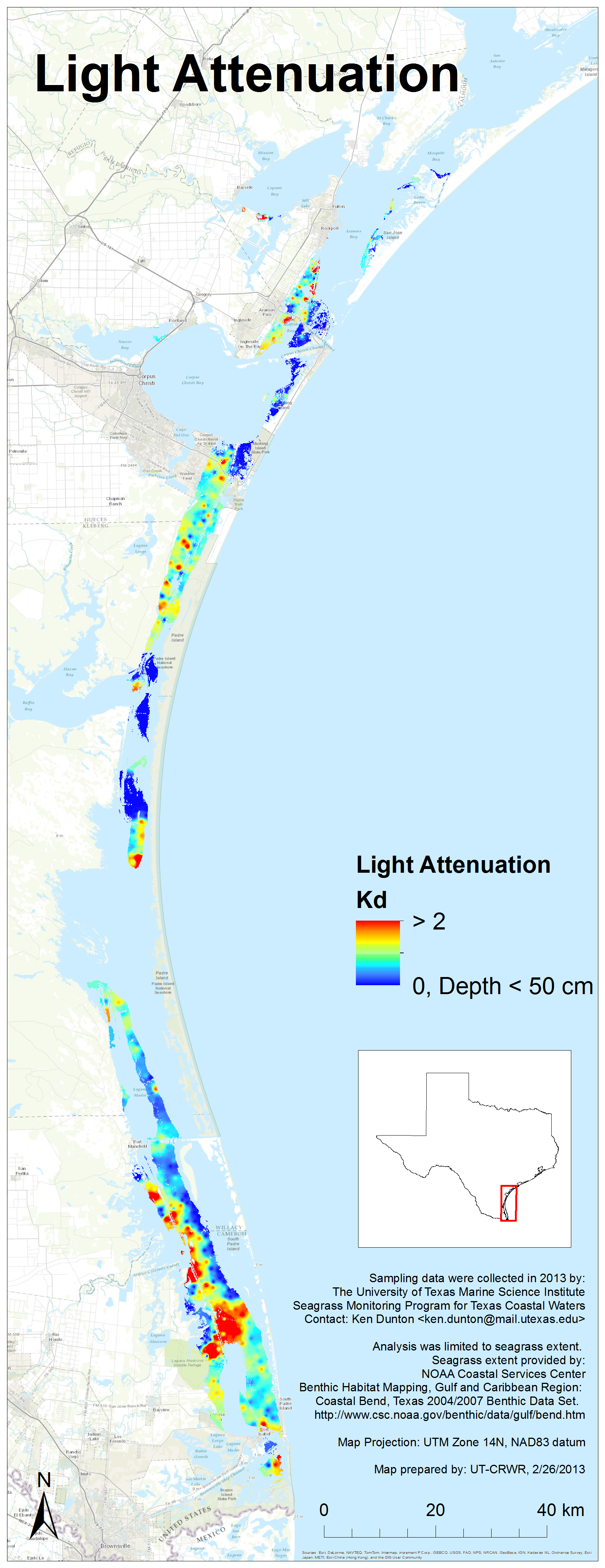
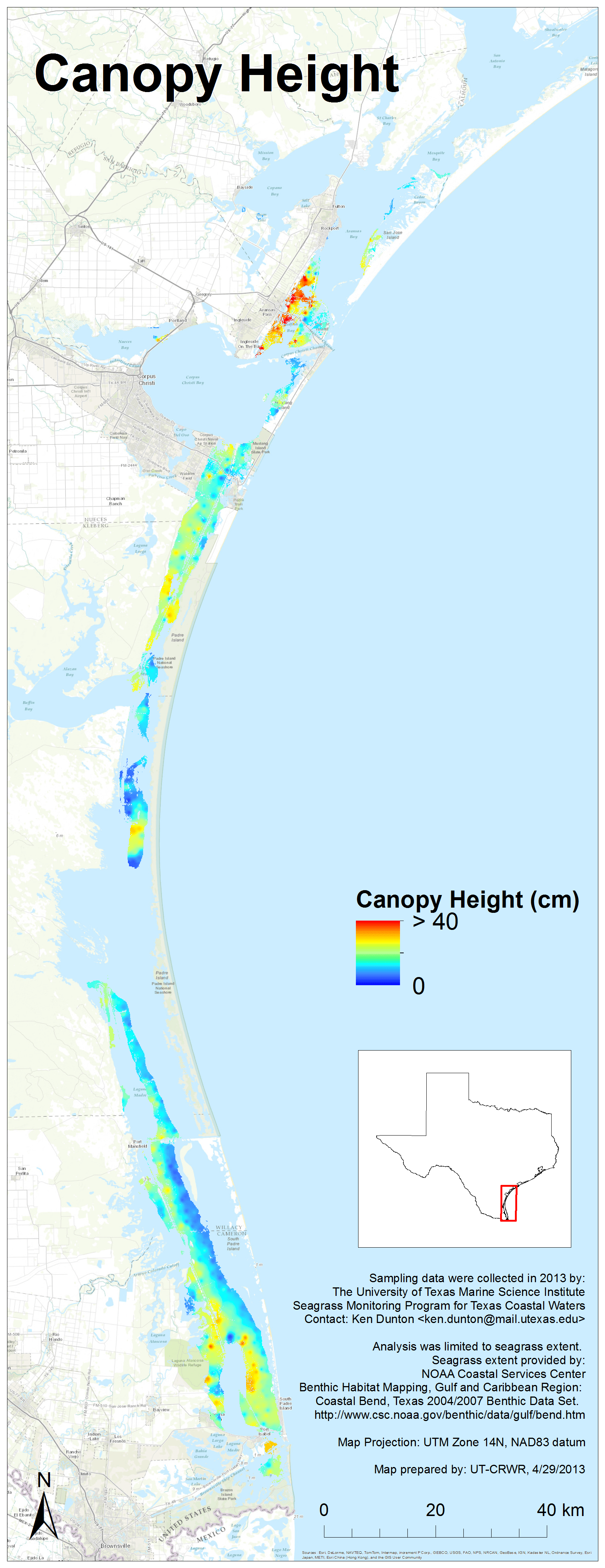
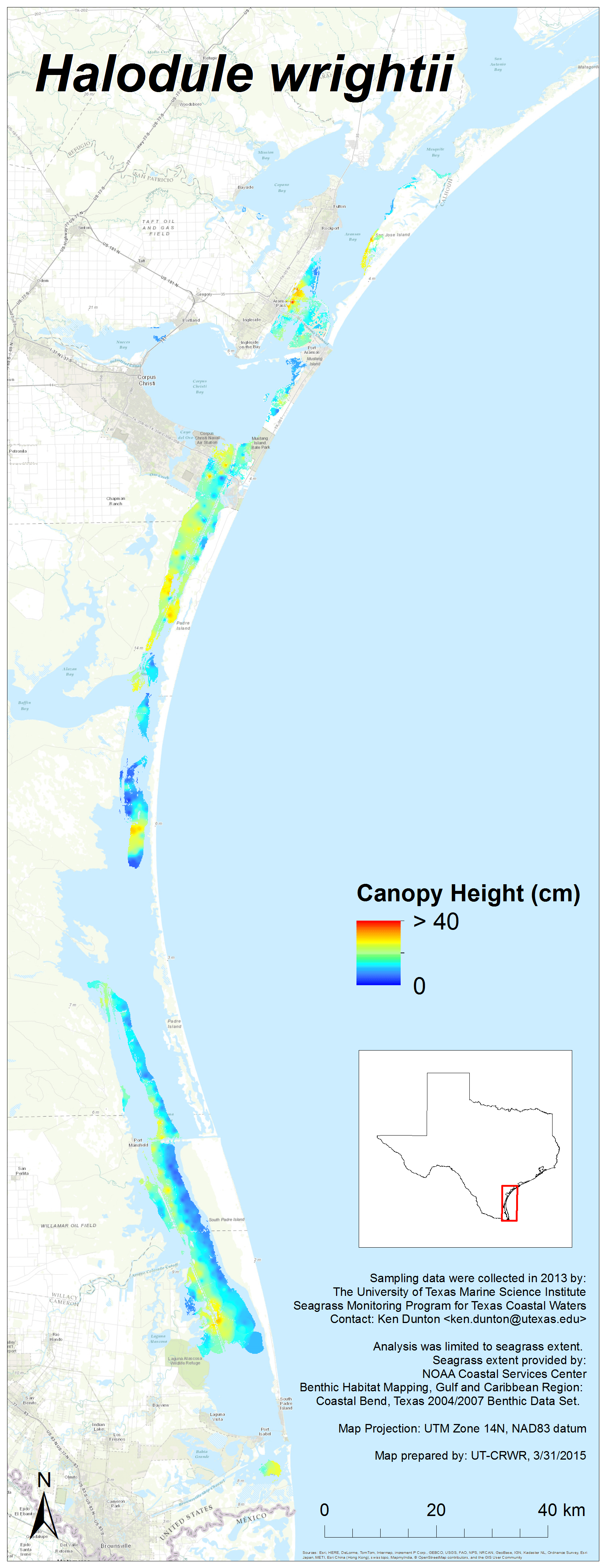
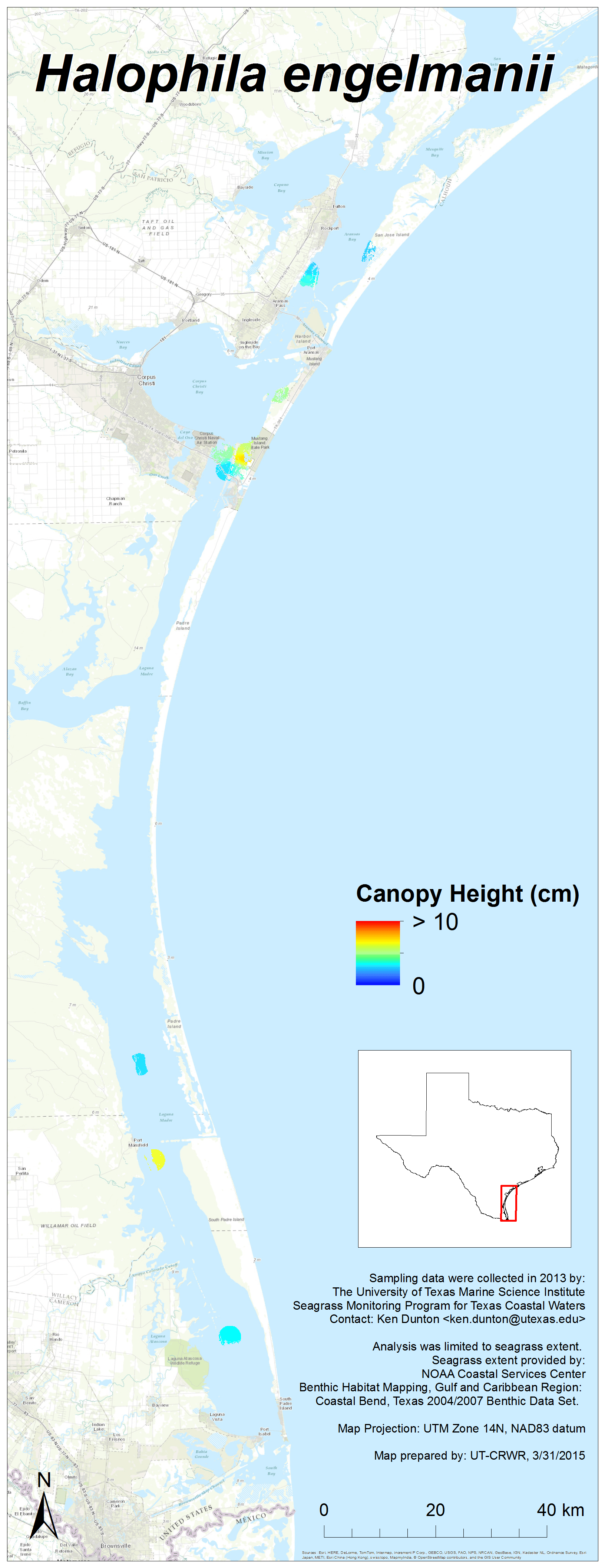
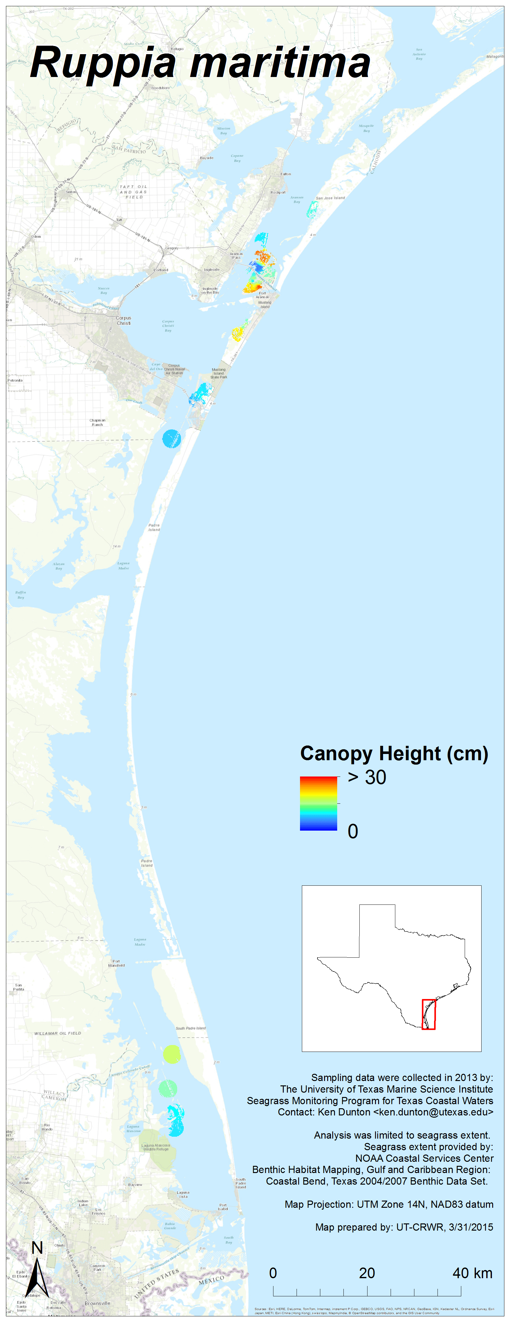
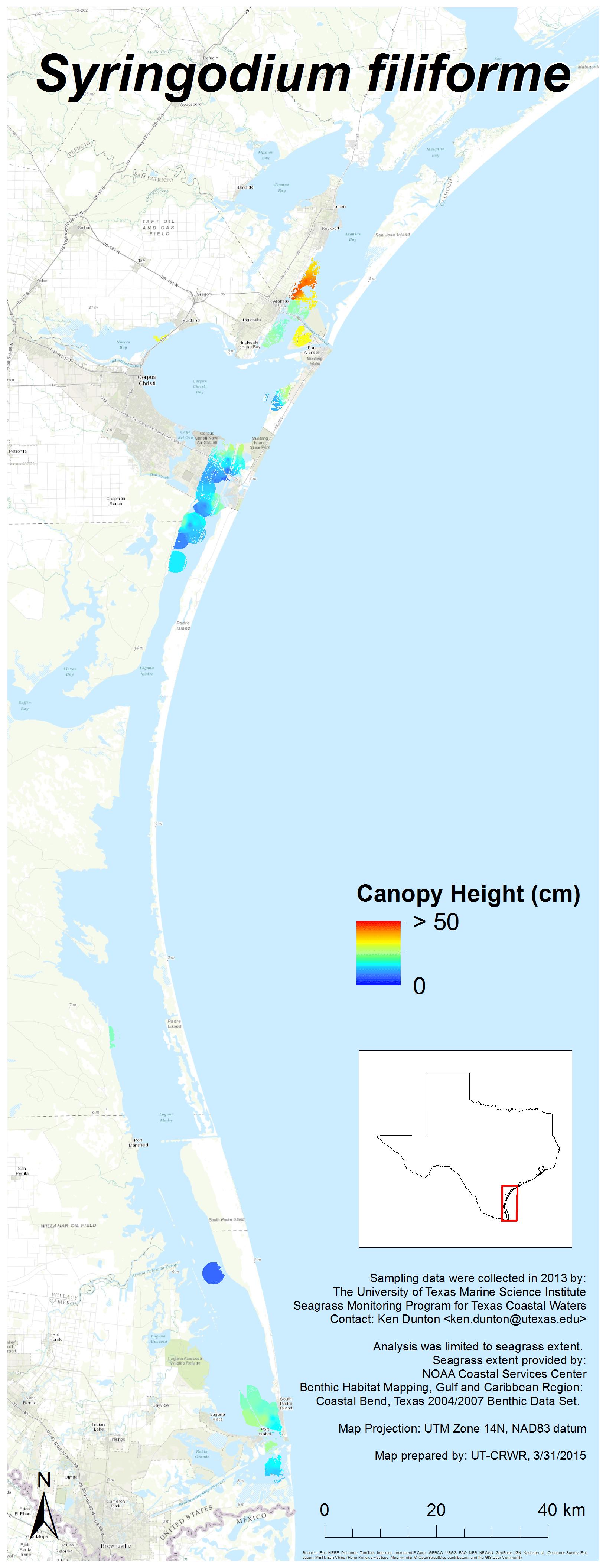
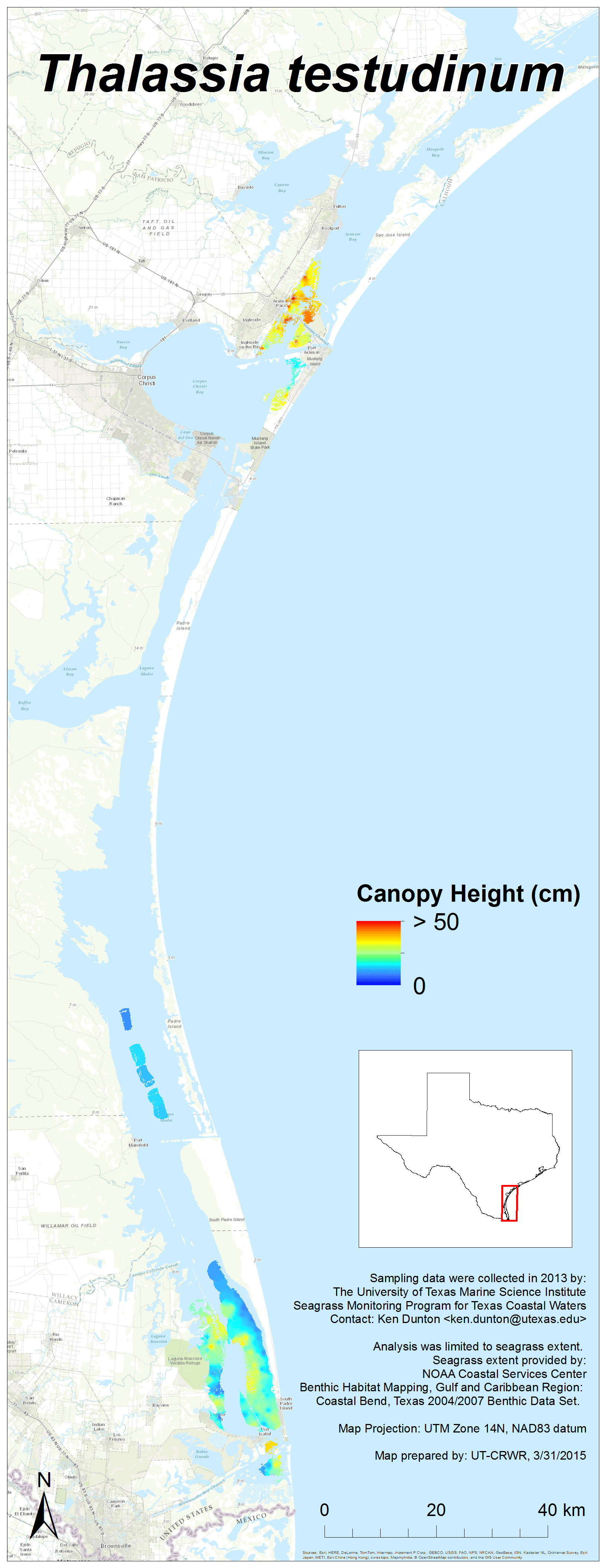
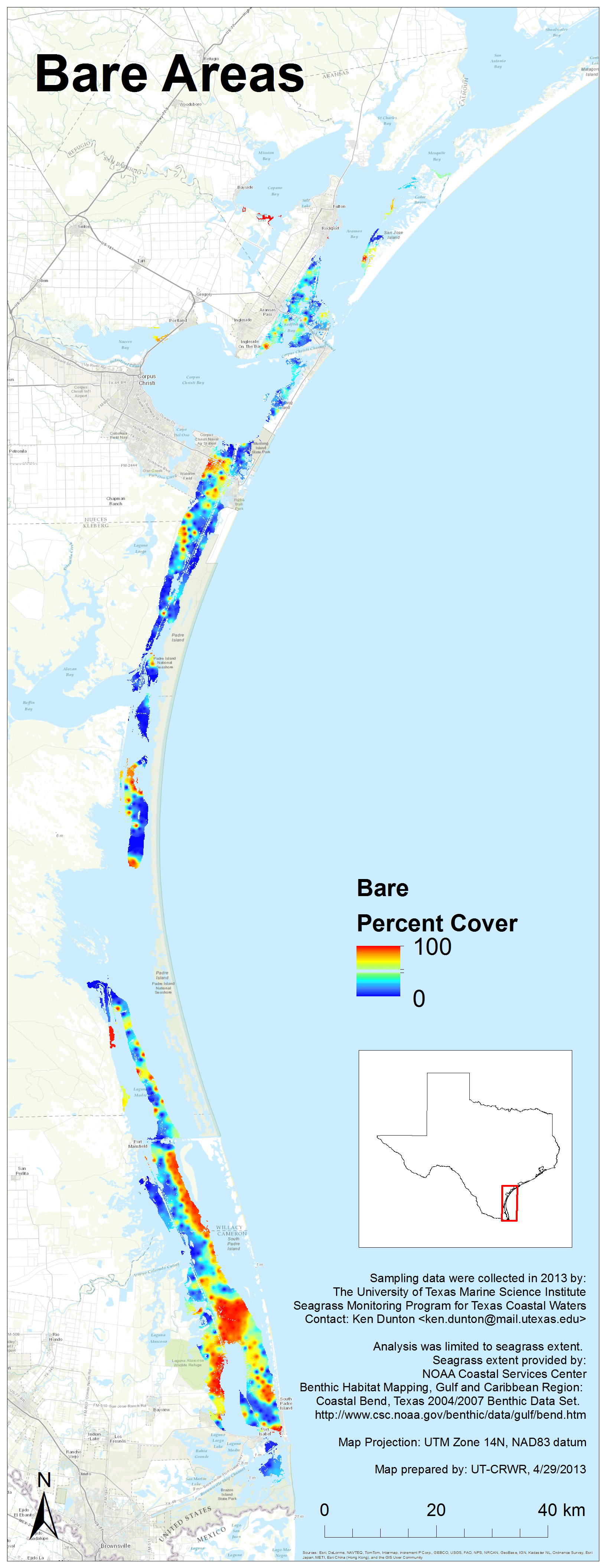
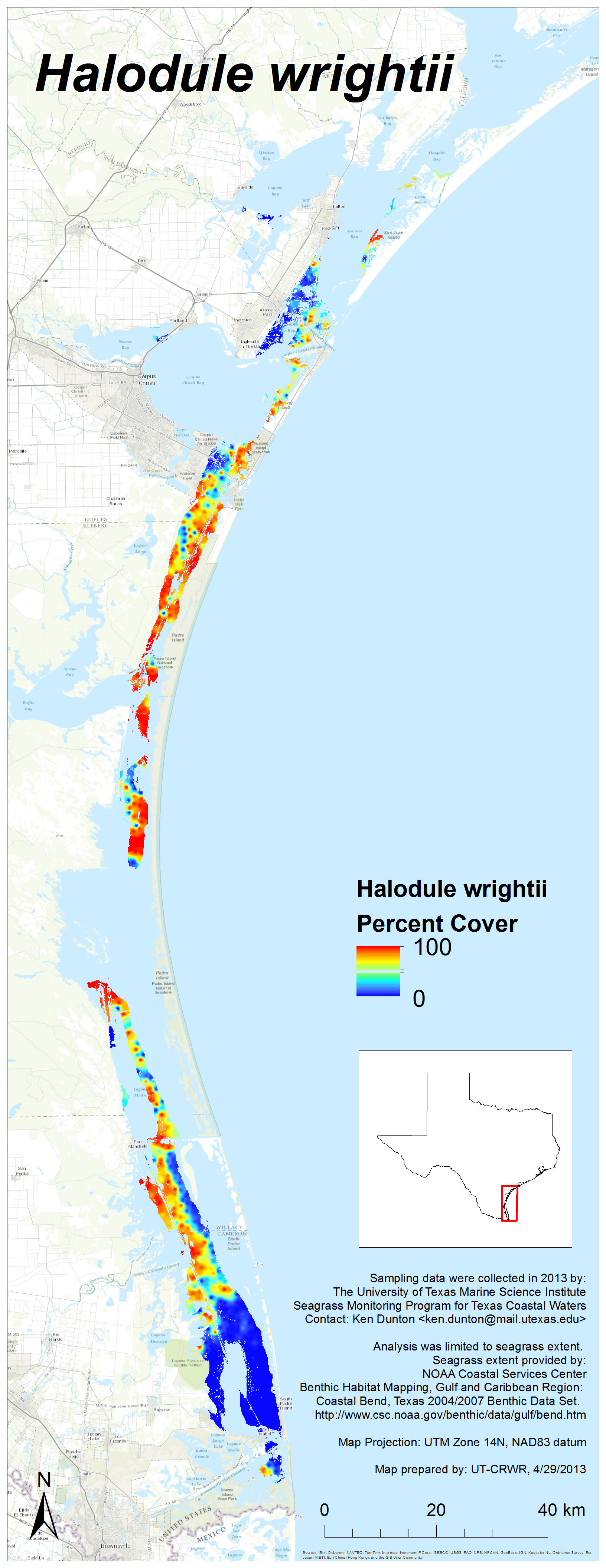
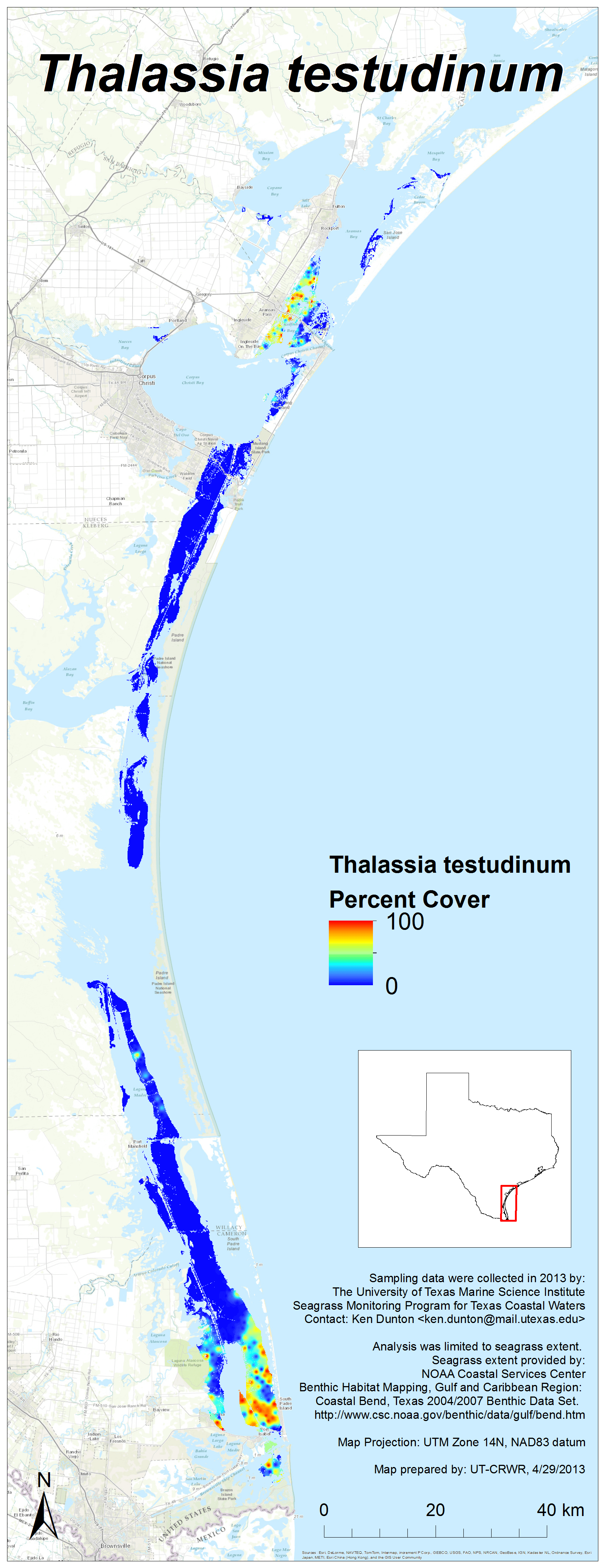
2013 Results
Each image links to a high resolution PNG. Click here to download the entire set (zipped, 26 MB).
Note: Canopy height maps for seagrass species were added on March 31, 2015


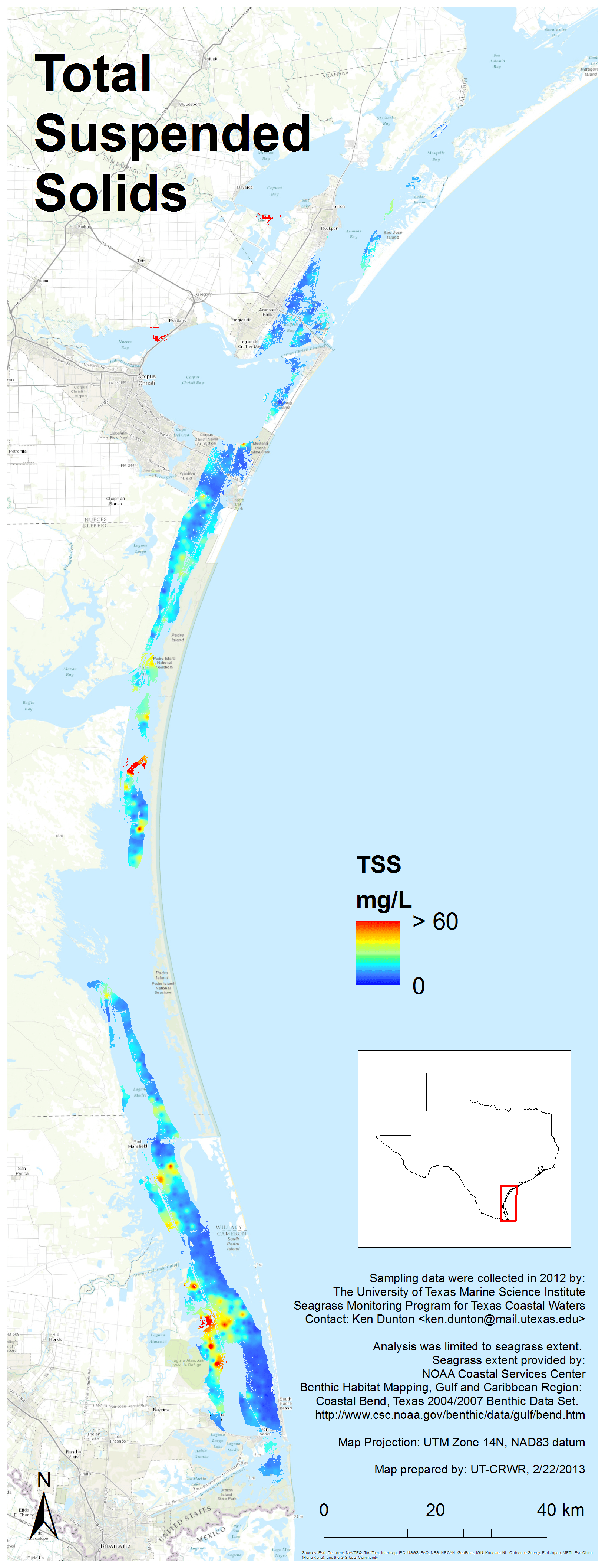
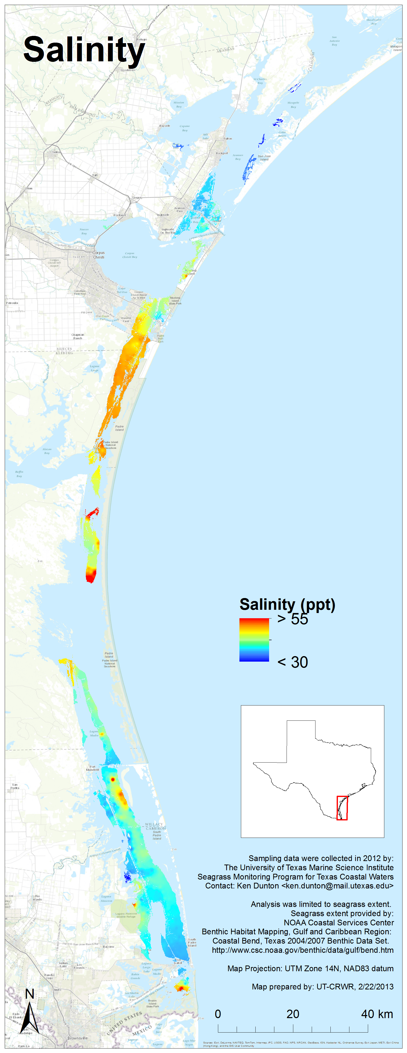
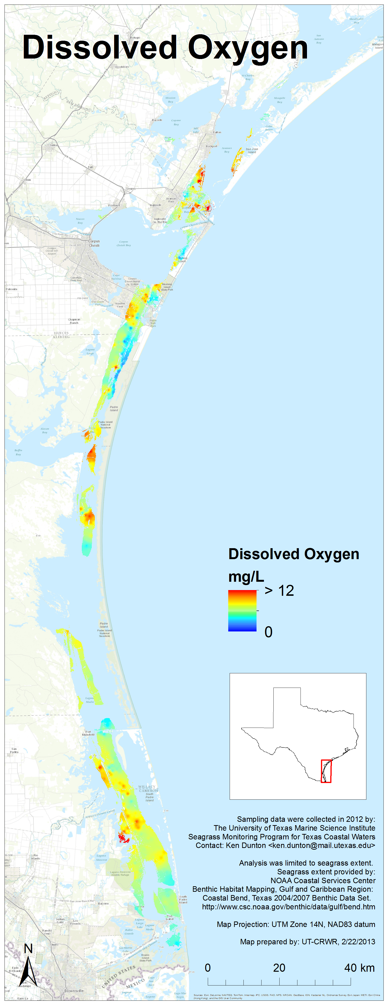
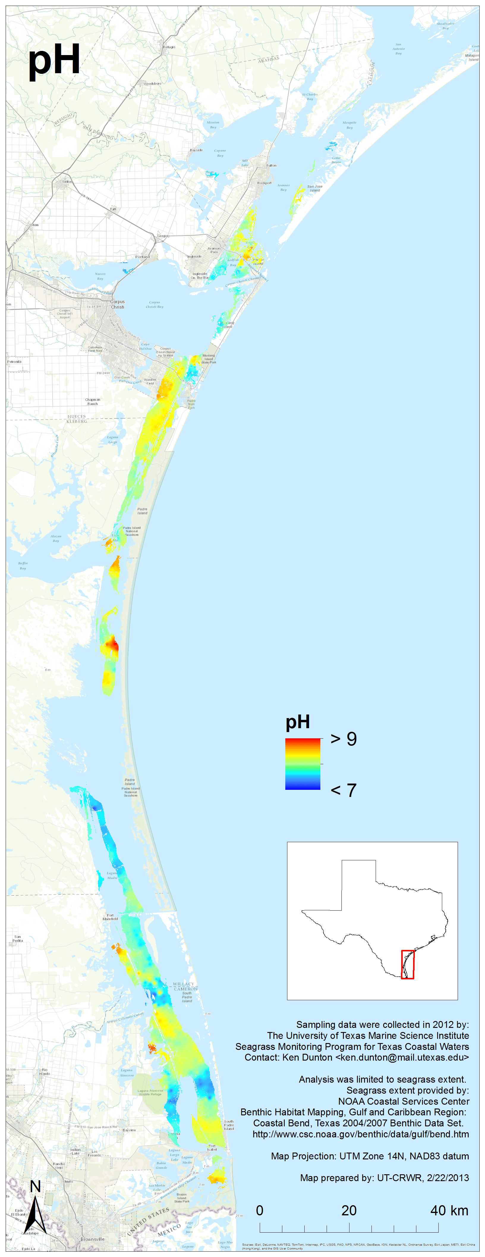
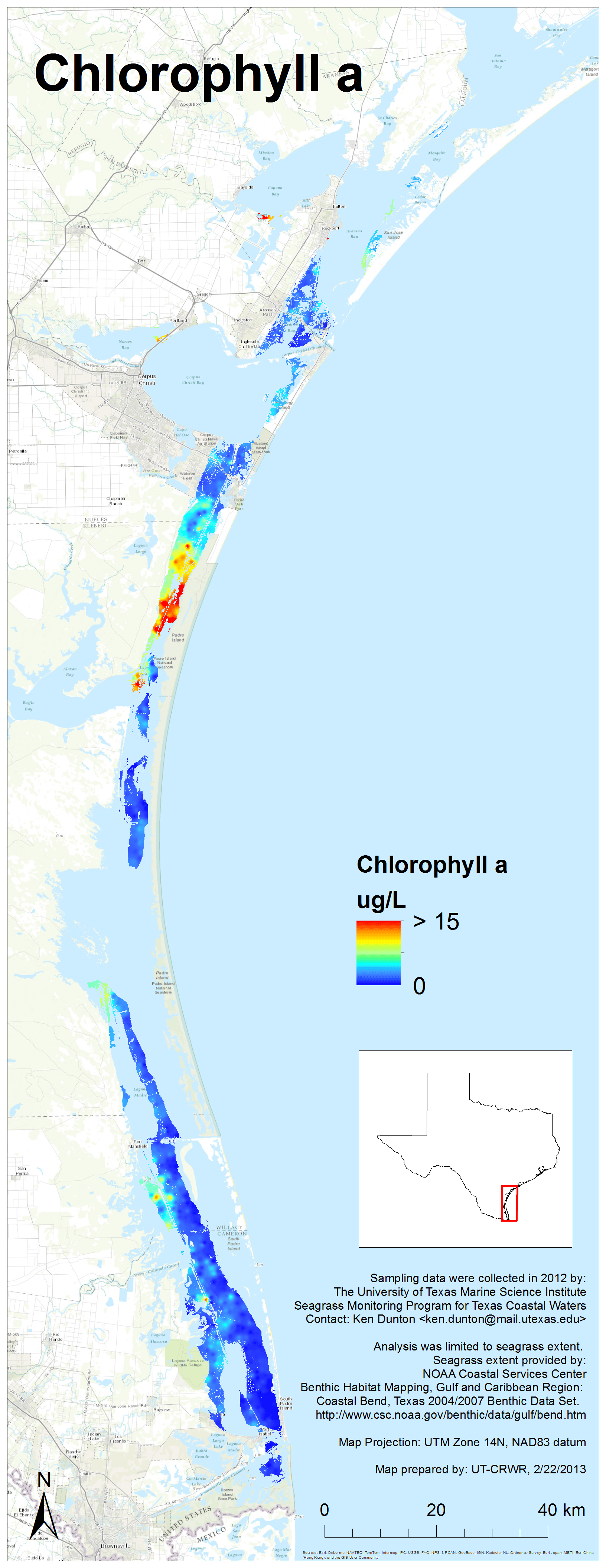
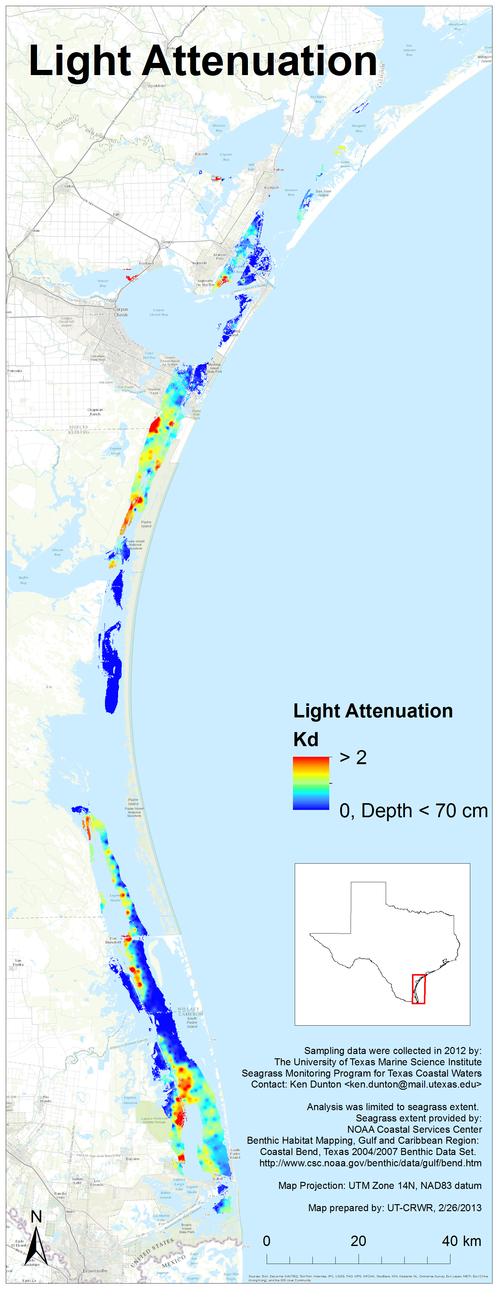
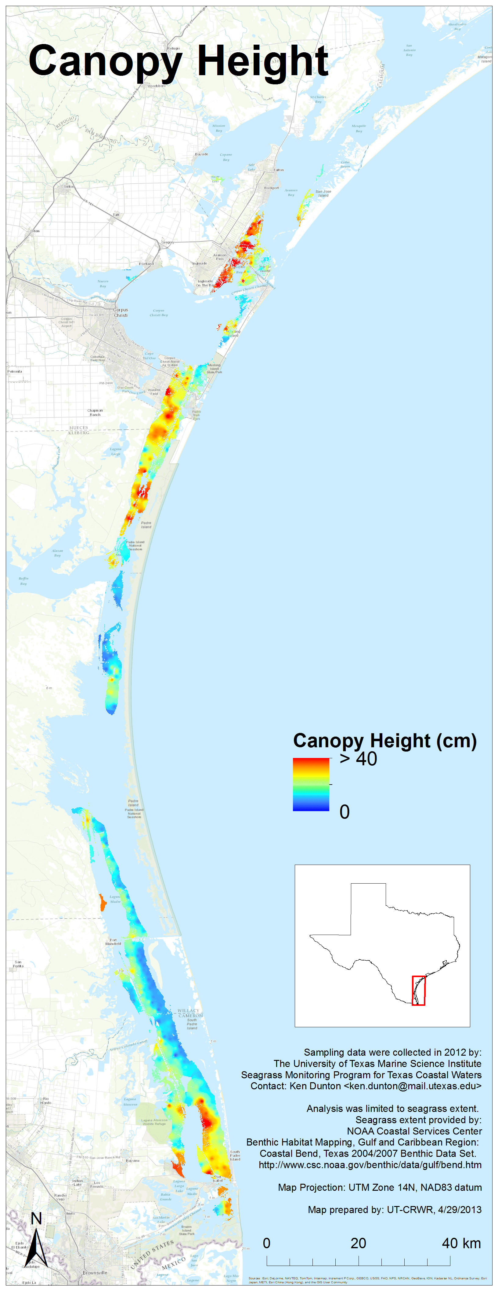
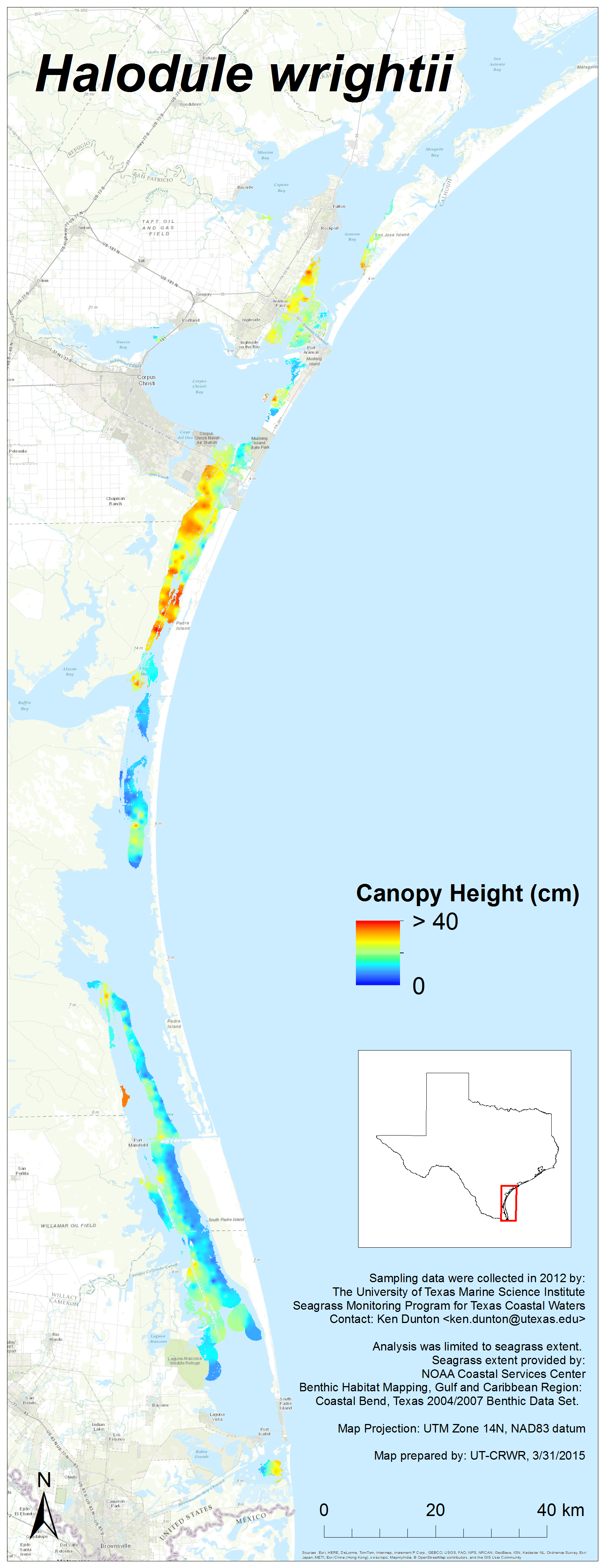
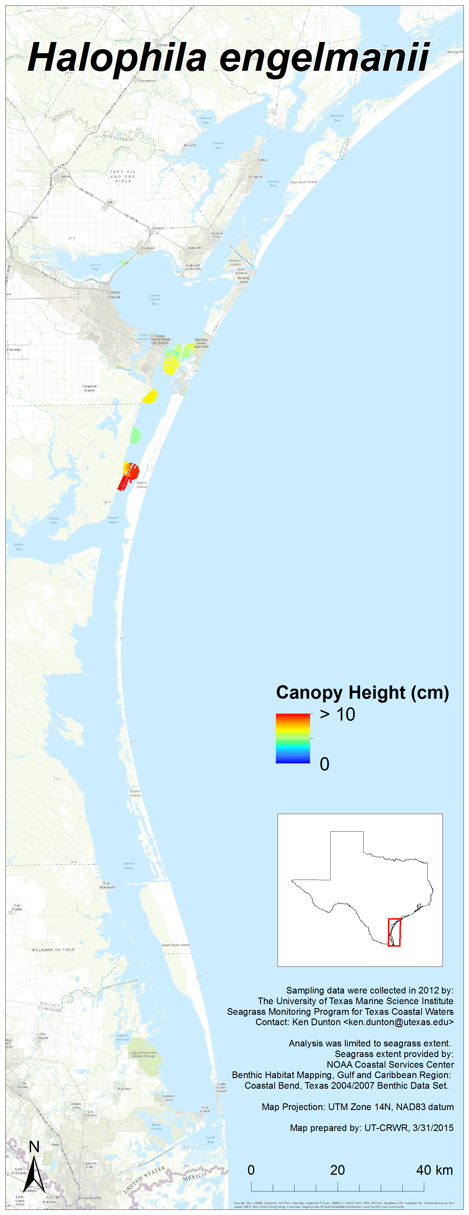
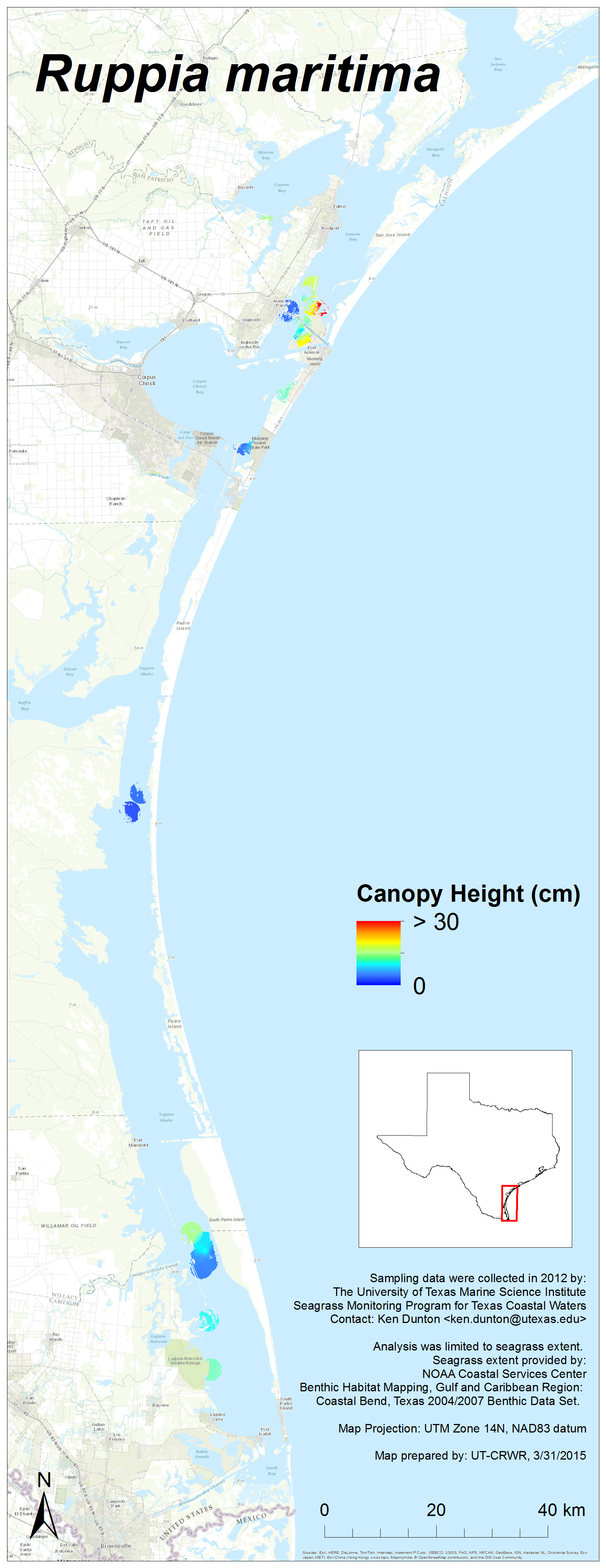
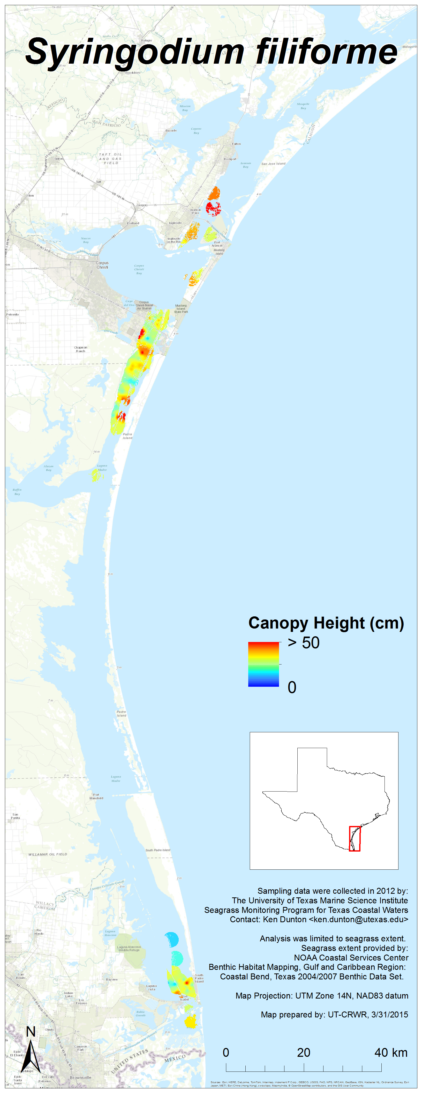
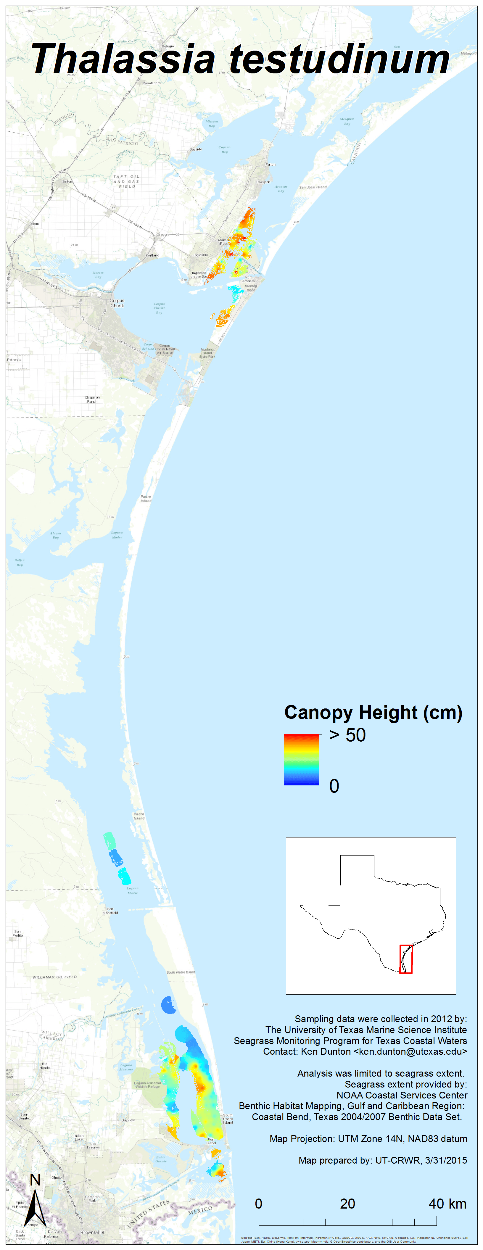
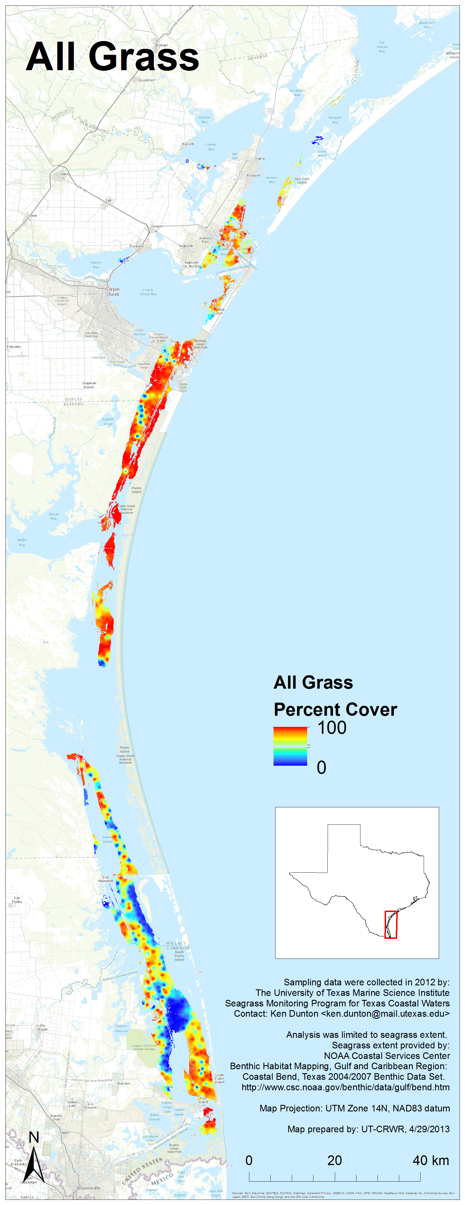
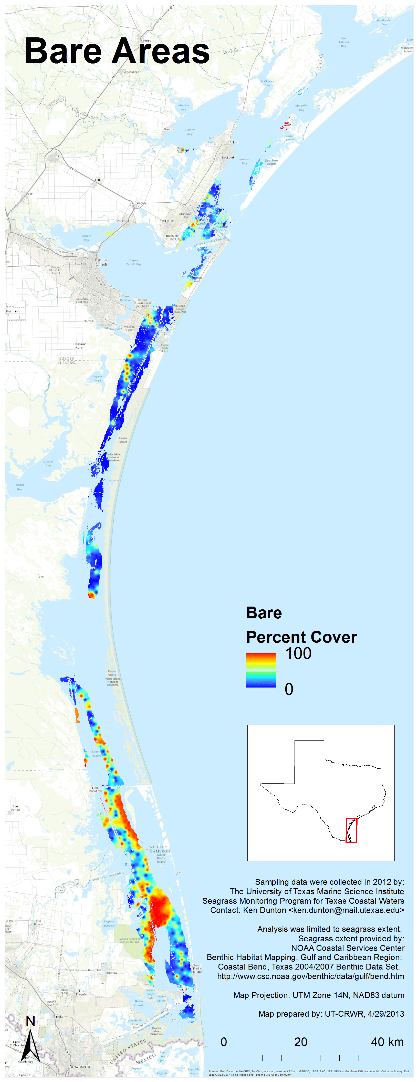
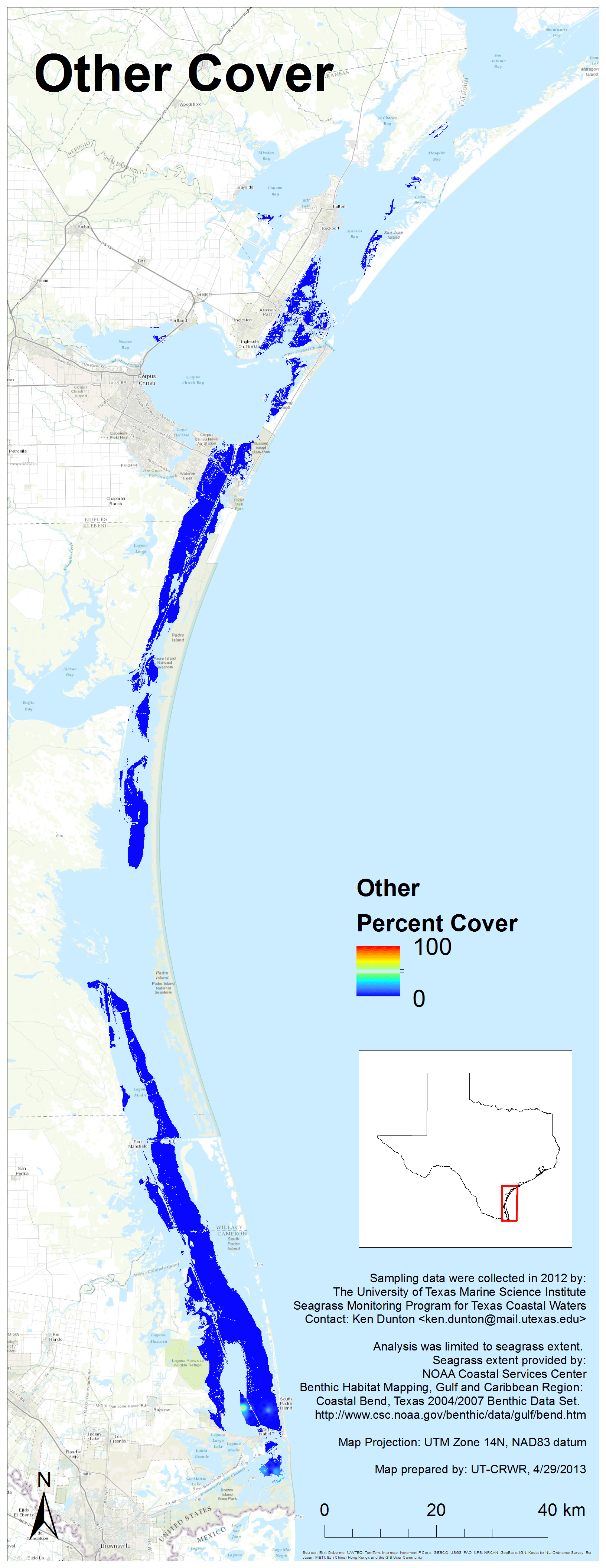
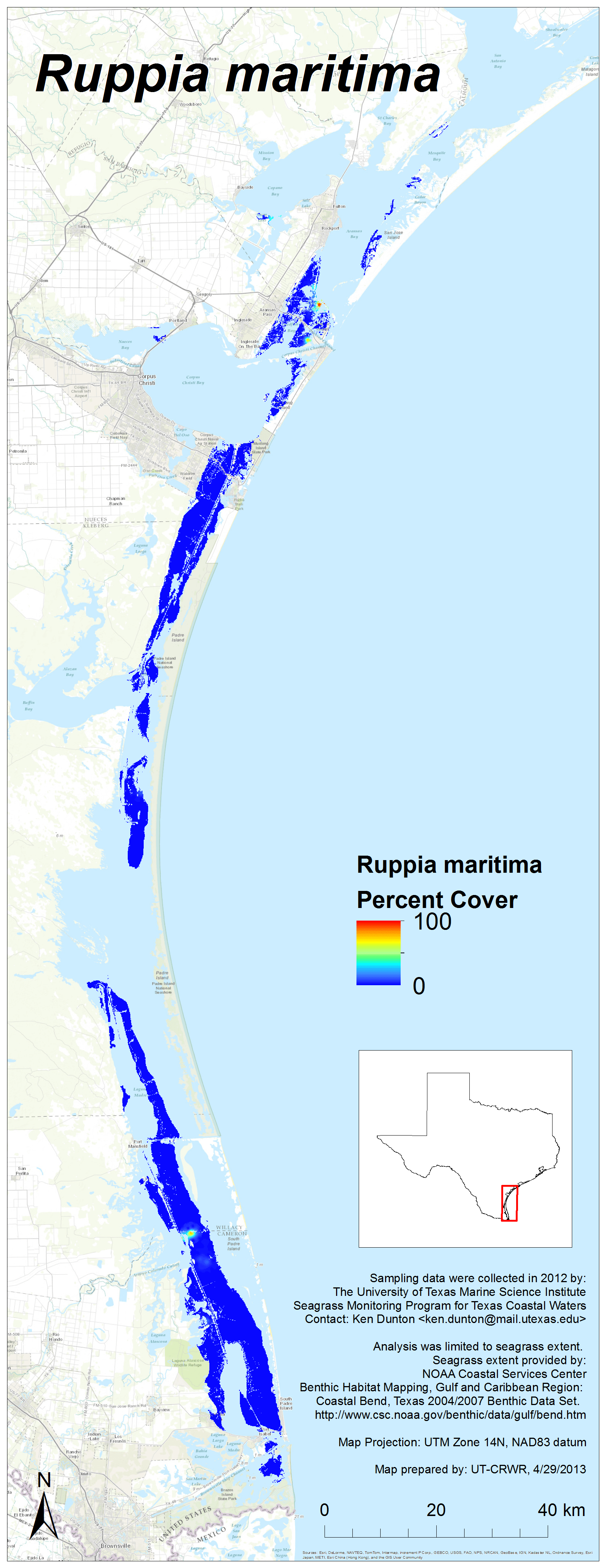
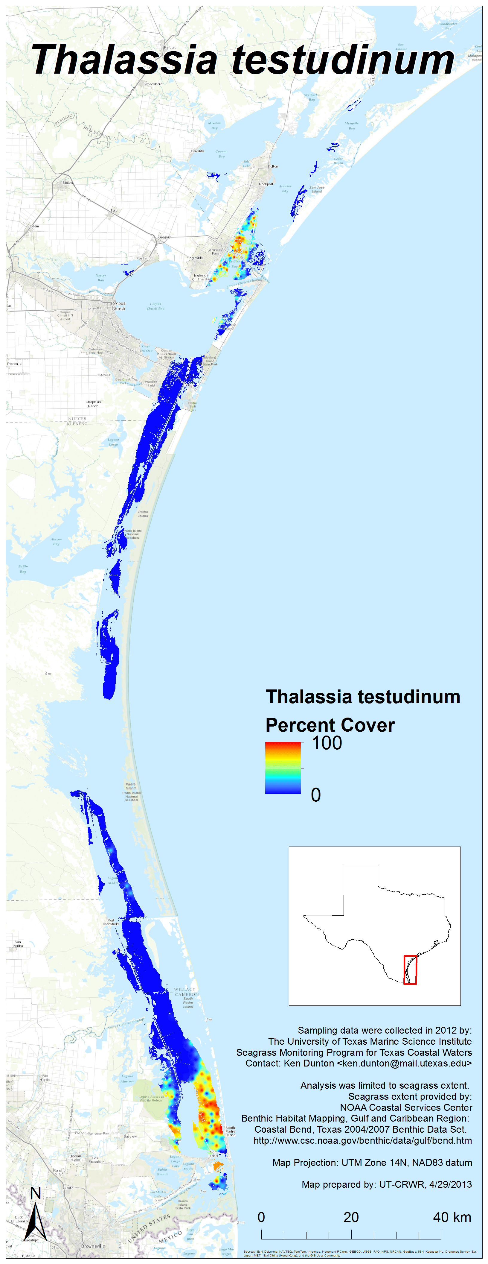
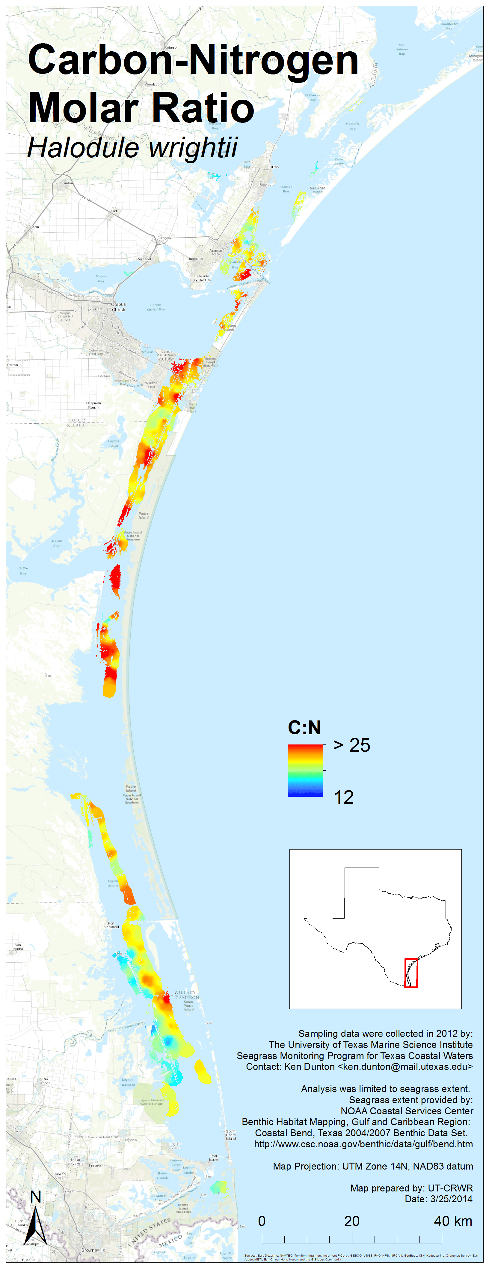
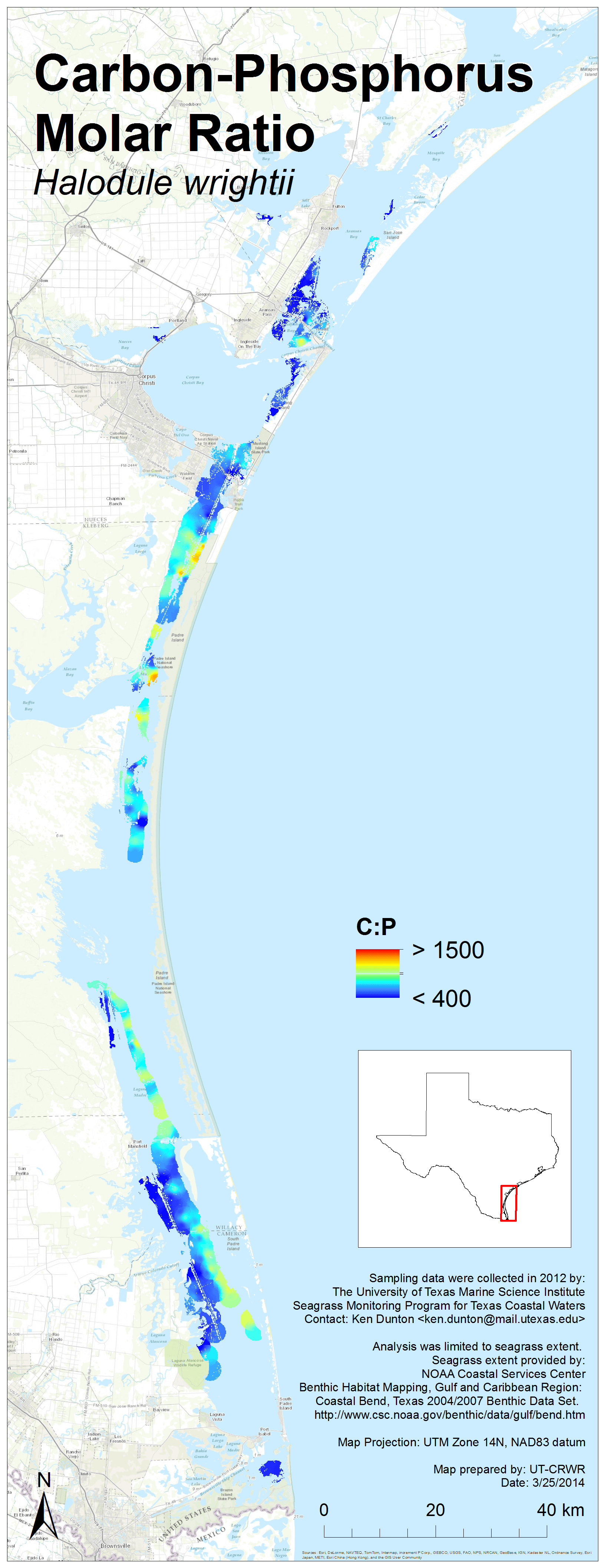
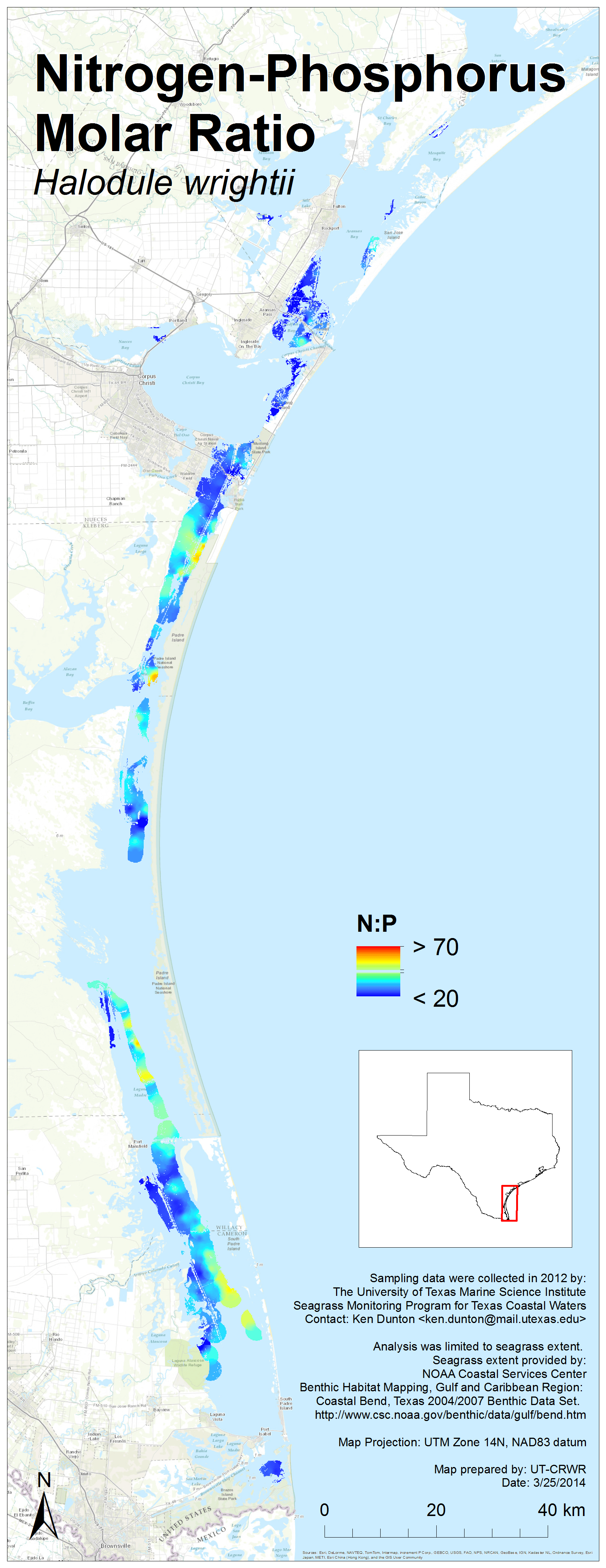
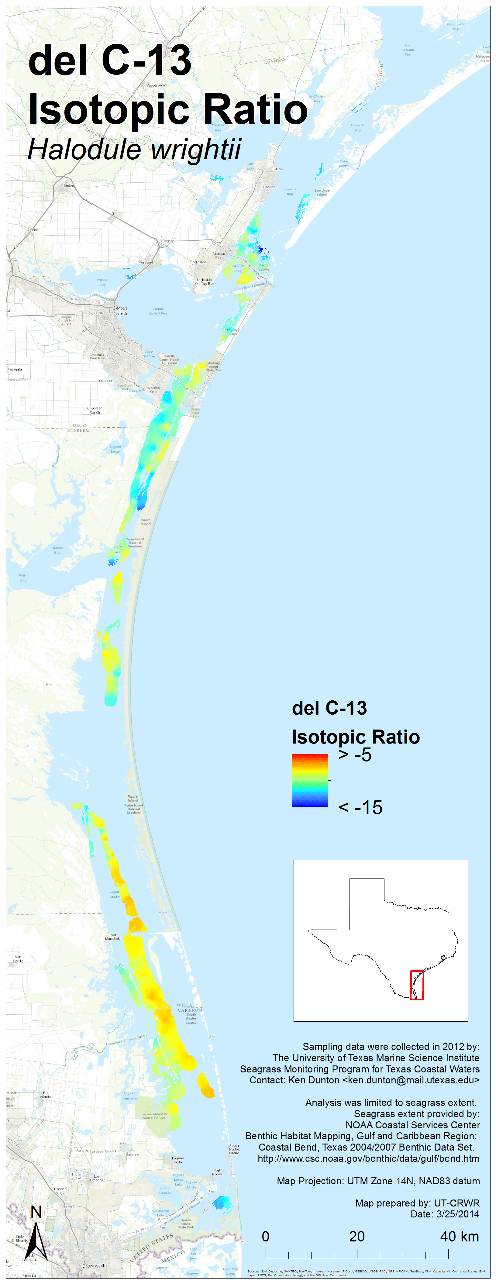
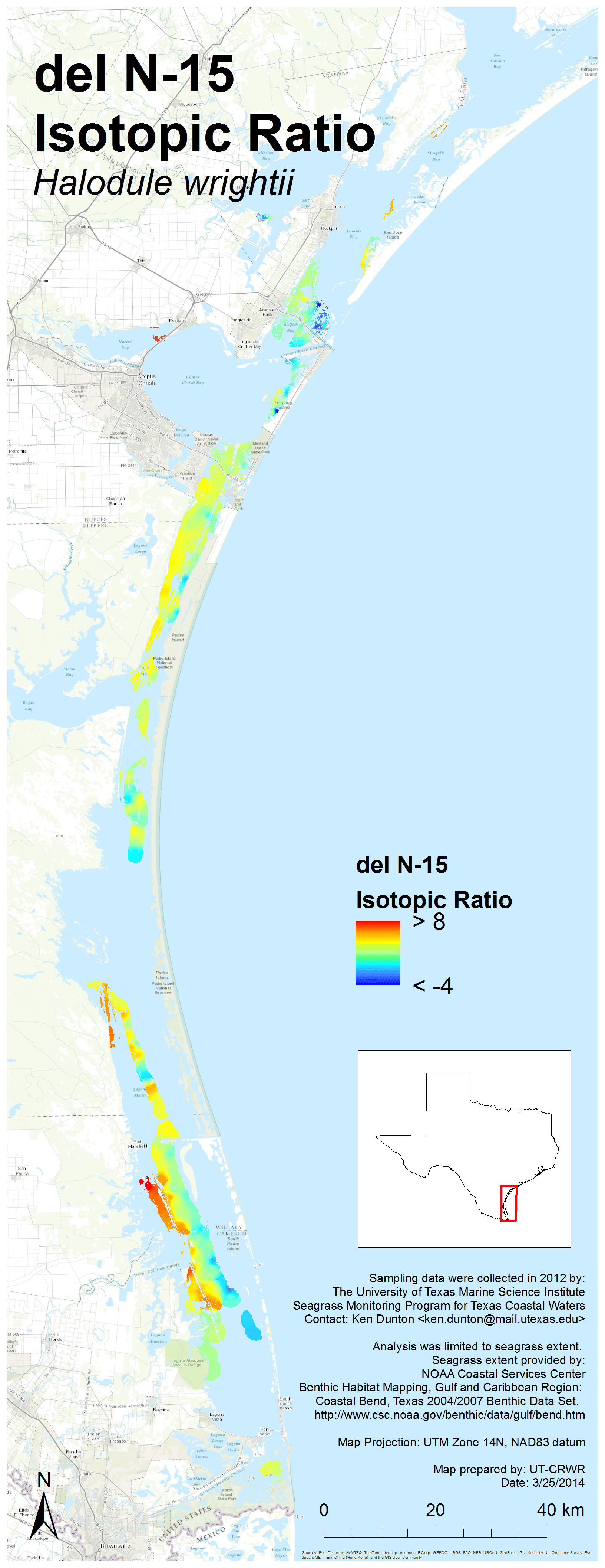
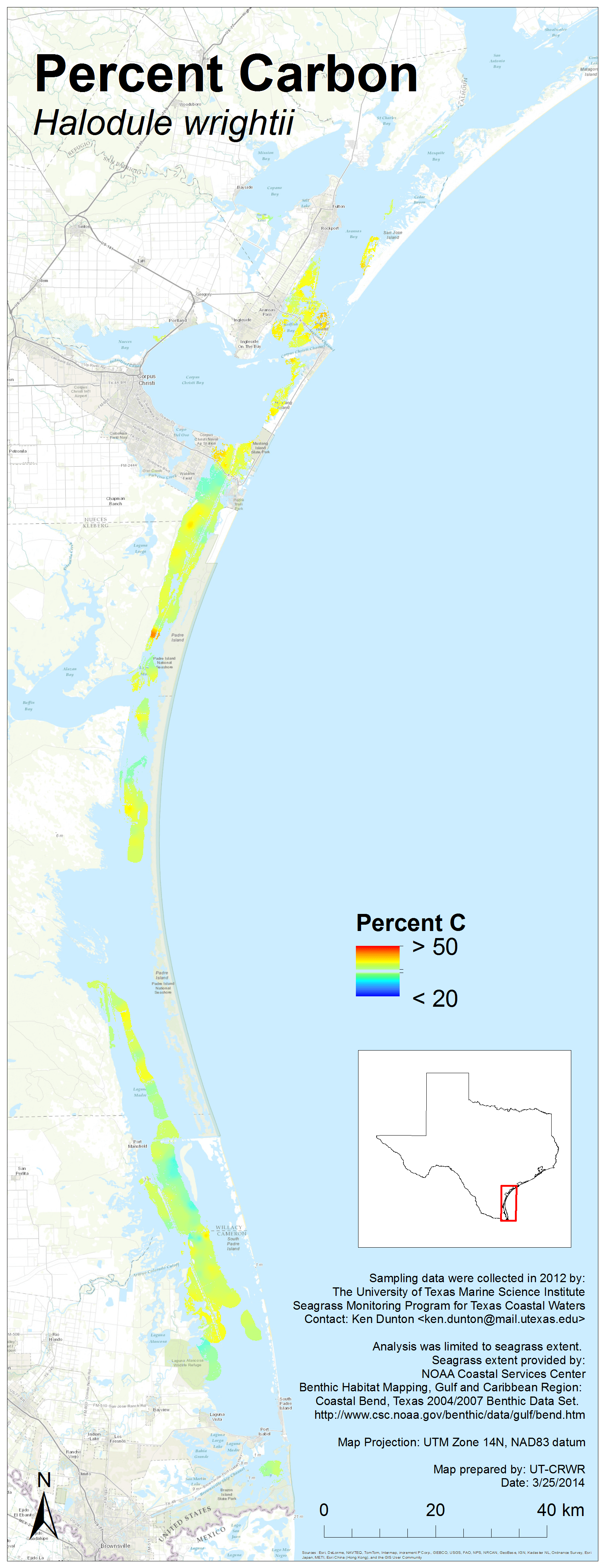
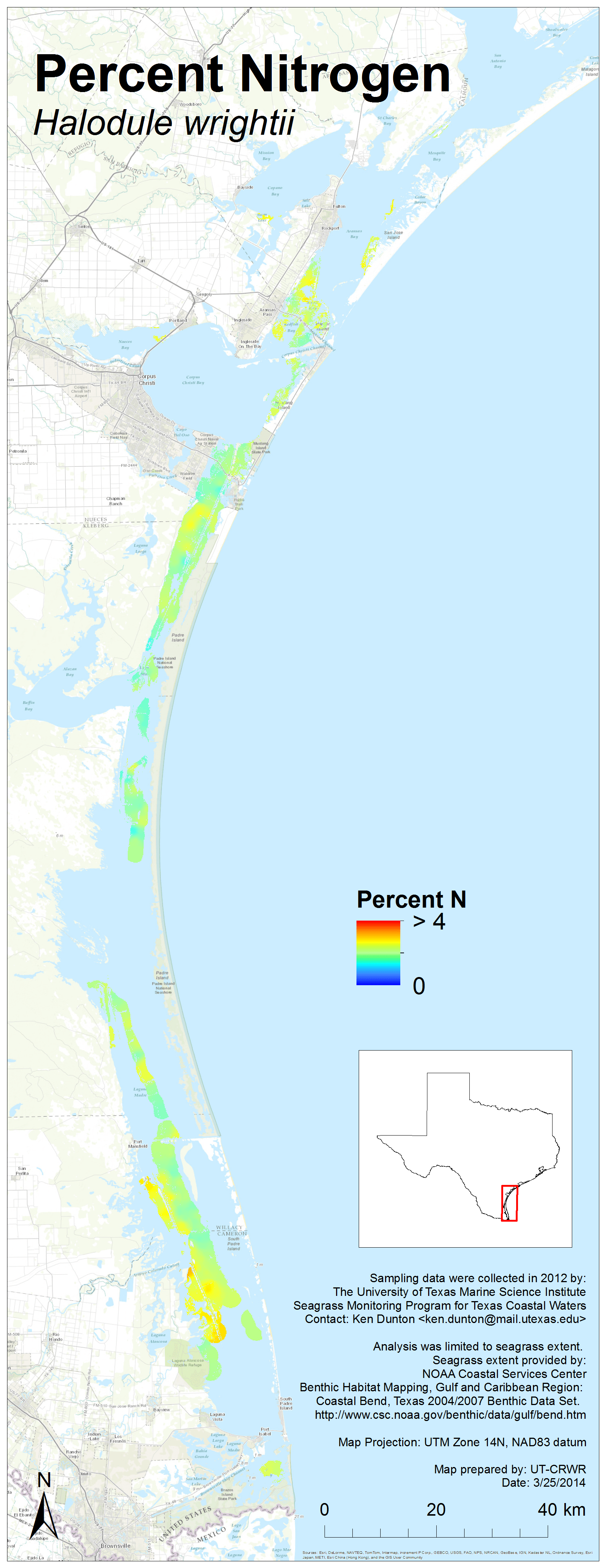
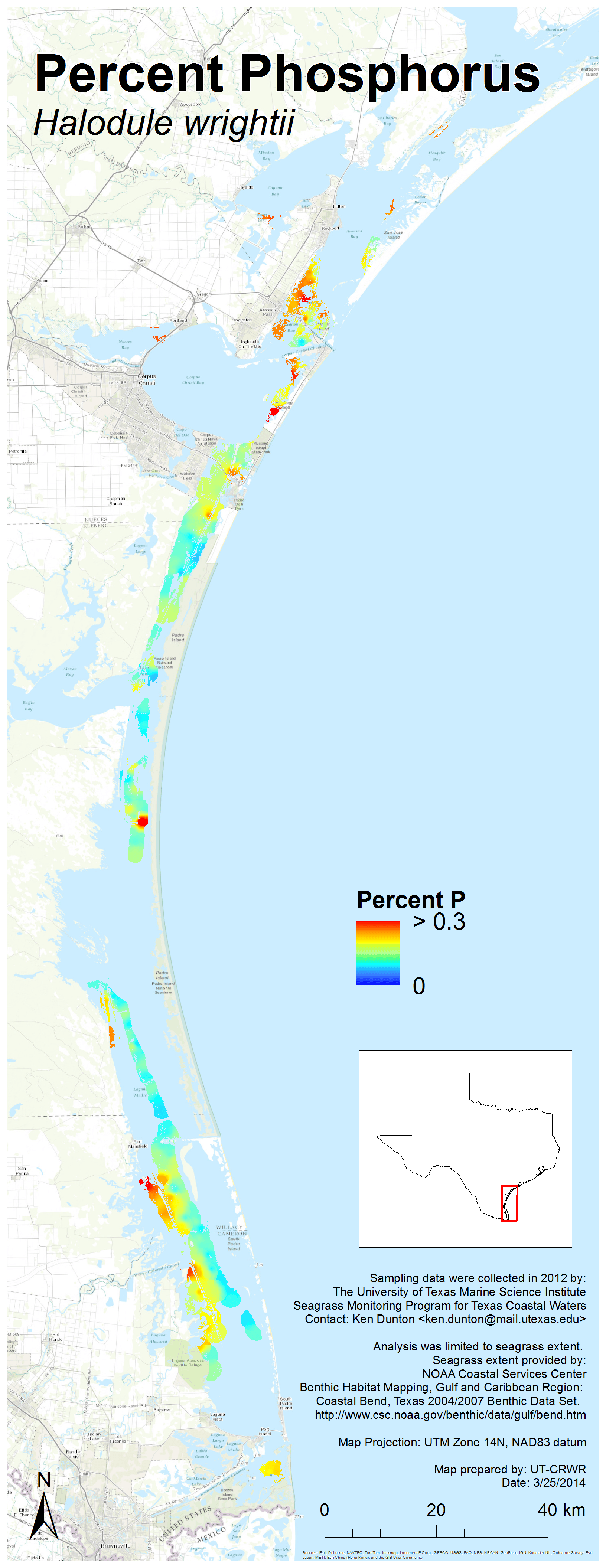
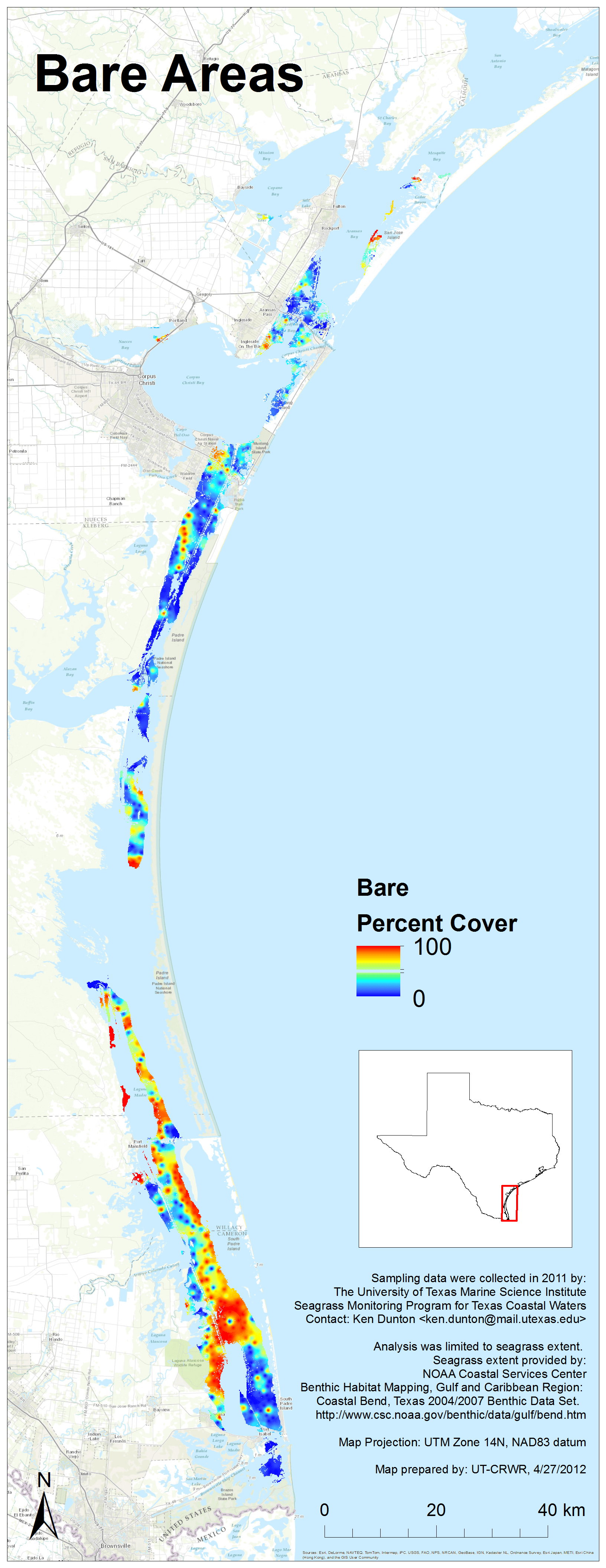
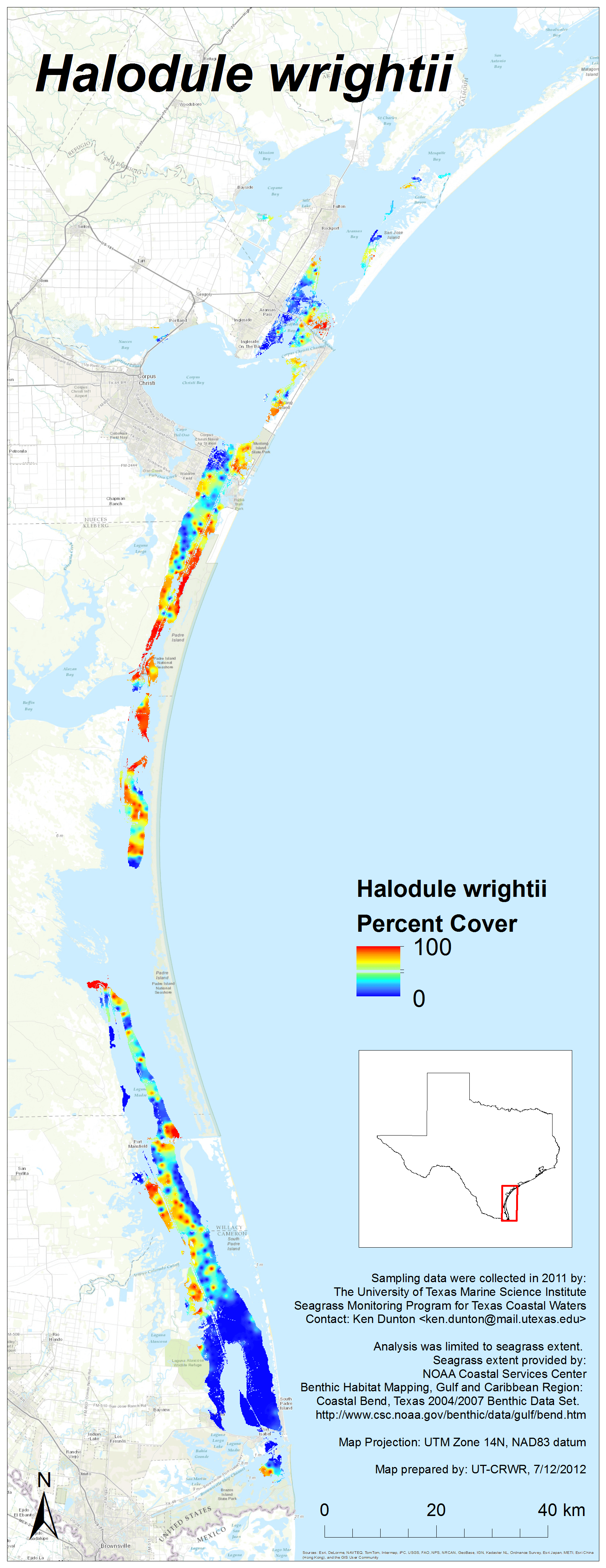
2012 Results
Each image links to a high resolution PNG. Click here to download the entire set (zipped, 38 MB).
Note: Canopy height maps for seagrass species were added on March 31, 2015


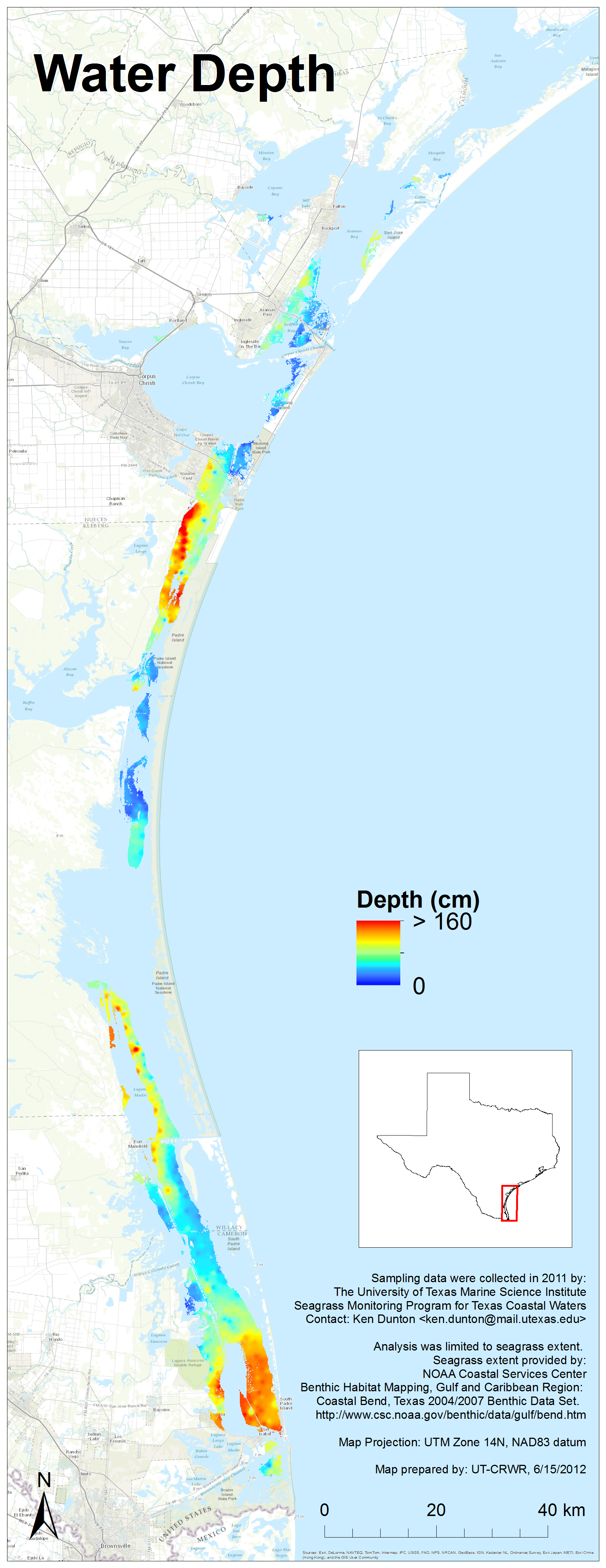
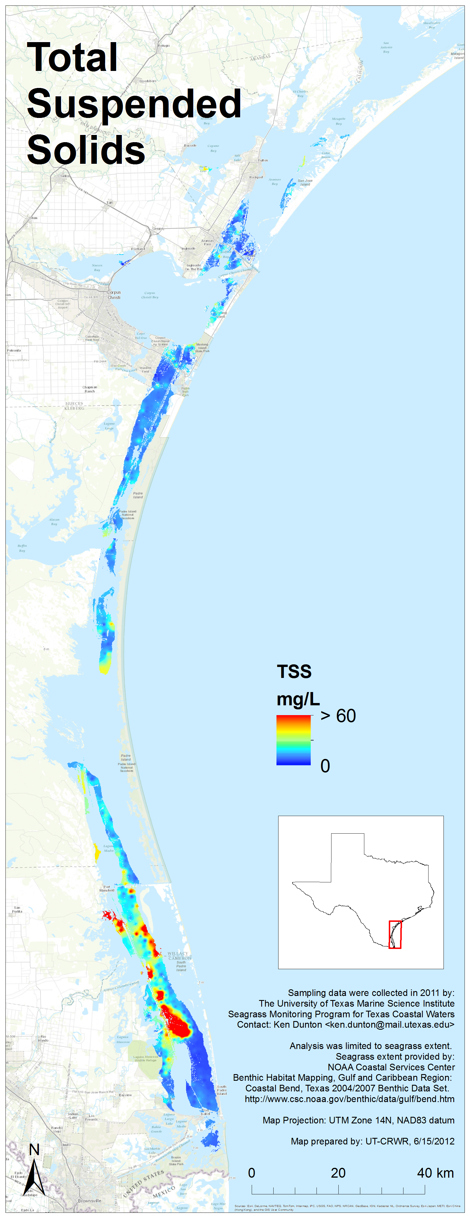
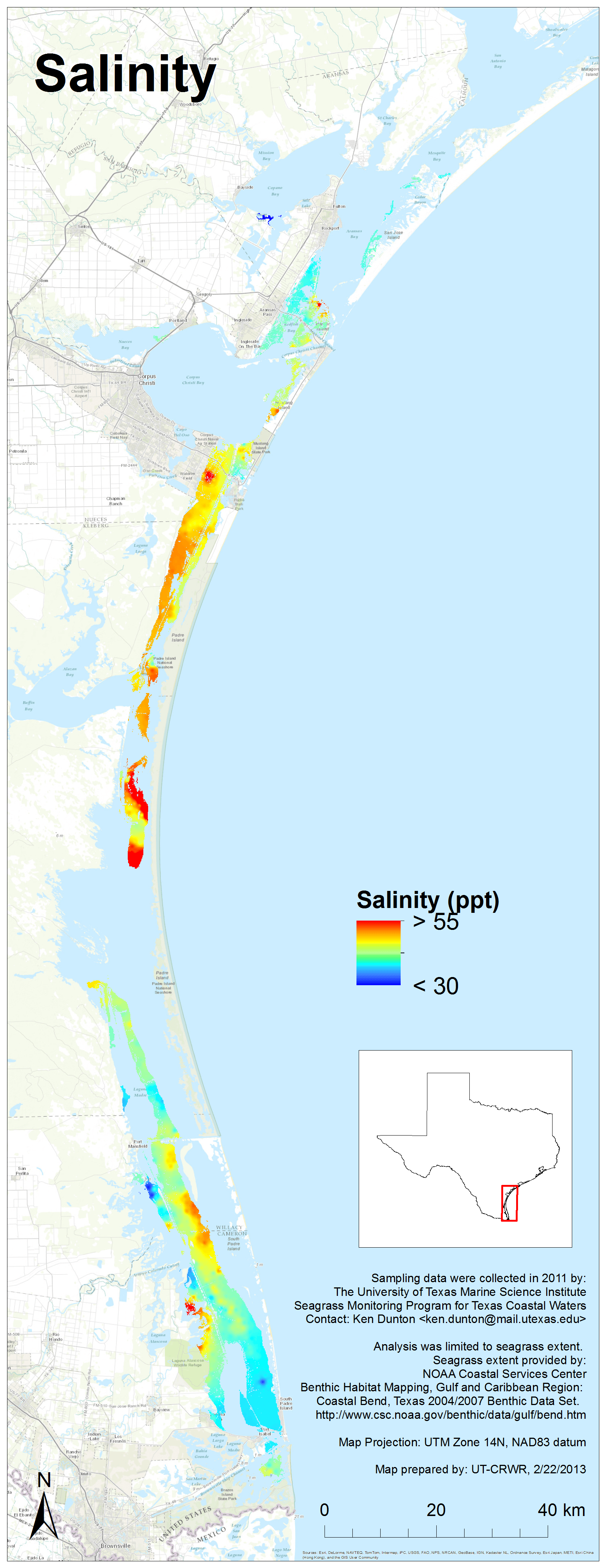
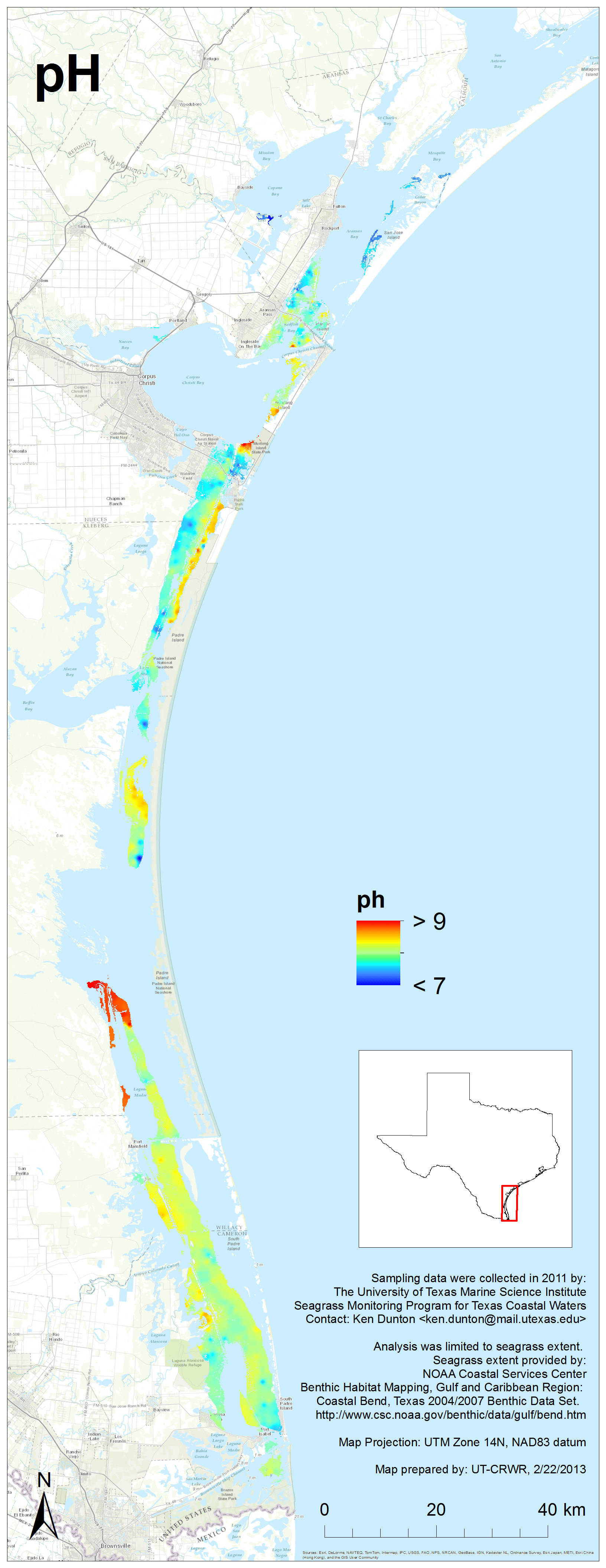
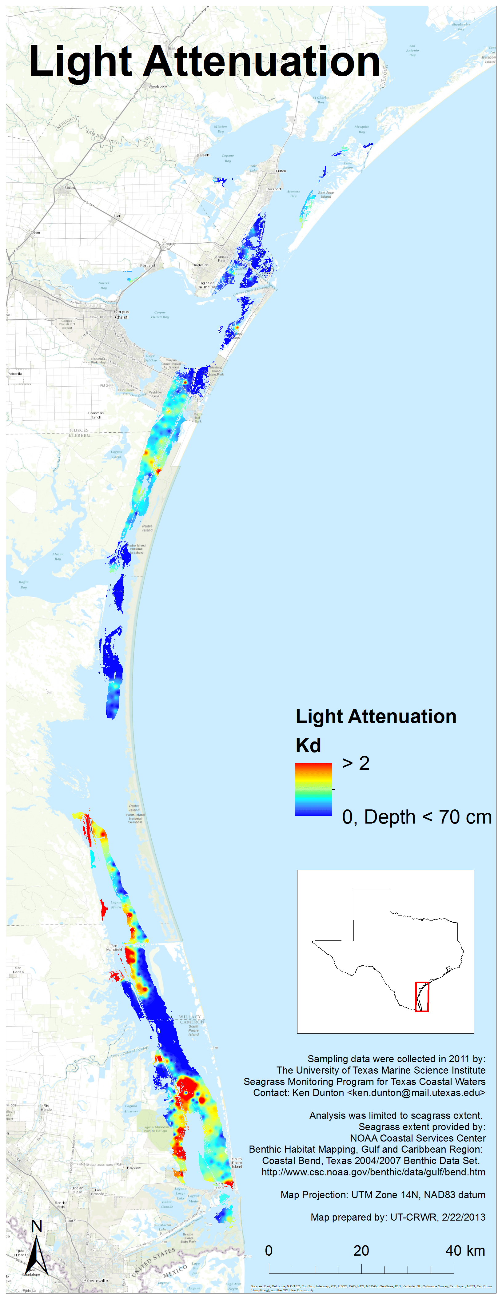
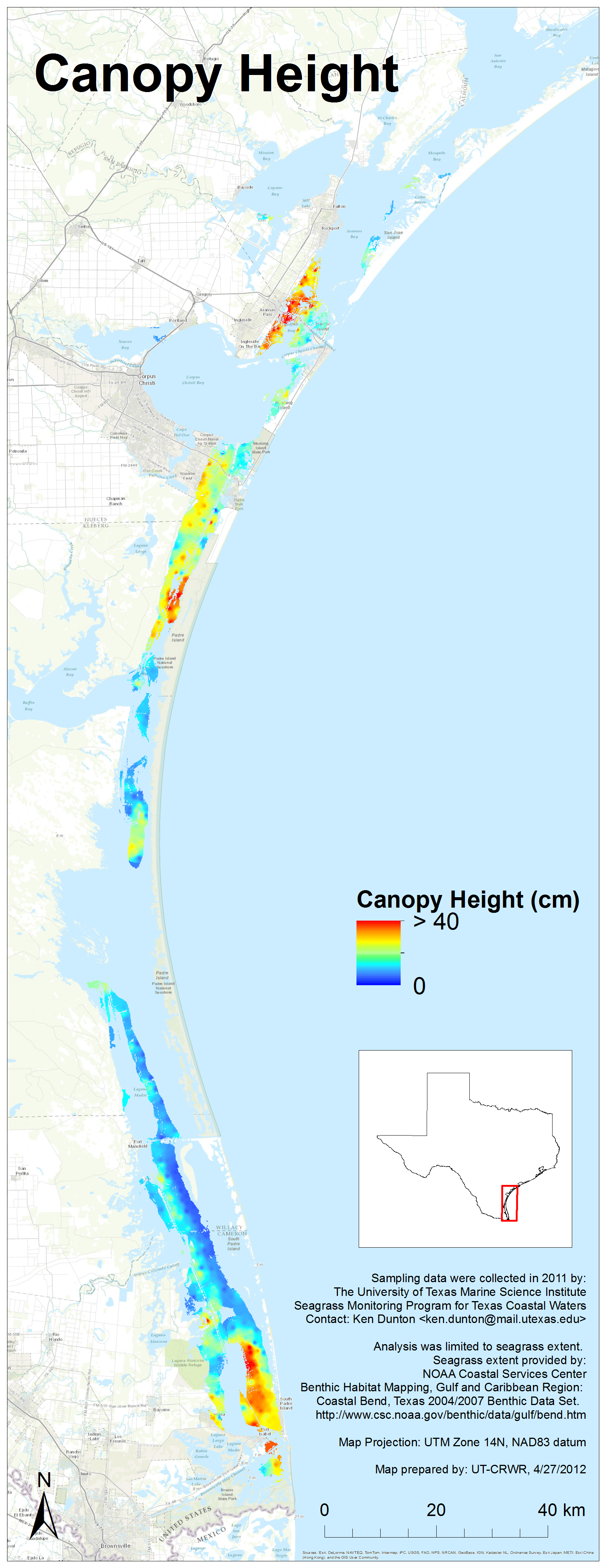
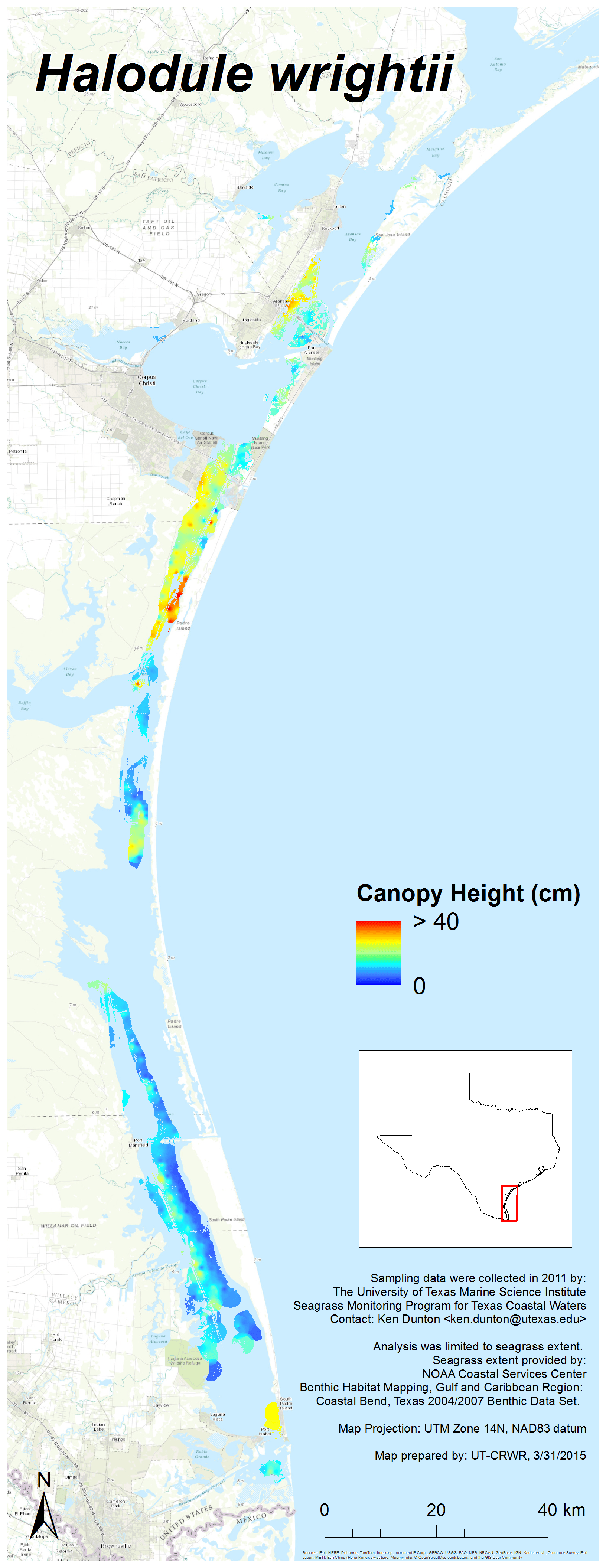
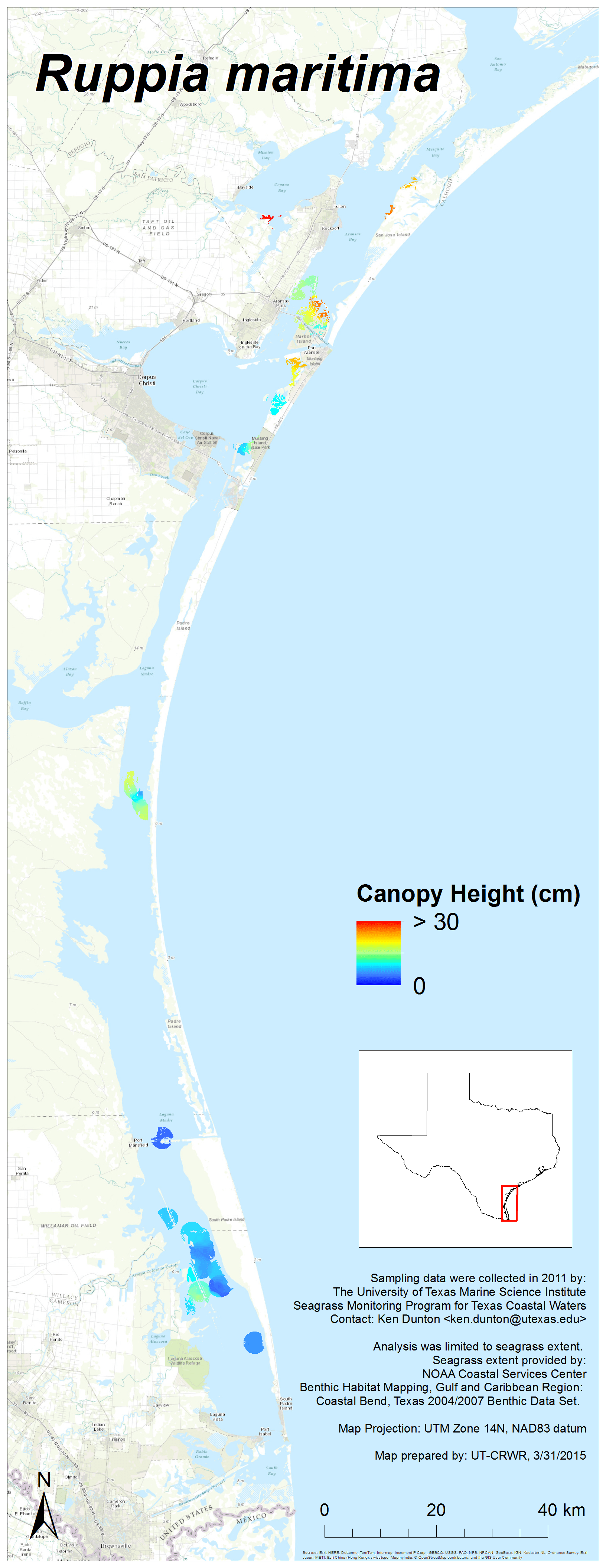
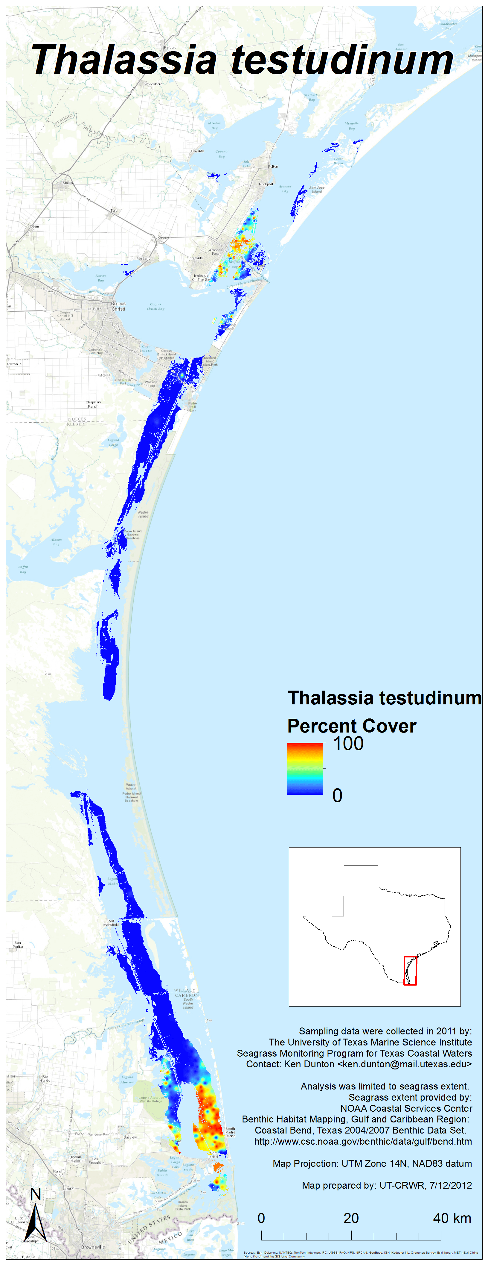
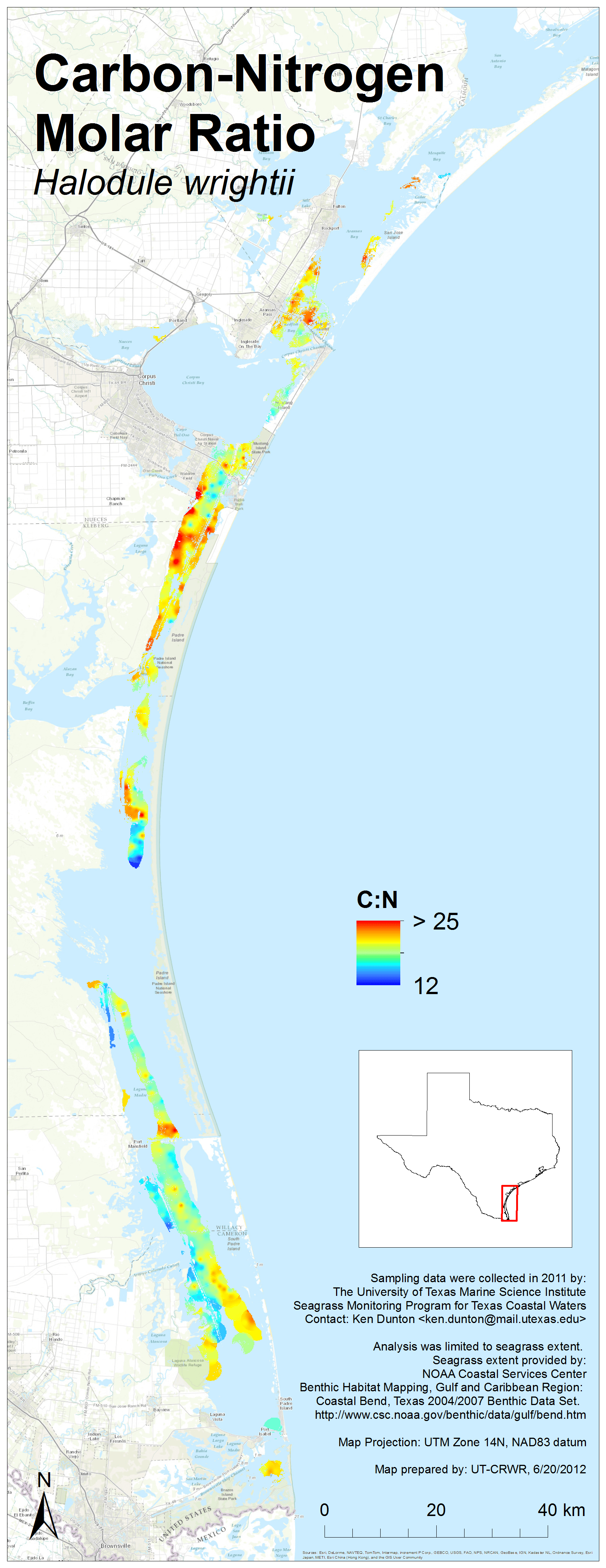
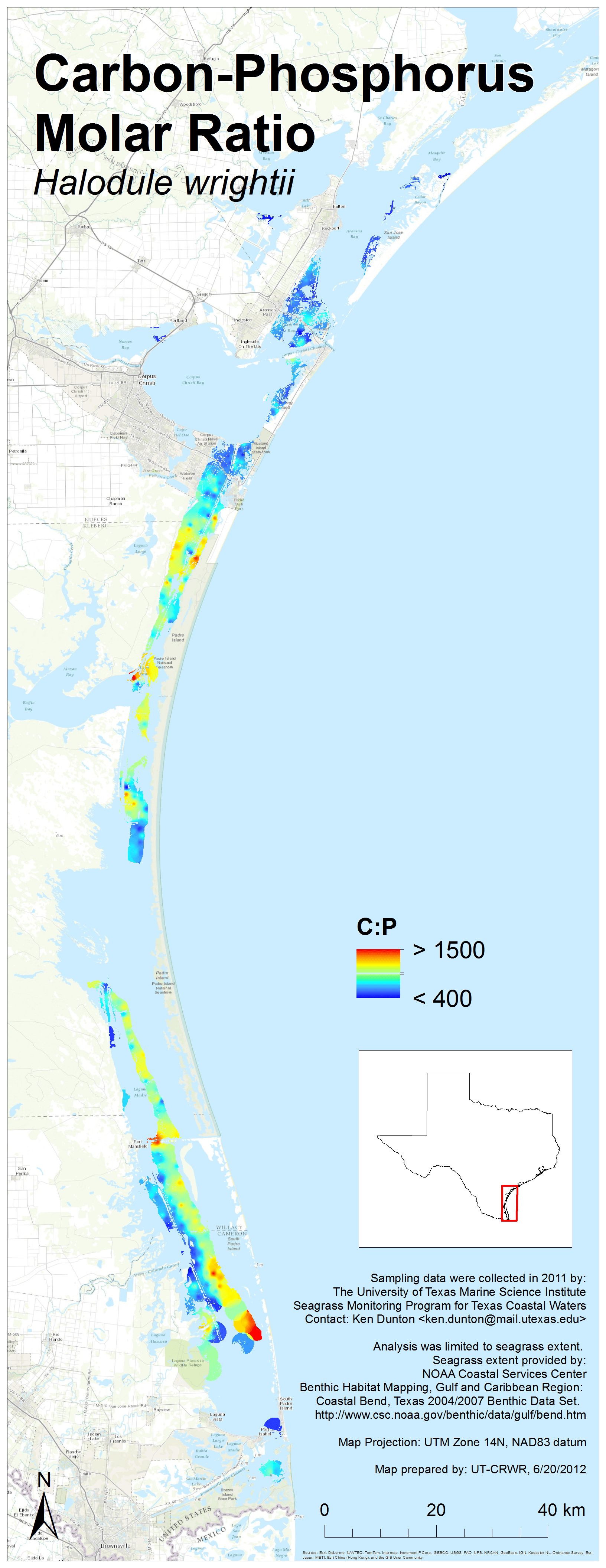
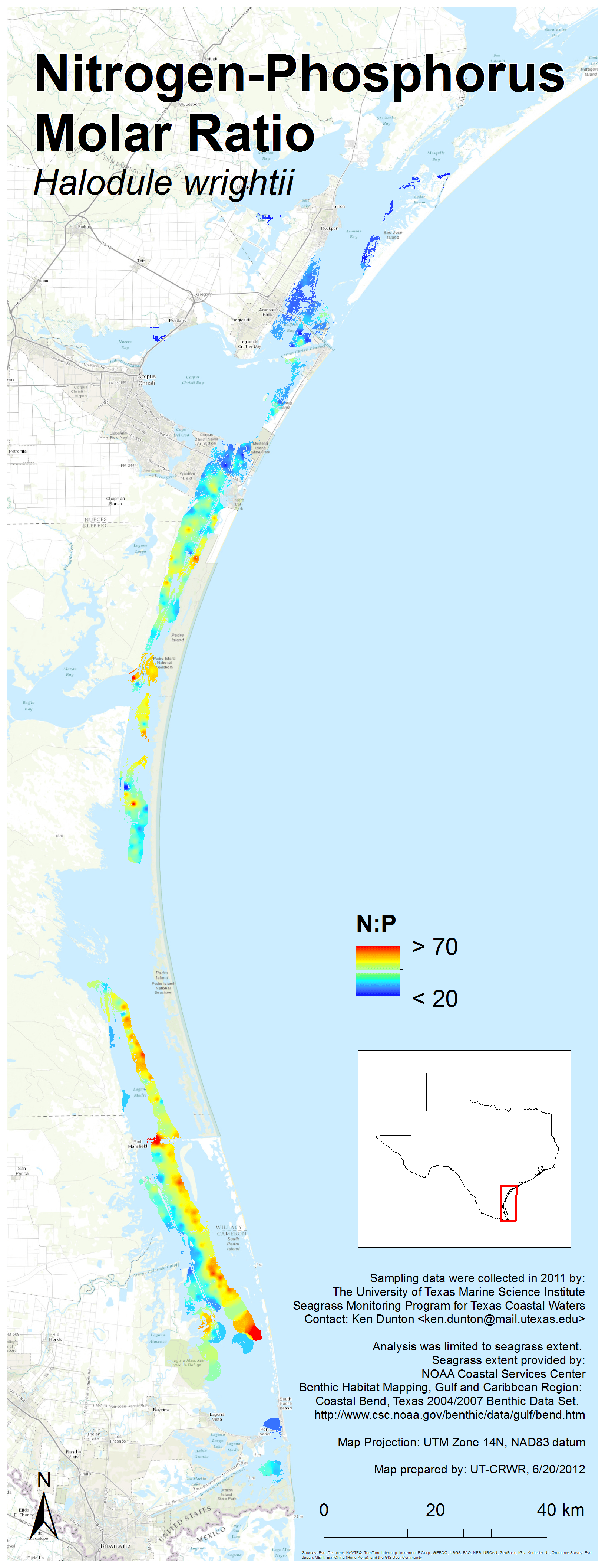
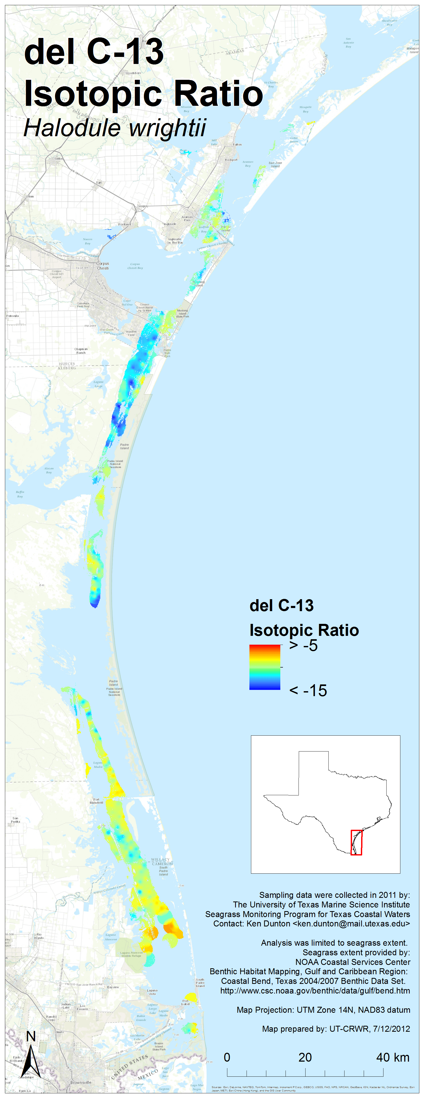
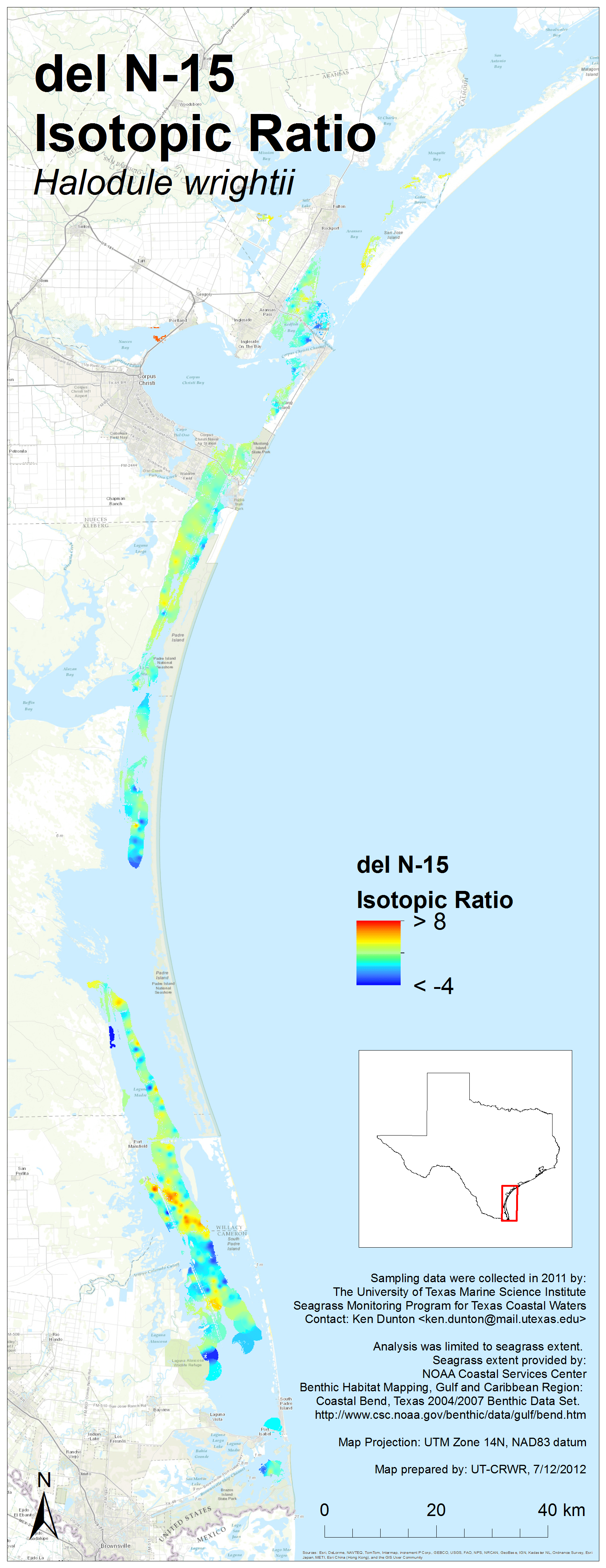
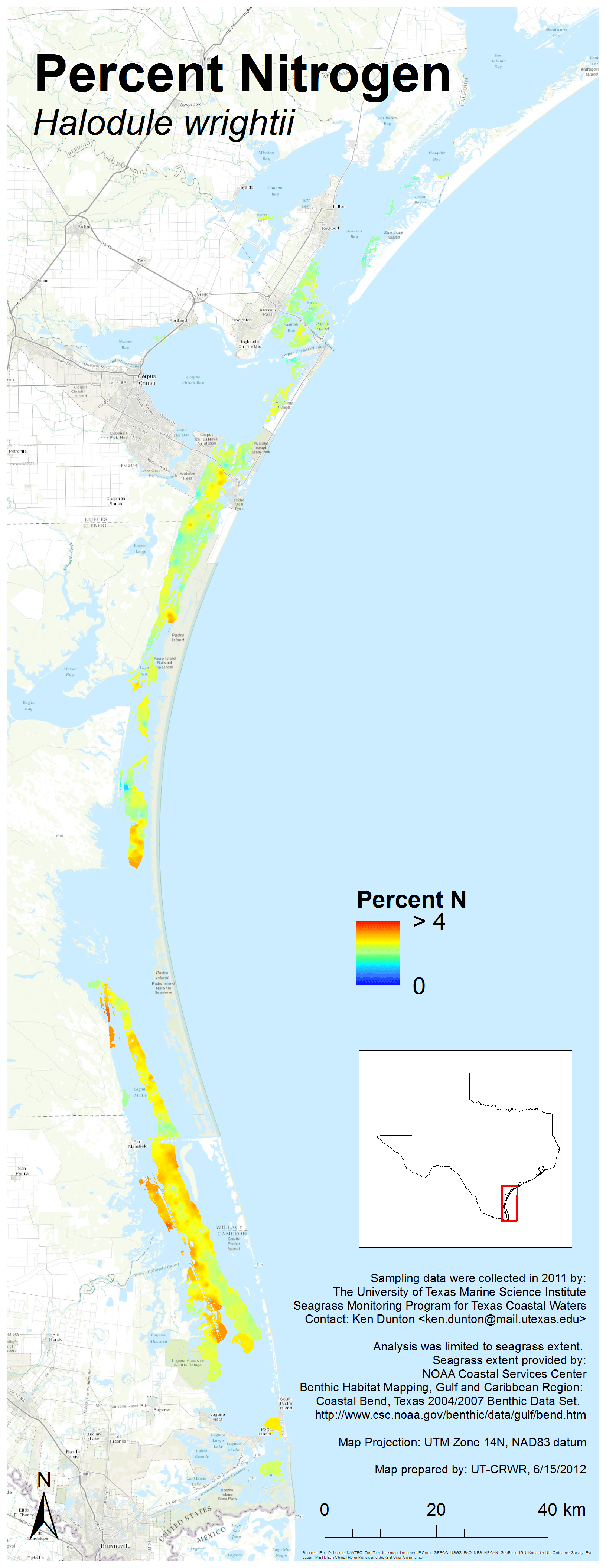
2011 Results
Each image links to a high resolution PNG. Click here to download the entire set (zipped, 38 MB).
Note: Canopy height maps for seagrass species were added on March 31, 2015


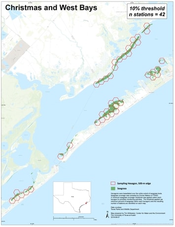
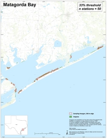
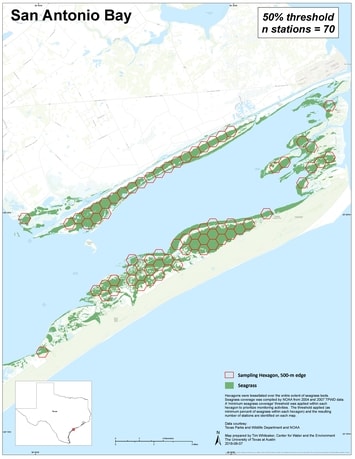
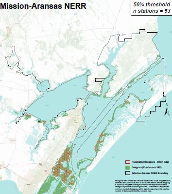
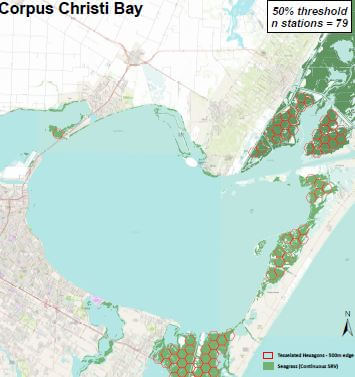
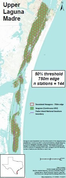
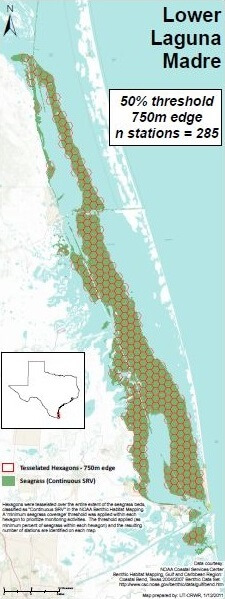
Monitoring Plan Maps
Each image links to a high resolution PDF